Category:Worstead
Aller à la navigation
Aller à la recherche
English: Worstead is a village and civil parish in the English county of Norfolk. It lies 5 km south of North Walsham, 9 km north of Wroxham, and 20 km north of Norwich. The village is served by Worstead railway station on the Bittern Line.
localité britannique du comté anglais de Norfolk  | |||||
| Téléverser des médias | |||||
| Nature de l’élément | |||||
|---|---|---|---|---|---|
| Lieu | North Norfolk, Norfolk, Angleterre de l'Est, Angleterre | ||||
| Superficie |
| ||||
 | |||||
Sous-catégories
Cette catégorie comprend 12 sous-catégories, dont les 12 ci-dessous.
Média dans la catégorie « Worstead »
Cette catégorie comprend 251 fichiers, dont les 200 ci-dessous.
(page précédente) (page suivante)-
 A pair of horses ploughing - geograph.org.uk - 517658.jpg 640 × 480 ; 186 kio
-
 A149 towards Dilham - geograph.org.uk - 5875108.jpg 1 024 × 684 ; 221 kio
-
 A149 towards Dilham - geograph.org.uk - 5875119.jpg 1 024 × 684 ; 270 kio
-
 A149 towards Dilham - geograph.org.uk - 5875146.jpg 1 024 × 684 ; 230 kio
-
 A149 towards Dilham - geograph.org.uk - 5875197.jpg 1 024 × 684 ; 158 kio
-
 Albert Bartlett, Worstead - geograph.org.uk - 5374362.jpg 1 600 × 1 208 ; 318 kio
-
 Approach to Worstead railway bridge - geograph.org.uk - 458321.jpg 640 × 480 ; 77 kio
-
 Approaching the A149 from Briggate - geograph.org.uk - 4557891.jpg 1 024 × 768 ; 337 kio
-
 Approaching the level crossing on Roman Road - geograph.org.uk - 1046336.jpg 480 × 640 ; 109 kio
-
 B1150 towards North Walsham - geograph.org.uk - 5877297.jpg 1 024 × 684 ; 263 kio
-
 Baptist chapel at Meeting Hill, Worstead - geograph.org.uk - 5330351.jpg 3 456 × 2 592 ; 3,88 Mio
-
 Barn Cottage, Briggate - geograph.org.uk - 5374357.jpg 1 600 × 1 200 ; 387 kio
-
 Between a hedge and a stock fence - geograph.org.uk - 1112380.jpg 640 × 480 ; 169 kio
-
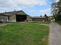
 Bunn's Farm - geograph.org.uk - 4287900.jpg 640 × 480 ; 156 kio
-
 Carman's Lane - geograph.org.uk - 1044881.jpg 480 × 640 ; 143 kio
-
 Circular walk to Worstead - geograph.org.uk - 1112430.jpg 640 × 480 ; 136 kio
-
 Crop boundary by Farm Road - geograph.org.uk - 6027748.jpg 1 600 × 1 200 ; 351 kio
-
 Crossing a culverted drain - geograph.org.uk - 1112399.jpg 640 × 480 ; 130 kio
-
 Dairyhouse Barn - geograph.org.uk - 5374314.jpg 1 600 × 1 200 ; 340 kio
-
 Derelict watermill at Briggate - geograph.org.uk - 3916975.jpg 640 × 480 ; 66 kio
-
 Dilham Road - geograph.org.uk - 5365299.jpg 1 600 × 1 163 ; 288 kio
-
 Drain traversing woodland - geograph.org.uk - 1112356.jpg 480 × 640 ; 183 kio
-
 Elbow Belt - geograph.org.uk - 1044871.jpg 480 × 640 ; 192 kio
-
 Emerging onto a ploughed field - geograph.org.uk - 1112450.jpg 480 × 640 ; 144 kio
-
 Entering Worstead on Dilham Road - geograph.org.uk - 4557872.jpg 1 024 × 768 ; 351 kio
-
 Entrance into a cattle pasture - geograph.org.uk - 1112299.jpg 640 × 480 ; 147 kio
-
 Entrance into a pasture - geograph.org.uk - 1112332.jpg 640 × 480 ; 146 kio
-
 Entrance of WW2 pillbox - geograph.org.uk - 3916967.jpg 640 × 480 ; 99 kio
-
 Farm track towards Bunn's Grove - geograph.org.uk - 4962536.jpg 640 × 433 ; 52 kio
-
 Farmland near Worstead Station - geograph.org.uk - 4962528.jpg 640 × 434 ; 48 kio
-
 Farmland near Worstead Station - geograph.org.uk - 5352482.jpg 640 × 480 ; 43 kio
-

-
 Farmland towards Bunn's Hill Wood - geograph.org.uk - 4962532.jpg 640 × 466 ; 45 kio
-
 Field adjoining Carman's Lane - geograph.org.uk - 1044926.jpg 640 × 480 ; 136 kio
-
 Field adjoining the footpath - geograph.org.uk - 1044787.jpg 640 × 409 ; 64 kio
-
 Field beside Station Road - geograph.org.uk - 1047441.jpg 640 × 480 ; 142 kio
-
 Field beside Westwick Road - geograph.org.uk - 4962530.jpg 640 × 406 ; 43 kio
-
 Field boundary hedge - geograph.org.uk - 1044859.jpg 640 × 572 ; 114 kio
-
 Field by Dilham Road - geograph.org.uk - 5365300.jpg 1 600 × 1 200 ; 316 kio
-
 Field by Meeting House Hill - geograph.org.uk - 5374346.jpg 1 600 × 1 200 ; 437 kio
-
 Field by Westwick Road - geograph.org.uk - 5374278.jpg 1 600 × 1 200 ; 473 kio
-
 Field by Worstead - geograph.org.uk - 5374322.jpg 1 600 × 1 162 ; 316 kio
-
 Field near Heath Farm - geograph.org.uk - 3117214.jpg 640 × 480 ; 88 kio
-
 Field of barley ripening in the June sunshine - geograph.org.uk - 6196619.jpg 3 456 × 2 592 ; 3,9 Mio
-
 Following a field's edge - geograph.org.uk - 1112406.jpg 640 × 426 ; 102 kio
-
 Footbridge over the canal - geograph.org.uk - 1053433.jpg 640 × 480 ; 165 kio
-
 Geoffrey the Dyer House, Worstead - geograph.org.uk - 5587625.jpg 640 × 480 ; 72 kio
-
 Green Lane - geograph.org.uk - 5374308.jpg 1 200 × 1 600 ; 431 kio
-
 Green Lane - geograph.org.uk - 5374350.jpg 1 600 × 1 200 ; 384 kio
-
 Green wheat off Dilham Road, Worstead - geograph.org.uk - 4557873.jpg 1 024 × 768 ; 368 kio
-
 Hadfield Nursery - geograph.org.uk - 5374252.jpg 1 600 × 1 200 ; 284 kio
-
 Hanging sign of 'The White Lady' at Worstead - geograph.org.uk - 5331320.jpg 2 592 × 3 456 ; 3,01 Mio
-
 High Street, Frankfort from Sloley Road - geograph.org.uk - 4557821.jpg 1 024 × 768 ; 557 kio
-
 Honing Road into Worstead - geograph.org.uk - 5374352.jpg 1 600 × 1 083 ; 245 kio
-
 House at Swan Farm - geograph.org.uk - 5374348.jpg 1 600 × 1 200 ; 362 kio
-
 Kissing gate at level crossing - geograph.org.uk - 1305988.jpg 480 × 640 ; 119 kio
-
 Lake outflow - geograph.org.uk - 1112368.jpg 480 × 640 ; 181 kio
-
 Level crossing - geograph.org.uk - 3114311.jpg 640 × 514 ; 150 kio
-
 Level crossing and station entrance at Worstead - geograph.org.uk - 6199090.jpg 3 566 × 2 590 ; 2,17 Mio
-
 Level crossing on Station Road - geograph.org.uk - 1047321.jpg 640 × 441 ; 72 kio
-
 Looking north-northwest at Worstead Station - geograph.org.uk - 5352472.jpg 640 × 480 ; 84 kio
-
 Lyngate Farm - geograph.org.uk - 1112409.jpg 640 × 445 ; 93 kio
-
 Marine Industrial, Worstead - geograph.org.uk - 5374364.jpg 1 600 × 1 146 ; 343 kio
-
 Meeting House Hill Road - geograph.org.uk - 6190478.jpg 1 067 × 1 600 ; 411 kio
-
 Minor road from Sloley - geograph.org.uk - 5374261.jpg 1 600 × 1 200 ; 584 kio
-
 Misty view towards Worstead - geograph.org.uk - 1112453.jpg 640 × 344 ; 71 kio
-
 New house, Swan Farm - geograph.org.uk - 5374331.jpg 1 600 × 1 200 ; 446 kio
-
 Next stop is North Walsham - geograph.org.uk - 1305992.jpg 640 × 480 ; 96 kio
-
 Nissen hut, Swan Farm - geograph.org.uk - 6027747.jpg 1 600 × 1 158 ; 218 kio
-
 North Walsham Switching Station - geograph.org.uk - 1305903.jpg 640 × 480 ; 94 kio
-
 Oak beside the start of a footpath - geograph.org.uk - 1044769.jpg 480 × 640 ; 124 kio
-
 Orpley Lane, Meeting House Hill - geograph.org.uk - 5374345.jpg 1 600 × 1 200 ; 353 kio
-
 Pasture beside the path - geograph.org.uk - 1112328.jpg 640 × 480 ; 98 kio
-
 Path across fields - geograph.org.uk - 1112319.jpg 640 × 480 ; 175 kio
-
 Path from Dairyhouse Barn - geograph.org.uk - 5374349.jpg 1 600 × 1 212 ; 735 kio
-
 Path from Station Road to the church - geograph.org.uk - 5352487.jpg 640 × 480 ; 80 kio
-
 Phonebox, Meeting House Hill - geograph.org.uk - 6027743.jpg 1 600 × 1 167 ; 365 kio
-
 Pond at Lyngate - geograph.org.uk - 5971911.jpg 1 600 × 1 200 ; 412 kio
-
 Pond at Swan Farm - geograph.org.uk - 5374328.jpg 1 600 × 1 200 ; 544 kio
-
 Pound Lane - geograph.org.uk - 516600.jpg 480 × 640 ; 104 kio
-
 Private link to A149 - geograph.org.uk - 5374287.jpg 1 600 × 1 200 ; 481 kio
-
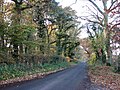
 Private road, Westwick Estate - geograph.org.uk - 458310.jpg 640 × 480 ; 50 kio
-
 Private telephone box - geograph.org.uk - 526490.jpg 480 × 640 ; 78 kio
-
 Progress on the conversion - geograph.org.uk - 6194717.jpg 1 600 × 1 067 ; 414 kio
-
 Public Footpath near Honing Row - geograph.org.uk - 526466.jpg 640 × 480 ; 101 kio
-
 Public footpath sign - geograph.org.uk - 1112297.jpg 640 × 480 ; 134 kio
-
 Public footpath to Worstead - geograph.org.uk - 1112445.jpg 640 × 450 ; 124 kio
-
 Pumping station - geograph.org.uk - 1112363.jpg 640 × 480 ; 179 kio
-
 Queen Elizabeth Hall, Worstead, spring 2017 - geograph.org.uk - 5352491.jpg 640 × 480 ; 91 kio
-
 Quick Fill, Worstead - geograph.org.uk - 5374266.jpg 1 600 × 1 200 ; 303 kio
-
 Railway bridge - geograph.org.uk - 516627.jpg 640 × 480 ; 74 kio
-
 Railway bridge on Westwick Road - geograph.org.uk - 4287893.jpg 640 × 480 ; 142 kio
-
 Railway bridge, Westwick Road - geograph.org.uk - 5374274.jpg 1 600 × 1 200 ; 335 kio
-
 Railway line - geograph.org.uk - 3114315.jpg 640 × 480 ; 105 kio
-
 Railway line - geograph.org.uk - 3114321.jpg 640 × 480 ; 86 kio
-
 Recreation ground, Worstead, spring 2017 - geograph.org.uk - 5352489.jpg 640 × 480 ; 66 kio
-
 Red telephone box - geograph.org.uk - 1047419.jpg 480 × 640 ; 112 kio
-
 Risk of Grounding - geograph.org.uk - 522213.jpg 480 × 640 ; 119 kio
-
 Road and path junction approaching Worstead - geograph.org.uk - 5352484.jpg 640 × 480 ; 88 kio
-
 Road and railway line - geograph.org.uk - 1305889.jpg 640 × 480 ; 99 kio
-
 Roofless building, Worstead - geograph.org.uk - 5971906.jpg 1 600 × 1 168 ; 277 kio
-
 Sandhill Farm - geograph.org.uk - 5374293.jpg 1 600 × 1 200 ; 370 kio
-
 Sandy Hill, North Walsham - geograph.org.uk - 4287916.jpg 640 × 480 ; 104 kio
-
 Sandy Lane - geograph.org.uk - 5374256.jpg 1 600 × 1 134 ; 269 kio
-
 Sign at the start of the track - geograph.org.uk - 1112372.jpg 640 × 453 ; 151 kio
-
 Signpost at the crossroads, Worstead - geograph.org.uk - 3321816.jpg 2 592 × 1 944 ; 1,3 Mio
-
 Sloley Road, Frankfort - geograph.org.uk - 4557824.jpg 1 024 × 768 ; 527 kio
-
 St Mary's, Worstead - geograph.org.uk - 5587609.jpg 640 × 480 ; 87 kio
-
 St Mary, Worstead, churchyard (a) - geograph.org.uk - 5352494.jpg 640 × 480 ; 106 kio
-
 St Mary, Worstead, churchyard (b) - geograph.org.uk - 5352496.jpg 640 × 480 ; 60 kio
-
 St Mary, Worstead, churchyard (c) - geograph.org.uk - 5352497.jpg 640 × 480 ; 92 kio
-
 St Mary, Worstead, churchyard (d) - geograph.org.uk - 5352500.jpg 640 × 480 ; 101 kio
-
 St Mary, Worstead, churchyard (e) - geograph.org.uk - 5352501.jpg 640 × 480 ; 92 kio
-
 St Mary, Worstead, churchyard (f) - geograph.org.uk - 5352503.jpg 640 × 480 ; 101 kio
-
 St Mary, Worstead, churchyard (g) - geograph.org.uk - 5352509.jpg 480 × 640 ; 75 kio
-
 St Mary, Worstead, churchyard (h) - geograph.org.uk - 5352513.jpg 480 × 640 ; 109 kio
-
 Station House and Station Cottages - geograph.org.uk - 1047430.jpg 640 × 480 ; 91 kio
-
 Station Road, Worstead - geograph.org.uk - 5352520.jpg 640 × 480 ; 68 kio
-
 Stubble field - geograph.org.uk - 1044909.jpg 640 × 458 ; 92 kio
-
 Stubble field beside Worstead Road - geograph.org.uk - 1044802.jpg 640 × 412 ; 67 kio
-
 The New Inn and church tower, Worstead, Norfolk - geograph.org.uk - 2220486.jpg 694 × 1 024 ; 194 kio
-
 The North Walsham and Dilham Canal - geograph.org.uk - 1053438.jpg 640 × 523 ; 152 kio
-
 The North Walsham Switching Station - entrance - geograph.org.uk - 1305897.jpg 640 × 480 ; 102 kio
-
 The North Walsham Switching Station - geograph.org.uk - 1305908.jpg 640 × 480 ; 99 kio
-
 The Old White Horse, Briggate - geograph.org.uk - 6190470.jpg 1 600 × 1 071 ; 321 kio
-
 The sign says 'Unsuitable for Motor Vehicles' - geograph.org.uk - 4557848.jpg 1 024 × 768 ; 377 kio
-
 This way to Norwich - geograph.org.uk - 1047318.jpg 480 × 640 ; 81 kio
-
 Track leading past shed - geograph.org.uk - 1112442.jpg 640 × 429 ; 127 kio
-
 Traffic jam in Worstead - geograph.org.uk - 5352518.jpg 640 × 480 ; 70 kio
-
 Trees growing in drain - geograph.org.uk - 1112431.jpg 480 × 640 ; 178 kio
-
 Victorian Postbox at Worstead Meeting Hill - geograph.org.uk - 5330006.jpg 2 592 × 3 456 ; 3,18 Mio
-
 View across a misty field - geograph.org.uk - 1112414.jpg 640 × 423 ; 89 kio
-

-
 View along footbridge - geograph.org.uk - 1053435.jpg 640 × 480 ; 152 kio
-
 View along Station Road - geograph.org.uk - 1047435.jpg 640 × 451 ; 63 kio
-
 View west along an autumnal Worstead Road - geograph.org.uk - 1044791.jpg 640 × 480 ; 157 kio
-
 Waiting for the plough - geograph.org.uk - 1112393.jpg 640 × 480 ; 106 kio
-
 Weavers' Way crossing Windmill Road - geograph.org.uk - 5374354.jpg 1 600 × 1 200 ; 467 kio
-
 Westwick Road leaving Worstead - geograph.org.uk - 5374320.jpg 1 600 × 1 305 ; 201 kio
-
 Windmill Road - geograph.org.uk - 497111.jpg 640 × 480 ; 154 kio
-
 Worstead Primary School - geograph.org.uk - 522194.jpg 640 × 480 ; 57 kio
-
 Worstead Railway Station - geograph.org.uk - 5587637.jpg 640 × 480 ; 132 kio
-
 Worstead railway Station - geograph.org.uk - 6195010.jpg 1 024 × 768 ; 170 kio
-
 Worstead railway station, Norfolk - geograph.org.uk - 4532797.jpg 1 600 × 1 200 ; 456 kio
-
 Worstead Station - geograph.org.uk - 2128978.jpg 640 × 438 ; 98 kio
-
 Worstead Station, spring 2017 - geograph.org.uk - 5352473.jpg 640 × 480 ; 82 kio
-
 Worstead village - geograph.org.uk - 1044824.jpg 640 × 598 ; 106 kio
-
 Worstead village hall - geograph.org.uk - 1960530.jpg 640 × 480 ; 212 kio
-
 Worstead Village Sign - geograph.org.uk - 5587596.jpg 480 × 640 ; 112 kio
-
 Worstead, St. Mary's Church - geograph.org.uk - 6059536.jpg 7 164 × 4 776 ; 7,62 Mio
-
 Worstead, St. Mary's Church - geograph.org.uk - 6059537.jpg 5 592 × 3 728 ; 4,22 Mio
-
 Worstead, St. Mary's Church, Choir stalls 1 - geograph.org.uk - 6059628.jpg 6 834 × 4 557 ; 5,79 Mio
-
 Worstead, St. Mary's Church, Choir stalls 2 - geograph.org.uk - 6059630.jpg 6 799 × 4 532 ; 6,04 Mio
-
 Worstead, St. Mary's Church, Eastern entrance to the churchyard - geograph.org.uk - 6059600.jpg 5 929 × 3 953 ; 4,22 Mio
-
 Worstead, St. Mary's Church, Nave roof corbel 1 - geograph.org.uk - 6059554.jpg 3 250 × 4 877 ; 3,04 Mio
-
 Worstead, St. Mary's Church, Nave roof corbel 10 - geograph.org.uk - 6059581.jpg 3 364 × 5 047 ; 3,13 Mio
-
 Worstead, St. Mary's Church, Nave roof corbel 11 - geograph.org.uk - 6059584.jpg 3 144 × 4 717 ; 2,84 Mio
-
 Worstead, St. Mary's Church, Nave roof corbel 12 - geograph.org.uk - 6059585.jpg 3 109 × 4 664 ; 2,65 Mio
-
 Worstead, St. Mary's Church, Nave roof corbel 13 - geograph.org.uk - 6059587.jpg 3 459 × 5 188 ; 3,36 Mio
-
 Worstead, St. Mary's Church, Nave roof corbel 14 - geograph.org.uk - 6059589.jpg 3 447 × 5 170 ; 3,41 Mio
-
 Worstead, St. Mary's Church, Nave roof corbel 15 - geograph.org.uk - 6059591.jpg 3 280 × 4 920 ; 2,98 Mio
-
 Worstead, St. Mary's Church, Nave roof corbel 16 - geograph.org.uk - 6059593.jpg 3 443 × 5 164 ; 3,2 Mio
-
 Worstead, St. Mary's Church, Nave roof corbel 17 - geograph.org.uk - 6059595.jpg 3 461 × 5 192 ; 3,07 Mio
-
 Worstead, St. Mary's Church, Nave roof corbel 18 - geograph.org.uk - 6059596.jpg 3 312 × 4 968 ; 2,94 Mio
-
 Worstead, St. Mary's Church, Nave roof corbel 19 - geograph.org.uk - 6059598.jpg 7 569 × 5 045 ; 7,11 Mio
-
 Worstead, St. Mary's Church, Nave roof corbel 2 - geograph.org.uk - 6059557.jpg 3 944 × 5 917 ; 4,42 Mio
-
 Worstead, St. Mary's Church, Nave roof corbel 3 - geograph.org.uk - 6059564.jpg 2 560 × 3 840 ; 2,19 Mio
-
 Worstead, St. Mary's Church, Nave roof corbel 4 - geograph.org.uk - 6059565.jpg 3 553 × 5 330 ; 3,84 Mio
-
 Worstead, St. Mary's Church, Nave roof corbel 5 - geograph.org.uk - 6059568.jpg 3 434 × 5 151 ; 3,25 Mio
-
 Worstead, St. Mary's Church, Nave roof corbel 6 - geograph.org.uk - 6059571.jpg 3 266 × 4 899 ; 3,03 Mio
-
 Worstead, St. Mary's Church, Nave roof corbel 7 - geograph.org.uk - 6059572.jpg 3 377 × 5 067 ; 3,09 Mio
-
 Worstead, St. Mary's Church, Nave roof corbel 8 - geograph.org.uk - 6059574.jpg 3 355 × 5 032 ; 3,13 Mio
-
 Worstead, St. Mary's Church, Nave roof corbel 9 - geograph.org.uk - 6059578.jpg 3 299 × 4 949 ; 2,73 Mio
-
 Worstead, St. Mary's Church, North doorway - geograph.org.uk - 6059544.jpg 3 186 × 4 779 ; 3,86 Mio
-
 Worstead, St. Mary's Church, North doorway into the chancel - geograph.org.uk - 6059661.jpg 6 718 × 4 479 ; 5,7 Mio
-

-

-
 Worstead, St. Mary's Church, Part of the northern aspect - geograph.org.uk - 6059546.jpg 5 627 × 3 752 ; 5,88 Mio
-
 Worstead, St. Mary's Church, Part of the southern aspect - geograph.org.uk - 6059543.jpg 5 549 × 3 700 ; 5,2 Mio
-
 Worstead, St. Mary's Church, South doorway - geograph.org.uk - 6059604.jpg 4 451 × 6 677 ; 6,05 Mio
-
 Worstead, St. Mary's Church, South doorway, king label stop - geograph.org.uk - 6059606.jpg 6 656 × 4 438 ; 5,55 Mio
-
 Worstead, St. Mary's Church, South doorway, queen label stop - geograph.org.uk - 6059610.jpg 6 670 × 4 447 ; 5,64 Mio
-
 Worstead, St. Mary's Church, The chancel screen of 1512 (detail) 1 - geograph.org.uk - 6059650.jpg 4 435 × 6 652 ; 7,75 Mio
-
 Worstead, St. Mary's Church, The chancel screen of 1512 (detail) 2 - geograph.org.uk - 6059653.jpg 4 194 × 6 291 ; 7,66 Mio
-
 Worstead, St. Mary's Church, The chancel screen of 1512 (detail) 3 - geograph.org.uk - 6059658.jpg 4 036 × 6 054 ; 6,77 Mio
-
 Worstead, St. Mary's Church, The chancel screen of 1512 (detail) 4 - geograph.org.uk - 6059663.jpg 4 293 × 6 439 ; 6,92 Mio
-
 Worstead, St. Mary's Church, The chancel screen of 1512 1 - geograph.org.uk - 6059642.jpg 7 212 × 4 807 ; 6,76 Mio
-
 Worstead, St. Mary's Church, The chancel screen of 1512 2 - geograph.org.uk - 6059644.jpg 6 265 × 4 176 ; 7,27 Mio
-
 Worstead, St. Mary's Church, The font 1 - geograph.org.uk - 6059548.jpg 5 090 × 7 634 ; 7,78 Mio
-
 Worstead, St. Mary's Church, The font 2 with tower screen of 1501 - geograph.org.uk - 6059549.jpg 7 238 × 4 825 ; 6,52 Mio
-
 Worstead, St. Mary's Church, The font 3 with tower screen of 1501 - geograph.org.uk - 6059551.jpg 5 033 × 7 551 ; 7,06 Mio
-
 Worstead, St. Mary's Church, The font 4 - geograph.org.uk - 6059614.jpg 5 011 × 7 515 ; 7,41 Mio
-
 Worstead, St. Mary's Church, The font 5 - geograph.org.uk - 6059616.jpg 4 690 × 7 036 ; 5,83 Mio
-
 Worstead, St. Mary's Church, The font 6 - geograph.org.uk - 6059621.jpg 4 729 × 7 094 ; 5,99 Mio
-
 Worstead, St. Mary's Church, The font 7 - geograph.org.uk - 6059623.jpg 7 126 × 4 750 ; 6,55 Mio
-
 Worstead, St. Mary's Church, The font 8 - geograph.org.uk - 6059625.jpg 7 074 × 4 716 ; 6,06 Mio
-
 Worstead, St. Mary's Church, The font 9 - geograph.org.uk - 6059626.jpg 6 861 × 4 574 ; 6,1 Mio
-
 Worstead, St. Mary's Church, The nave - geograph.org.uk - 6059632.jpg 6 985 × 4 657 ; 5,71 Mio
-
 Worstead, St. Mary's Church, The tower screen of 1501 - geograph.org.uk - 6059635.jpg 7 235 × 4 823 ; 7,48 Mio
-
 Worstead, St. Mary's Church, The tower screen of 1501 - geograph.org.uk - 6059638.jpg 6 572 × 4 382 ; 5,33 Mio


_-_geograph.org.uk_-_5352494.jpg)
_-_geograph.org.uk_-_5352496.jpg)
_-_geograph.org.uk_-_5352497.jpg)
_-_geograph.org.uk_-_5352500.jpg)
_-_geograph.org.uk_-_5352501.jpg)
_-_geograph.org.uk_-_5352503.jpg)
_-_geograph.org.uk_-_5352509.jpg)
_-_geograph.org.uk_-_5352513.jpg)


_1_-_geograph.org.uk_-_6059650.jpg)
_2_-_geograph.org.uk_-_6059653.jpg)
_3_-_geograph.org.uk_-_6059658.jpg)
_4_-_geograph.org.uk_-_6059663.jpg)


