Category:Wroxall, Isle of Wight
Vai alla navigazione
Vai alla ricerca
village and civil parish in the central south of the Isle of Wight  | |||||
| Carica un file multimediale | |||||
| Istanza di | |||||
|---|---|---|---|---|---|
| Luogo | isola di Wight, Sud Est dell'Inghilterra, Inghilterra | ||||
 | |||||
Sottocategorie
Questa categoria contiene le 8 sottocategorie indicate di seguito, su un totale di 8.
File nella categoria "Wroxall, Isle of Wight"
Questa categoria contiene 200 file, indicati di seguito, su un totale di 223.
(pagina precedente) (pagina successiva)-

-
 A3020 towards Godshill - geograph.org.uk - 5129824.jpg 640 × 480; 109 KB
-
 Amongst the cow parsley - geograph.org.uk - 2007187.jpg 640 × 426; 237 KB
-
 An OS Trig Point - geograph.org.uk - 5972978.jpg 1 024 × 768; 219 KB
-
 Approaching Freemantle Gate - geograph.org.uk - 3279474.jpg 640 × 424; 224 KB
-
 Appuldurcombe Farm - geograph.org.uk - 5689556.jpg 1 000 × 665; 828 KB
-
 Appuldurcombe Park gate - geograph.org.uk - 5539453.jpg 574 × 370; 75 KB
-
 Appuldurcombe Park IOW - geograph.org.uk - 5539457.jpg 828 × 561; 137 KB
-
 Archery Practice at Appuldurcombe, Isle of Wight - geograph.org.uk - 1983902.jpg 3 872 × 2 592; 5,65 MB
-
 B3327 heading to Wroxall - geograph.org.uk - 1034033.jpg 640 × 480; 58 KB
-
 B3327 heads south out of Wroxall - geograph.org.uk - 1034077.jpg 640 × 480; 63 KB
-
 Bachelors Farm - geograph.org.uk - 508705.jpg 640 × 479; 139 KB
-
 Baycroft Farm - geograph.org.uk - 4107591.jpg 1 024 × 680; 333 KB
-
 Being watched - geograph.org.uk - 5972991.jpg 1 024 × 768; 211 KB
-
 Blasted Tree - geograph.org.uk - 4073303.jpg 427 × 640; 307 KB
-
 Bluebells, Wroxall Down, Isle of Wight - geograph.org.uk - 5491114.jpg 3 836 × 2 985; 3,52 MB
-
 Bonchurch Down - geograph.org.uk - 5381827.jpg 3 456 × 2 592; 4,3 MB
-
 Bridge at Wroxall, Isle of Wight - geograph.org.uk - 1982392.jpg 3 872 × 2 592; 4,39 MB
-

-
 Bridge over the old railway line, Wroxall, Isle of Wight, England.jpg 2 226 × 1 642; 2,08 MB
-
 Bridleway at Wroxall, Isle of Wight - geograph.org.uk - 1982398.jpg 2 592 × 3 872; 4,83 MB
-
 Bridleway sign on Wroxall Down - geograph.org.uk - 4031607.jpg 1 024 × 680; 238 KB
-
 Bridleway to Wroxall covered in snow.JPG 4 592 × 3 056; 3,61 MB
-
 Bridleway, Wroxall Copse - geograph.org.uk - 508525.jpg 479 × 640; 224 KB
-
 But Basher, those are horses^ - geograph.org.uk - 3857872.jpg 640 × 480; 80 KB
-
 Byway V60 covered in snow.JPG 4 592 × 3 056; 5,73 MB
-
 Camp Site - geograph.org.uk - 1578971.jpg 640 × 480; 64 KB
-
 Colourful day over Shanklin - geograph.org.uk - 3727871.jpg 640 × 429; 67 KB
-
 Converted Farm Buildings - geograph.org.uk - 2691443.jpg 3 264 × 2 448; 3,51 MB
-
 Cook's Castle stone - geograph.org.uk - 2007159.jpg 640 × 427; 229 KB
-
 Cottage at Whiteley Bank - geograph.org.uk - 4637076.jpg 1 600 × 1 065; 973 KB
-
 Cottages - geograph.org.uk - 2691477.jpg 3 264 × 2 448; 4,06 MB
-
 Derelict buildings, Wroxall, Isle of Wight, England.jpg 3 584 × 2 689; 4,4 MB
-
 Diamond Jubilee Memorial 1837 - 1897, Wroxall - geograph.org.uk - 6254453.jpg 1 024 × 684; 239 KB
-
 Dismantled railway - geograph.org.uk - 1034066.jpg 640 × 480; 80 KB
-
 Disused Warehouse at Wroxall, Isle of Wight - geograph.org.uk - 1984526.jpg 3 872 × 2 592; 5,07 MB
-
 Disused Warehouse at Wroxall, Isle of Wight - geograph.org.uk - 1984540.jpg 3 872 × 2 592; 3,17 MB
-
 Donkey Paddocks - geograph.org.uk - 2691416.jpg 1 451 × 1 088; 958 KB
-
 Drive at Appuldurcombe, looking east - geograph.org.uk - 2156432.jpg 480 × 640; 274 KB
-
 Driveway to Appuldurcombe, Isle of Wight - geograph.org.uk - 1979161.jpg 3 872 × 2 592; 4,7 MB
-
 Edge of field beside dismantled railway - geograph.org.uk - 4460530.jpg 640 × 427; 107 KB
-
 Farmland near Wroxall - geograph.org.uk - 4107085.jpg 800 × 531; 142 KB
-
 Field as seen from Rew Lane - geograph.org.uk - 3104179.jpg 640 × 480; 104 KB
-
 Field near Appuldurcombe - geograph.org.uk - 4073294.jpg 640 × 427; 396 KB
-
 Fields south of Rew Lane - geograph.org.uk - 6255813.jpg 1 024 × 768; 178 KB
-
 First house in Wroxall - geograph.org.uk - 6254503.jpg 1 024 × 768; 234 KB
-
 Footpath going down to Wroxall Cemetery - geograph.org.uk - 3702078.jpg 2 432 × 4 320; 4,79 MB
-
 Footpath Junction, Whiteley Bank, Isle of Wight - geograph.org.uk - 1979439.jpg 2 592 × 3 872; 4,96 MB
-
 Footpath Sign at Ventnor Down - geograph.org.uk - 4547461.jpg 4 896 × 3 672; 6,65 MB
-
 Footpath to Shanklin - geograph.org.uk - 508235.jpg 640 × 479; 181 KB
-
 Footpath towards St. Martin's Down - geograph.org.uk - 2007148.jpg 640 × 426; 253 KB
-
 Footpath up St Martins Down - geograph.org.uk - 3702072.jpg 4 320 × 2 432; 2,64 MB
-
 Former site of Cook's Castle now a grassy field - geograph.org.uk - 3702107.jpg 4 320 × 2 432; 2,59 MB
-
 Freemantle Gate and Appuldurcombe Park from Wroxall Down - geograph.org.uk - 5491156.jpg 3 965 × 2 468; 1,46 MB
-
 Freemantle Gates and Lodge, Appuldurcombe Park - geograph.org.uk - 6253067.jpg 1 024 × 768; 280 KB
-
 From Shanklin Down - geograph.org.uk - 2007991.jpg 640 × 427; 230 KB
-
 Frozen lake.JPG 4 592 × 3 056; 6,03 MB
-
 Gate and path on St. Martin's Down - geograph.org.uk - 4460442.jpg 640 × 427; 77 KB
-
 Gate at Appuldurcombe - geograph.org.uk - 2007129.jpg 640 × 426; 252 KB
-
 Gate at Appuldurcombe - geograph.org.uk - 2156434.jpg 640 × 480; 316 KB
-
 Gate on Luccombe Down - geograph.org.uk - 4031622.jpg 1 024 × 680; 266 KB
-
 Godshill Park gate - geograph.org.uk - 2007069.jpg 426 × 640; 197 KB
-
 Grassland below St. Martin's Down - geograph.org.uk - 2007174.jpg 640 × 427; 179 KB
-
 Grassland near Freemantle Gate - geograph.org.uk - 2007119.jpg 640 × 426; 189 KB
-
 Grazing sheep on Week Down - geograph.org.uk - 581357.jpg 640 × 480; 81 KB
-
 Harvesting the Hay, Whiteley Bank, Isle of Wight - geograph.org.uk - 1984569.jpg 3 872 × 2 592; 4,23 MB
-
 High security^ - geograph.org.uk - 5973013.jpg 1 024 × 768; 199 KB
-
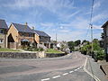
 High Street, Wroxall - geograph.org.uk - 6254484.jpg 1 024 × 768; 189 KB
-
 Houses on Station Road, Wroxall - geograph.org.uk - 6254497.jpg 1 024 × 684; 153 KB
-
 Houses on West Street, Wroxall - geograph.org.uk - 6253336.jpg 1 024 × 768; 234 KB
-
 IOW Donkey Sanctuary - geograph.org.uk - 2689866.jpg 3 264 × 2 448; 4,42 MB
-
 Japanese Rose, Rosa rugosa - geograph.org.uk - 6253701.jpg 1 024 × 1 024; 330 KB
-

-
 Lane down from Stenbury Down towards Wroxall - geograph.org.uk - 6256156.jpg 1 024 × 768; 222 KB
-
 Lane down from Stenbury Down towards Wroxall - geograph.org.uk - 6256232.jpg 1 024 × 768; 309 KB
-
 Lane down from Stenbury Down towards Wroxall - geograph.org.uk - 6256422.jpg 1 024 × 768; 274 KB
-
 Lane down from Stenbury Down towards Wroxall - geograph.org.uk - 6256427.jpg 1 024 × 768; 359 KB
-
 Leaving Wroxall - geograph.org.uk - 2007135.jpg 640 × 426; 249 KB
-
 Livestock drinking tanks - geograph.org.uk - 4031632.jpg 1 024 × 680; 294 KB
-
 Lower Winstone Farm - geograph.org.uk - 2690825.jpg 3 264 × 2 448; 5,09 MB
-
 Luccombe Down - geograph.org.uk - 2008002.jpg 640 × 427; 240 KB
-
 Luccombe Down - geograph.org.uk - 2008006.jpg 640 × 426; 229 KB
-
 Luccombe Down - geograph.org.uk - 4086456.jpg 640 × 427; 386 KB
-
 Luccombe Down - geograph.org.uk - 4086464.jpg 640 × 427; 379 KB
-
 Luccombe Down - geograph.org.uk - 5381820.jpg 3 456 × 2 592; 4,29 MB
-
 Methodist Church for sale, Wroxall - geograph.org.uk - 6254196.jpg 1 024 × 768; 198 KB
-
 Methodist Church Hall, Wroxall - geograph.org.uk - 6254177.jpg 1 024 × 768; 208 KB
-
 Middle Barn - geograph.org.uk - 508255.jpg 640 × 479; 153 KB
-
 Middle Barn, Wroxall - geograph.org.uk - 5502761.jpg 3 952 × 2 964; 2,52 MB
-
 On St. Martin's Down - geograph.org.uk - 2007178.jpg 640 × 427; 164 KB
-
 On St. Martin's Down - geograph.org.uk - 2007183.jpg 640 × 427; 164 KB
-
 Part of Appeldurcombe House estate - geograph.org.uk - 146368.jpg 640 × 480; 70 KB
-

-

-
 Path on St Martin's Down - geograph.org.uk - 4631107.jpg 1 200 × 799; 450 KB
-
 Pathway to Appuldurcombe House - geograph.org.uk - 1578987.jpg 640 × 480; 76 KB
-
 Pavement in Wroxall, Isle of Wight - geograph.org.uk - 1982092.jpg 3 872 × 2 592; 4,91 MB
-
 Pillbox on St Boniface Down - geograph.org.uk - 4031590.jpg 800 × 531; 161 KB
-

-
 Public footpath NT1 covered in snow.JPG 4 592 × 3 056; 6,53 MB
-
 Public footpaths, Luccombe Down - geograph.org.uk - 5512819.jpg 3 958 × 2 968; 1,81 MB
-
 Railway Embankment, Whiteley Bank, Isle of Wight - geograph.org.uk - 1979430.jpg 3 872 × 2 592; 4,69 MB
-
 Redhill Lane - geograph.org.uk - 2689786.jpg 3 264 × 2 448; 1,83 MB
-
 Rew Lane - geograph.org.uk - 4107084.jpg 1 024 × 680; 318 KB
-
 Rew Lane at junction with way up Stenbury Down - geograph.org.uk - 6256045.jpg 1 024 × 768; 198 KB
-
 Rew Lane descending towards Wroxall - geograph.org.uk - 6255884.jpg 1 024 × 768; 221 KB
-
 Rew Lane, Wroxall - geograph.org.uk - 4107596.jpg 800 × 531; 127 KB
-
 Rew Lane, Wroxall - geograph.org.uk - 4258193.jpg 800 × 531; 107 KB
-
 Road leading to Cooks Castle Farm, Wroxall - geograph.org.uk - 4637079.jpg 1 600 × 1 122; 885 KB
-
 Ruined building at foot of St. Martin's Down, Wroxall 01.jpg 4 128 × 3 096; 7,62 MB
-
 Ruined building at foot of St. Martin's Down, Wroxall 02.jpg 4 128 × 3 096; 7,55 MB
-
 Ruined building at foot of St. Martin's Down, Wroxall 03.jpg 4 128 × 3 096; 8,04 MB
-
 Ruined building at foot of St. Martin's Down, Wroxall 04.jpg 4 128 × 3 096; 8,74 MB
-
 Ruined building at foot of St. Martin's Down, Wroxall 05.jpg 4 128 × 3 096; 8,13 MB
-
 Safely Gathered in - geograph.org.uk - 1984467.jpg 3 872 × 2 592; 4,73 MB
-
 Scenic view on Isle of Wight - geograph.org.uk - 3727892.jpg 640 × 429; 61 KB
-
 Shanklin Down - geograph.org.uk - 2007987.jpg 640 × 427; 244 KB
-
 Shanklin to Ventnor road, Luccombe - geograph.org.uk - 5491216.jpg 2 952 × 3 936; 2,45 MB
-
 Sheep in Appuldurcombe Park - geograph.org.uk - 6289130.jpg 2 630 × 3 300; 1,72 MB
-
 Sheep in field north of Rew Lane - geograph.org.uk - 6255818.jpg 1 024 × 768; 175 KB
-
 Sheep, east slopes of Stenbury Down - geograph.org.uk - 6256250.jpg 1 024 × 768; 242 KB
-
 Span Farm - geograph.org.uk - 6256163.jpg 1 024 × 768; 179 KB
-
 Span Lodge, Wroxall 01.jpg 4 128 × 3 096; 6,59 MB
-
 Span Lodge, Wroxall 02.jpg 4 128 × 3 096; 8,46 MB
-
 Span Lodge, Wroxall 03.jpg 3 096 × 4 128; 7,57 MB
-
 Span Lodge, Wroxall 04.jpg 3 096 × 4 128; 4,37 MB
-
 Span Lodge, Wroxall 05.jpg 4 128 × 3 096; 6,92 MB
-
 Span Lodge, Wroxall 06.jpg 5 152 × 3 864; 7,64 MB
-
 Span Lodge, Wroxall 09.jpg 5 152 × 3 864; 7,46 MB
-
 Spectacular views from site of Cook's Castle - geograph.org.uk - 3702121.jpg 4 320 × 2 432; 2,2 MB
-
 St Boniface Down - geograph.org.uk - 3336892.jpg 2 592 × 1 944; 1,61 MB
-
 St Boniface Down - geograph.org.uk - 5167338.jpg 640 × 480; 57 KB
-

-
 St John's Road - geograph.org.uk - 2689882.jpg 3 264 × 2 448; 4,31 MB
-
 St Martin's Down - geograph.org.uk - 146439.jpg 640 × 482; 78 KB
-
 St Martins Down path from Wroxall - geograph.org.uk - 5539465.jpg 842 × 564; 191 KB
-
 St.John's Road, Wroxall, Isle of Wight - geograph.org.uk - 1982060.jpg 3 872 × 2 592; 4,69 MB
-
 Starlings on church weather vane, Wroxall - geograph.org.uk - 6254250.jpg 768 × 1 024; 110 KB
-
 Stenbury Trail leaving Wroxall - geograph.org.uk - 2007127.jpg 640 × 428; 198 KB
-
 Steps, Homelands Pit Farm - geograph.org.uk - 508516.jpg 479 × 640; 243 KB
-
 Thatched Cottage (geograph 6650794).jpg 1 024 × 684; 224 KB
-
 Thatched Cottages, High Street, Wroxall - geograph.org.uk - 6254469.jpg 1 024 × 684; 221 KB
-
 The Eagle Will not Take off - geograph.org.uk - 1981692.jpg 3 872 × 2 592; 3,35 MB
-
 The Post Office on West Street, Wroxall - geograph.org.uk - 4631126.jpg 1 200 × 799; 400 KB
-
 The road into Wroxall - geograph.org.uk - 2689843.jpg 3 264 × 2 448; 949 KB
-
 The Star Inn, Wroxall - geograph.org.uk - 4631116.jpg 1 200 × 799; 346 KB
-
 The Star Inn, Wroxall - geograph.org.uk - 4631120.jpg 1 200 × 799; 204 KB
-
 The Star Inn, Wroxall - geograph.org.uk - 6253744.jpg 1 024 × 768; 173 KB
-
 The village of Wroxall - geograph.org.uk - 4056118.jpg 1 024 × 680; 300 KB
-
 The Worsley (derelict pub), Wroxall, Isle of Wight, England.jpg 1 955 × 1 454; 1,24 MB
-
 The Worsley Trail in Appuldurcombe Park - geograph.org.uk - 4631148.jpg 1 200 × 799; 401 KB
-
 The Worsley, Wroxall (closed) - geograph.org.uk - 6253352.jpg 1 024 × 684; 171 KB
-
 The Worsley, Wroxall - geograph.org.uk - 4631135.jpg 1 200 × 799; 390 KB
-

-
 Track and tree - geograph.org.uk - 4038196.jpg 1 024 × 680; 301 KB
-

-
 Track on Luccombe Down - geograph.org.uk - 4031615.jpg 1 024 × 680; 270 KB
-
 Track to Baycroft Farm - geograph.org.uk - 6255806.jpg 1 024 × 768; 204 KB
-
 Track to Span Lodge - geograph.org.uk - 6255900.jpg 1 024 × 768; 314 KB
-
 View from a pillbox - geograph.org.uk - 4031595.jpg 1 024 × 680; 150 KB
-
 View From Appuldurcombe, Isle of Wight - geograph.org.uk - 1984338.jpg 3 872 × 2 592; 4 MB
-
 View From Appuldurcombe, Isle of Wight - geograph.org.uk - 1984350.jpg 3 872 × 2 592; 5,31 MB
-
 View From Appuldurcombe, Isle of Wight - geograph.org.uk - 1984368.jpg 3 872 × 2 592; 4,42 MB
-
 View from Luccombe Down - geograph.org.uk - 2008011.jpg 640 × 427; 190 KB
-
 View from Shanklin Down - geograph.org.uk - 2007997.jpg 640 × 428; 217 KB
-
 View From the Sunshine Trail, Isle of Wight - geograph.org.uk - 1984616.jpg 3 872 × 2 592; 4,86 MB
-
 View From the Sunshine Trail, Isle of Wight - geograph.org.uk - 1985303.jpg 3 872 × 2 592; 4,37 MB
-
 View From the Sunshine Trail, Isle of Wight - geograph.org.uk - 1985315.jpg 3 872 × 2 592; 3,85 MB
-

-
 View of hay bales from footpath near Cook's Castle - geograph.org.uk - 3702084.jpg 4 320 × 2 432; 3,21 MB
-
 View to Shanklin Down - geograph.org.uk - 4038201.jpg 1 024 × 680; 316 KB
-
 View to Wroxall - geograph.org.uk - 4258197.jpg 800 × 531; 127 KB
-
 View towards Luccombe Down from Middle Barn, Wroxall - geograph.org.uk - 5502763.jpg 3 942 × 2 818; 3,07 MB
-
 Wall at Appuldurcombe, Isle of Wight - geograph.org.uk - 1984378.jpg 3 872 × 2 592; 4,5 MB
-
 We Have Lift-off - geograph.org.uk - 1981697.jpg 3 872 × 2 592; 2,42 MB
-
 West Street - geograph.org.uk - 1578963.jpg 640 × 480; 62 KB
-

-
 West Wight - geograph.org.uk - 5490377.jpg 3 966 × 2 974; 1,86 MB
-
 Whiteley Bank - geograph.org.uk - 3760125.jpg 640 × 480; 373 KB
-
 Wroxall - geograph.org.uk - 1578958.jpg 640 × 480; 55 KB
-
 Wroxall church - geograph.org.uk - 6254283.jpg 1 024 × 768; 153 KB
-
 Wroxall Community Centre 01.jpg 4 128 × 3 096; 4,84 MB
-
 Wroxall Community Centre 02.jpg 4 128 × 3 096; 4,4 MB
-
 Wroxall Community Centre 03.jpg 4 128 × 3 096; 5,65 MB
-
 Wroxall Diamond Jubilee Memorial.JPG 3 072 × 2 304; 2,38 MB
-
 Wroxall Down - geograph.org.uk - 1045348.jpg 640 × 480; 60 KB
-
 Wroxall Farm Barn (geograph 6656863).jpg 1 024 × 684; 180 KB
-
 Wroxall Football Ground - geograph.org.uk - 1579010.jpg 640 × 480; 43 KB
-
 Wroxall from Rew Down.JPG 4 592 × 3 056; 3,85 MB
-
 Wroxall from Stenbury Down during snow December 2010 2.JPG 4 592 × 3 056; 3,17 MB
-
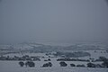 Wroxall from Stenbury Down during snow December 2010.JPG 4 592 × 3 056; 3,24 MB
-
 Wroxall Grove Road old public toilets.JPG 4 000 × 3 000; 4,84 MB
-
 Wroxall Grove Road public toilets closure notice.JPG 3 000 × 4 000; 3,7 MB
-
 Wroxall High Street 2.JPG 4 000 × 3 000; 4,97 MB
-
 Wroxall High Street during snow December 2010.JPG 4 000 × 3 000; 4,59 MB
-
 Wroxall High Street.JPG 4 000 × 3 000; 4,75 MB
-
 Wroxall Post Office - geograph.org.uk - 4056121.jpg 680 × 1 024; 242 KB
-
 Wroxall Post Office, Isle of Wight - geograph.org.uk - 1980487.jpg 2 592 × 3 872; 3,88 MB
-
 Wroxall Post Office.JPG 2 304 × 3 072; 2,35 MB
-
 Wroxall Primary School.JPG 4 000 × 3 000; 4,52 MB


.jpg)


,_Wroxall,_Isle_of_Wight,_England.jpg)

_-_geograph.org.uk_-_6253352.jpg)


.jpg)


