Category:Wymington
Vai alla navigazione
Vai alla ricerca
village and civil parish in Bedfordshire, UK  | |||||
| Carica un file multimediale | |||||
| Istanza di | |||||
|---|---|---|---|---|---|
| Luogo | Bedford, Bedfordshire, Est dell'Inghilterra, Inghilterra | ||||
 | |||||
English: Wymington is a village and civil parish in the Bedfordshire district of Bedford in England. It is in the north of Bedfordshire, near the county border with Northamptonshire, and the nearest town is Rushden in Northants, which it boarders to the north. Other nearby places are Podington, to the south-west, and Farndish to the west.
Sottocategorie
Questa categoria contiene le 2 sottocategorie indicate di seguito, su un totale di 2.
W
- Wymington Meadow (6 F)
File nella categoria "Wymington"
Questa categoria contiene 81 file, indicati di seguito, su un totale di 81.
-

-
 Allotments by the bridleway - geograph.org.uk - 6312537.jpg 1 600 × 1 066; 581 KB
-
 Ancient and modern - geograph.org.uk - 1291415.jpg 640 × 480; 84 KB
-
 Blackmere Farm - geograph.org.uk - 3203495.jpg 1 024 × 768; 267 KB
-
 Blackmere Wind Turbine - geograph.org.uk - 4851564.jpg 640 × 640; 45 KB
-
 Bridleway goes into the spinney - geograph.org.uk - 6312654.jpg 1 600 × 1 066; 616 KB
-
 Bridleway to Knuston - geograph.org.uk - 6312532.jpg 1 600 × 1 066; 569 KB
-
 Bridleway towards the A6 - geograph.org.uk - 6307656.jpg 1 600 × 1 066; 759 KB
-
 Bridleway towards the A6 - geograph.org.uk - 6312583.jpg 1 600 × 1 066; 483 KB
-
 Buttercups down to the railway line - geograph.org.uk - 6167232.jpg 1 600 × 1 066; 480 KB
-
 Church Lane Wymington.jpg 1 237 × 928; 342 KB
-
 Church Lane, Wymington.jpg 1 247 × 935; 300 KB
-
 Evidence of electrification work progressing - geograph.org.uk - 6023936.jpg 1 024 × 768; 215 KB
-
 Farmland near Irchester - geograph.org.uk - 4744389.jpg 640 × 426; 51 KB
-
 Farmland with tree by the footpath - geograph.org.uk - 6166664.jpg 1 600 × 1 066; 453 KB
-
 Farmland, Wymington - geograph.org.uk - 4741175.jpg 640 × 426; 57 KB
-
 Farmland, Wymington - geograph.org.uk - 4741177.jpg 640 × 330; 40 KB
-
 Field and New Buildings - geograph.org.uk - 6166416.jpg 1 600 × 1 066; 344 KB
-
 Field by Blackmere Farm - geograph.org.uk - 6166298.jpg 1 600 × 1 066; 292 KB
-
 Footbridge on the footpath to Wymington - geograph.org.uk - 6167250.jpg 1 600 × 1 066; 419 KB
-
 Footpath - geograph.org.uk - 93607.jpg 640 × 480; 66 KB
-
 Footpath off Rushden Road - geograph.org.uk - 1552261.jpg 640 × 480; 130 KB
-
 Footpath to Blackmere Farm - geograph.org.uk - 6166655.jpg 1 600 × 1 066; 592 KB
-
 Footpath to Blackmere Farm - geograph.org.uk - 6166659.jpg 1 600 × 1 066; 631 KB
-
 Footpath to Church Lane - geograph.org.uk - 6167224.jpg 1 600 × 1 066; 463 KB
-
 Footpath to Goosey Lodge - geograph.org.uk - 6167214.jpg 1 600 × 1 066; 626 KB
-
 Footpath to Wymington - geograph.org.uk - 6166686.jpg 1 600 × 1 066; 431 KB
-
 Footpath to Wymington - geograph.org.uk - 6167241.jpg 1 600 × 1 066; 339 KB
-
 Footpath to Wymington - geograph.org.uk - 6305751.jpg 1 600 × 1 066; 574 KB
-
 Footpath towards Souldrop - geograph.org.uk - 6166010.jpg 1 600 × 1 066; 643 KB
-
 Footpath towards Souldrop and Blackmere Farm - geograph.org.uk - 6166300.jpg 1 600 × 1 066; 543 KB
-
 Footpath towards the solar park - geograph.org.uk - 6167239.jpg 1 600 × 1 066; 529 KB
-
 Fordson Power Major - geograph.org.uk - 1291524.jpg 640 × 480; 97 KB
-
 Forty Foot Lane - geograph.org.uk - 4851556.jpg 640 × 640; 132 KB
-
 Forty Foot Lane - geograph.org.uk - 4851565.jpg 640 × 640; 107 KB
-
 Forty Foot Lane byway - geograph.org.uk - 6166237.jpg 1 600 × 1 066; 477 KB
-
 Forty Foot Lane Railway Bridge - geograph.org.uk - 4851557.jpg 640 × 640; 156 KB
-
 Goosey Lodge site from the footpath - geograph.org.uk - 6166667.jpg 1 600 × 1 066; 376 KB
-
 Goosey's Lodge - geograph.org.uk - 3203486.jpg 2 560 × 1 920; 1,05 MB
-
 Industry, Goosey Lodge - geograph.org.uk - 4782873.jpg 640 × 426; 35 KB
-
 Knuston High Farm - geograph.org.uk - 3203455.jpg 2 560 × 1 920; 1,03 MB
-
 Looking North - geograph.org.uk - 4851559.jpg 640 × 640; 103 KB
-
 Looking South - geograph.org.uk - 4851560.jpg 640 × 640; 63 KB
-
 Memorial Hall by the church - geograph.org.uk - 6167222.jpg 1 600 × 1 066; 310 KB
-
 Near Wymington - geograph.org.uk - 4783834.jpg 640 × 225; 17 KB
-
 North Lodge - geograph.org.uk - 3203491.jpg 640 × 480; 66 KB
-
 On Forty Foot Lane - geograph.org.uk - 6023935.jpg 768 × 1 024; 334 KB
-
 Paddocks by the trees - geograph.org.uk - 6166420.jpg 1 600 × 1 066; 528 KB
-
 Path towards Goosey Lodge - geograph.org.uk - 6166410.jpg 1 600 × 1 066; 512 KB
-
 Railway Bridge - geograph.org.uk - 277834.jpg 640 × 480; 141 KB
-
 Railway Bridge West of Wymington - geograph.org.uk - 315558.jpg 640 × 480; 159 KB
-
 Railway Track West of Wymington - geograph.org.uk - 315563.jpg 640 × 480; 104 KB
-
 Rough grassland near Rushden - geograph.org.uk - 4783832.jpg 640 × 563; 92 KB
-
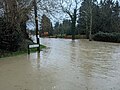
 Rushden Road and Manor Lane Flooding.jpg 1 247 × 935; 462 KB
-
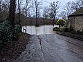
 Rushden Road Flood in Wymington.jpg 1 247 × 935; 371 KB
-
 Sharnford Summit Nature Reserve - geograph.org.uk - 4851562.jpg 640 × 640; 129 KB
-
 Smoking Stack - geograph.org.uk - 1337574.jpg 640 × 426; 280 KB
-
 St Lawrence's churchyard - geograph.org.uk - 6167219.jpg 1 600 × 1 070; 712 KB
-
 Telephone mast by the woodland - geograph.org.uk - 6166308.jpg 1 600 × 1 200; 407 KB
-
 The New Inn, Wymington.jpg 1 247 × 935; 338 KB
-
 Tunnel air shaft with PV cells on top - geograph.org.uk - 6023939.jpg 768 × 1 024; 215 KB
-
 Woodland near Blackmere farm - geograph.org.uk - 6166005.jpg 1 600 × 1 066; 595 KB
-
 Woodland near Wymington - geograph.org.uk - 4741178.jpg 640 × 355; 36 KB
-
 Work in progress - geograph.org.uk - 3203480.jpg 2 560 × 1 920; 1,08 MB
-
 Wymington - geograph.org.uk - 93604.jpg 640 × 480; 77 KB
-
 Wymington Fields.jpg 1 247 × 935; 351 KB
-
 Wymington, St Lawrence - geograph.org.uk - 5472845.jpg 4 608 × 3 456; 3,98 MB
-

-
 Byway to Wymington - geograph.org.uk - 315539.jpg 640 × 480; 179 KB
-
 Enclosed Bridleway - geograph.org.uk - 277827.jpg 640 × 480; 119 KB
-
 Footbridge West of Wymington - geograph.org.uk - 315565.jpg 640 × 480; 168 KB
-
 Footpath to Wymington - geograph.org.uk - 315538.jpg 640 × 480; 178 KB
-
 Former A6 descending into Rushden - geograph.org.uk - 93616.jpg 640 × 480; 62 KB
-
 Goosey Lodge Industrial Estate - geograph.org.uk - 93603.jpg 640 × 480; 75 KB
-
 Old Mediaeval Road - geograph.org.uk - 277490.jpg 640 × 480; 112 KB
-
 Public footpath into Great Hayes Wood - geograph.org.uk - 528810.jpg 640 × 480; 230 KB
-
 Railway Bridge near Wymington - geograph.org.uk - 336646.jpg 640 × 480; 134 KB
-
 Rural Scene - geograph.org.uk - 277558.jpg 640 × 480; 112 KB
-
 The A6 road south of Rushden - geograph.org.uk - 93612.jpg 640 × 480; 121 KB
-
 Woodland Edge West of Wymington - geograph.org.uk - 315556.jpg 640 × 480; 159 KB
-
 Woodland Path - geograph.org.uk - 277476.jpg 640 × 480; 171 KB


