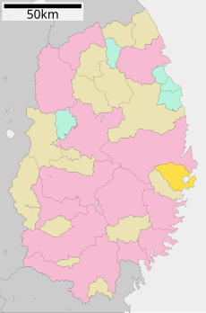
Category:Yamada, Iwate
Zur Navigation springen
Zur Suche springen
Ort in der Präfektur Iwate, Japan | |||||
| Medium hochladen | |||||
| Ist ein(e) | |||||
|---|---|---|---|---|---|
| Ort |
| ||||
| Liegt am oder im Gewässer |
| ||||
| Rechtsform |
| ||||
| Datum der Gründung, Erstellung, Entstehung, Erbauung |
| ||||
| Einwohnerzahl |
| ||||
| Fläche |
| ||||
| Ersetzt |
| ||||
| offizielle Website | |||||
 | |||||

한국어: 야마다 정
Русский: Ямада (посёлок)
中文:山田町
Unterkategorien
Es werden 7 von insgesamt 7 Unterkategorien in dieser Kategorie angezeigt:
In Klammern die Anzahl der enthaltenen Kategorien (K), Seiten (S), Dateien (D)
I
- Iwate-Funakoshi Station (4 D)
M
- Michinoeki Yamada (4 D)
O
- Orikasa Station (2 D)
R
- Rikuchu-Yamada Station (5 D)
T
- Toyomane Station (2 D)
Medien in der Kategorie „Yamada, Iwate“
Folgende 41 Dateien sind in dieser Kategorie, von 41 insgesamt.
-
Yamada in Iwate Prefecture Ja.svg 400 × 604; 12 KB
-
Yamada in Iwate Prefecture.png 981 × 801; 34 KB
-
Yamada in the Iwate prefecture.png 981 × 801; 34 KB
-
Yamada town Iwate prefecture Japan.svg 621 × 964; 19 KB
-
Bihan supermarket All Store.jpg 5.163 × 2.582; 9,6 MB
-
Emblem of Yamada, Iwate (black).svg 250 × 250; 905 Bytes
-
Emblem of Yamada, Iwate.jpg 137 × 141; 6 KB
-
Emblem of Yamada, Iwate.svg 250 × 250; 920 Bytes
-
Flag of Yamada Iwate.JPG 324 × 216; 7 KB
-
Flag of Yamada, Iwate.svg 600 × 400; 948 Bytes
-
Iwate Prefectural Yamada High School.jpg 3.776 × 2.520; 7,52 MB
-
Iwate Prefectural Yamada Hospital.jpg 5.993 × 2.996; 12,44 MB
-
Mercedes-Benz Zetros as a relief vehicle for the 2011 Tohoku Earthquake.jpg 3.600 × 2.400; 1,46 MB
-
NHK Yamada radio station1.JPG 3.936 × 5.248; 5,32 MB
-
NHK Yamada radio station2.jpg 2.273 × 1.792; 1,28 MB
-
Oranda-Jima Island Aerial Photograph.jpg 1.735 × 1.258; 242 KB
-
Population distribution of Yamada, Iwate, Japan.svg 512 × 256; 22 KB
-
Port of Yamada 19920219.jpg 1.610 × 1.078; 813 KB
-
Port yamada 20130601.JPG 3.072 × 2.304; 3,19 MB
-
Rikuchu yamada station east 20130601.JPG 3.072 × 2.304; 3,31 MB
-
Rikuchu yamada station northeast 20130601.JPG 3.072 × 2.304; 3,24 MB
-
Rikuchu yamada station west 20130601.JPG 3.072 × 2.304; 3,19 MB
-
The beacon for recovery - panoramio (1).jpg 3.648 × 2.736; 1,83 MB
-
The beacon for recovery - panoramio (2).jpg 3.648 × 2.736; 1,91 MB
-
The Sanriku Expressway was built with tsunamis in mind.jpg 1.279 × 840; 208 KB
-
Yamada Fire Station in Yamada, Iwate, Japan.jpg 5.180 × 2.590; 8,45 MB
-
Yamada IC 1.jpg 5.184 × 3.888; 4,57 MB
-
Yamada Municipal Yamada Junior High School.jpg 6.199 × 3.100; 11,16 MB
-
Yamada Oshima 20130601.jpg 3.072 × 2.304; 3,16 MB
-
Yamada Post Office in Yamada, Iwate, Japan.jpg 5.499 × 3.666; 9,99 MB
-
Yamada Saien 1.jpg 5.184 × 3.888; 6,01 MB
-
Yamada town hall in Iwate.JPG 3.648 × 2.736; 2,71 MB
-
Yamada wan 20130601.JPG 3.072 × 2.304; 3 MB
-
Yamada,Iwate town center area Aerial photograph.1977.jpg 5.267 × 4.999; 17,17 MB
-
Yamada-Kita IC 1.jpg 4.480 × 3.535; 2,59 MB
-
Yamada-Minami IC 1.jpg 5.184 × 3.888; 4,18 MB
-
Yamadaminami IC.jpg 1.157 × 868; 316 KB
-
十二神山 Junishin-zan - panoramio.jpg 3.456 × 2.304; 1,09 MB
-
基礎自治体位置図 03482 20140101.svg 600 × 970; 37 KB
-
安倍晋三‐2013.4.6.tif 234 × 350; 236 KB
-
山田八幡宮本殿.jpg 1.600 × 1.200; 676 KB


