Category:Yealand Conyers
Aller à la navigation
Aller à la recherche
English: Yealand Conyers is a village and civil parish in the English county of Lancashire. It is part of the City of Lancaster district. (→Yealand Conyers)
Polski: Yealand Conyers – wieś w Anglii, w hrabstwie Lancashire, w dystrykcie Lancaster. Leży 85 km na północny zachód od miasta Manchester i 344 km na północny zachód od Londynu. (→Yealand Conyers)
localité britannique du comté anglais de Lancashire  | |||||
| Téléverser des médias | |||||
| Nature de l’élément | |||||
|---|---|---|---|---|---|
| Lieu | cité de Lancaster, Lancashire, Angleterre du Nord-Ouest, Angleterre | ||||
 | |||||
Sous-catégories
Cette catégorie comprend 5 sous-catégories, dont les 5 ci-dessous.
L
- Leighton Hall, Lancashire (18 F)
- Leighton Moss RSPB reserve (67 F)
M
Média dans la catégorie « Yealand Conyers »
Cette catégorie comprend 307 fichiers, dont les 200 ci-dessous.
(page précédente) (page suivante)-
 "Sorry to stare ..... - geograph.org.uk - 3335823.jpg 2 555 × 1 775 ; 2,07 Mio
-
 A Coal Tit at Leighton Moss - geograph.org.uk - 5625268.jpg 1 600 × 1 179 ; 352 kio
-
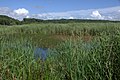
 A corner of Leighton Moss RSPB Reserve - geograph.org.uk - 1236255.jpg 640 × 480 ; 92 kio
-
 A corner of Leighton Moss RSPB Reserve. - geograph.org.uk - 1236251.jpg 640 × 480 ; 98 kio
-
 A Marsh Tit at Leighton Moss - geograph.org.uk - 5625263.jpg 1 600 × 1 192 ; 345 kio
-
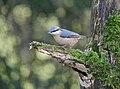 A Nuthatch at Leighton Moss - geograph.org.uk - 5625257.jpg 1 600 × 1 190 ; 296 kio
-
 A view across Leighton Moss - geograph.org.uk - 5625274.jpg 1 125 × 1 600 ; 196 kio
-
 A View of Leighton Moss - geograph.org.uk - 5689360.jpg 640 × 439 ; 85 kio
-
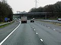
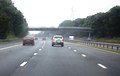
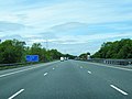
 A6 northbound near Yealand Conyers - geograph.org.uk - 5683922.jpg 640 × 480 ; 68 kio
-
 Approaching Grisedale - geograph.org.uk - 3399555.jpg 4 320 × 3 240 ; 4,51 Mio
-
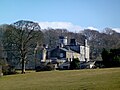
 Arriving at Leighton Hall - geograph.org.uk - 5390658.jpg 800 × 600 ; 180 kio
-
 At Leighton Moss - geograph.org.uk - 5689354.jpg 640 × 423 ; 69 kio
-
 At Leighton Moss Bridge - geograph.org.uk - 5183214.jpg 5 152 × 3 864 ; 7,41 Mio
-
 Bank Vole (Myodes glareolus), Leighton Moss - geograph.org.uk - 6228495.jpg 1 600 × 1 067 ; 620 kio
-

-
 Bearded Tit nesting facility - geograph.org.uk - 2304498.jpg 2 048 × 1 536 ; 2,96 Mio
-
 Beech roots, Summerhouse Hill - geograph.org.uk - 4523890.jpg 800 × 600 ; 223 kio
-

-
 Bench mark on St John's Church, Yealand Conyers - geograph.org.uk - 3716727.jpg 480 × 640 ; 139 kio
-
 Birdwatching hide at Leighton Moss RSPB Reserve - geograph.org.uk - 4335331.jpg 2 592 × 1 944 ; 690 kio
-

-
 Blue-tailed Damselfly (Ischnura elegans), Leighton Moss - geograph.org.uk - 3582576.jpg 1 024 × 681 ; 127 kio
-
 Boardwalk at Myers Farm - geograph.org.uk - 5183206.jpg 5 152 × 3 864 ; 7,65 Mio
-
 Bouldering area, Hyning Scout Wood - geograph.org.uk - 4386802.jpg 640 × 480 ; 163 kio
-
 Boundary stone for Warton and Yealand Conyers - geograph.org.uk - 2188054.jpg 480 × 640 ; 142 kio
-
 Bridge 141, Lancaster Canal - geograph.org.uk - 4871858.jpg 640 × 425 ; 236 kio
-
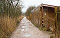 Bridleway passing Public Hide - geograph.org.uk - 5292287.jpg 1 500 × 946 ; 1,7 Mio
-
 Brown Hawker (Aeshna grandis), Leighton Moss - geograph.org.uk - 3582566.jpg 1 024 × 681 ; 31 kio
-
 Bus calling in at Leighton Hall - geograph.org.uk - 4275130.jpg 640 × 480 ; 105 kio
-
 Bus stop on Yealand Road, Yealand Conyers - geograph.org.uk - 4691336.jpg 640 × 480 ; 65 kio
-
 Canal bridge - geograph.org.uk - 2691091.jpg 640 × 480 ; 60 kio
-
 Canals end - geograph.org.uk - 5513696.jpg 928 × 667 ; 500 kio
-
 Car-parking area, Leighton Hall - geograph.org.uk - 3335824.jpg 2 592 × 1 944 ; 1,29 Mio
-
 Causeway bridge at Leighton Moss - geograph.org.uk - 2299835.jpg 2 048 × 1 536 ; 2,65 Mio
-
 Causeway through the reedbed - geograph.org.uk - 4468476.jpg 1 024 × 683 ; 956 kio
-
 Causeway through the reedbed - geograph.org.uk - 4468495.jpg 1 024 × 683 ; 1,03 Mio
-
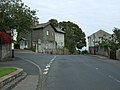
 Church, Yealand Conyers - geograph.org.uk - 4691333.jpg 640 × 480 ; 84 kio
-
 Cinderbarrow Lane Bridge over Southbound M6 - geograph.org.uk - 4032739.jpg 640 × 480 ; 255 kio
-
 Cinderbarrow Lane Bridge, M6 - geograph.org.uk - 2637151.jpg 640 × 406 ; 31 kio
-
 Cleared enclosure, Yealand Conyers - geograph.org.uk - 4935426.jpg 640 × 425 ; 241 kio
-
 Commemorative seat above Leighton Hall - geograph.org.uk - 1451868.jpg 640 × 426 ; 322 kio
-
 Coots (Fulica atra), Leighton Moss - geograph.org.uk - 6228498.jpg 1 600 × 1 068 ; 634 kio
-
 Cornfield near Grisedale Farm - geograph.org.uk - 1451860.jpg 640 × 426 ; 301 kio
-
 Cottages at Yealand Manor - geograph.org.uk - 4994760.jpg 1 024 × 768 ; 228 kio
-

-
 Dedication stone, Yealand War Memorial (2) - geograph.org.uk - 4274383.jpg 640 × 480 ; 167 kio
-
 Dedication stone, Yealand War Memorial (3) - geograph.org.uk - 4274395.jpg 640 × 480 ; 179 kio
-
 Dedication stones, Yealand War Memorial - geograph.org.uk - 4274380.jpg 640 × 480 ; 176 kio
-
 Deepdale - geograph.org.uk - 1601569.jpg 640 × 480 ; 139 kio
-
 Deepdale and Grisedale Woods - geograph.org.uk - 5183158.jpg 5 152 × 3 864 ; 7,58 Mio
-
 Deepdale Pond - geograph.org.uk - 3308365.jpg 2 560 × 1 920 ; 2,01 Mio
-
 Deepdale Pond - geograph.org.uk - 5474607.jpg 640 × 480 ; 150 kio
-
 Deepdale Wood - geograph.org.uk - 5183222.jpg 5 152 × 3 864 ; 7,73 Mio
-
 Detail of the sign at Peter Lane kiln - geograph.org.uk - 4386685.jpg 480 × 640 ; 111 kio
-
 Disused lime kiln near Yealand Conyers - geograph.org.uk - 4994718.jpg 1 024 × 768 ; 295 kio
-
 Disused lock at Tewitfield - geograph.org.uk - 4994784.jpg 1 024 × 768 ; 270 kio
-
 Doline in Cringlebarrow Wood - geograph.org.uk - 820576.jpg 640 × 480 ; 149 kio
-
 Doline near Yealand Manor - geograph.org.uk - 4896149.jpg 640 × 480 ; 73 kio
-
 Drain in the marsh at Leighton Moss - geograph.org.uk - 3582582.jpg 681 × 1 024 ; 242 kio
-
 Drain in the reedbed at Leighton Moss - geograph.org.uk - 6228485.jpg 1 600 × 1 067 ; 860 kio
-
 Drainage channel, Leighton Hall Home Farm - geograph.org.uk - 1601585.jpg 480 × 640 ; 106 kio
-
 Dykes House, Yealand Conyers - geograph.org.uk - 2176176.jpg 640 × 480 ; 104 kio
-
 Eighth Lock above Tewitfield - geograph.org.uk - 5513690.jpg 1 024 × 768 ; 734 kio
-
 End of bridleway - geograph.org.uk - 4468470.jpg 1 024 × 683 ; 1,07 Mio
-
 Entering Lancashire - The Red Rose County - geograph.org.uk - 3100828.jpg 4 126 × 1 953 ; 4,41 Mio
-
 Farm track (footpath) off Peter Lane - geograph.org.uk - 4691408.jpg 640 × 480 ; 124 kio
-
 Fifth Lock above Tewitfield - geograph.org.uk - 5513678.jpg 1 024 × 768 ; 699 kio
-
 Flooded causeway, Leighton Moss - geograph.org.uk - 1591088.jpg 480 × 640 ; 105 kio
-
 Flooding at Yealand School - geograph.org.uk - 4780627.jpg 720 × 540 ; 115 kio
-
 Footbridge over drain - geograph.org.uk - 4468501.jpg 1 024 × 683 ; 1,31 Mio
-
 Footpath off Peter Lane - geograph.org.uk - 4691400.jpg 640 × 480 ; 146 kio
-
 Footpath off Peter Lane, Yealand Conyers - geograph.org.uk - 4691340.jpg 640 × 480 ; 139 kio
-
 Footpath to Leighton Hall - geograph.org.uk - 3582573.jpg 1 024 × 682 ; 178 kio
-
 Former Farmhouse near Leighton Moss NR - geograph.org.uk - 2302602.jpg 600 × 450 ; 216 kio
-
 Former Police Station, Yealand Conyers - geograph.org.uk - 3716755.jpg 640 × 480 ; 106 kio
-
 Fourth Lock above Tewitfield - geograph.org.uk - 5513670.jpg 966 × 726 ; 621 kio
-
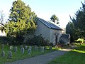
 Friends Meeting House, Yealand Conyers - geograph.org.uk - 3382539.jpg 640 × 425 ; 145 kio
-
 Friends Meeting House, Yealand Conyers - geograph.org.uk - 3753068.jpg 4 320 × 3 240 ; 5,59 Mio
-
 From Lilian's Hide - geograph.org.uk - 5183194.jpg 5 152 × 3 864 ; 7,4 Mio
-
 From the Public Hide, Leighton Moss - geograph.org.uk - 3353820.jpg 800 × 530 ; 114 kio
-
 Grazing off Peter Lane - geograph.org.uk - 4678666.jpg 640 × 480 ; 83 kio
-
 Grazing off Snape Lane - geograph.org.uk - 4691328.jpg 640 × 480 ; 46 kio
-
 Grisedale - geograph.org.uk - 5474568.jpg 640 × 480 ; 78 kio
-
 Grisedale and Stoney Woods - geograph.org.uk - 5183147.jpg 5 152 × 3 864 ; 7,71 Mio
-
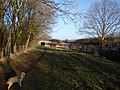
 Grisedale Farm - geograph.org.uk - 1451364.jpg 640 × 426 ; 292 kio
-
 Grisedale Farm and Leighton Moss - geograph.org.uk - 3728849.jpg 800 × 600 ; 164 kio
-
 Heading to Leighton Hall - geograph.org.uk - 5203818.jpg 800 × 600 ; 149 kio
-
 Holmer Tarn - geograph.org.uk - 1601544.jpg 640 × 480 ; 111 kio
-
 Holmer Tarn - geograph.org.uk - 1748923.jpg 640 × 480 ; 95 kio
-
 Holmer Tarn - gone^ - geograph.org.uk - 1913098.jpg 640 × 480 ; 69 kio
-
 Holmer Tarn - what's left of it - geograph.org.uk - 1856529.jpg 640 × 480 ; 101 kio
-
 Holmer Tarn much reduced - geograph.org.uk - 1748926.jpg 640 × 480 ; 74 kio
-
 Holmer Tarn, full to overflowing (2) - geograph.org.uk - 3303961.jpg 800 × 464 ; 83 kio
-
 Holmer Tarn, full to overflowing - geograph.org.uk - 3303958.jpg 800 × 488 ; 81 kio
-
 House on Yealand Road, Yealand Conyers - geograph.org.uk - 4678660.jpg 640 × 480 ; 81 kio
-
 Hungry sheep - geograph.org.uk - 1659098.jpg 640 × 480 ; 112 kio
-
 In Cringlebarrow Wood - geograph.org.uk - 3308350.jpg 1 920 × 2 560 ; 1,38 Mio
-

-
 Island in front of the Public Hide at Leighton Moss - geograph.org.uk - 3582561.jpg 1 024 × 682 ; 232 kio
-
 Lamb on boulder, Summerhouse Hill - geograph.org.uk - 5390645.jpg 800 × 600 ; 116 kio
-
 Lancaster Canal - geograph.org.uk - 4325969.jpg 4 608 × 3 456 ; 3,72 Mio
-
 Lancaster Canal from Saltermire Bridge - geograph.org.uk - 2990500.jpg 640 × 480 ; 148 kio
-
 Lancaster Canal, north of Tewitfield - geograph.org.uk - 1900295.jpg 425 × 640 ; 383 kio
-
 Lancaster Canal, Tewitfield - geograph.org.uk - 4871854.jpg 640 × 640 ; 310 kio
-
 Late November afternoon, Yealand Conyers - geograph.org.uk - 2176132.jpg 960 × 601 ; 175 kio
-
 Leighton Hall from the rear - geograph.org.uk - 6373554.jpg 4 320 × 3 240 ; 4,61 Mio
-
 Leighton Moss - geograph.org.uk - 2404538.jpg 1 024 × 768 ; 200 kio
-
 Leighton Moss - geograph.org.uk - 4695287.jpg 640 × 381 ; 103 kio
-
 Leighton Moss Causeway - geograph.org.uk - 2304526.jpg 2 048 × 1 536 ; 2,36 Mio
-
 Leighton Moss from the causeway - geograph.org.uk - 2304528.jpg 2 048 × 1 536 ; 2,08 Mio
-
 Leighton Moss from the causeway bridge - geograph.org.uk - 2304522.jpg 2 048 × 1 536 ; 2,28 Mio
-

-
 Leighton Moss from the public hide - geograph.org.uk - 2304531.jpg 2 048 × 1 536 ; 1,39 Mio
-
 Leighton Moss from the Skytower - geograph.org.uk - 6228478.jpg 1 600 × 1 067 ; 630 kio
-
 Leighton Moss from the Skytower - geograph.org.uk - 6228479.jpg 1 600 × 1 067 ; 706 kio
-
 Leighton Moss from the Skytower - geograph.org.uk - 6228481.jpg 1 600 × 1 067 ; 719 kio
-
 Leighton Moss in spring - geograph.org.uk - 4474250.jpg 640 × 425 ; 163 kio
-
 Leighton Moss in spring - geograph.org.uk - 4474255.jpg 640 × 349 ; 115 kio
-
 Leighton Moss in spring - geograph.org.uk - 4474259.jpg 640 × 425 ; 209 kio
-
 Leighton Moss in spring - geograph.org.uk - 4474261.jpg 640 × 476 ; 241 kio
-
 Leighton Moss in summer - geograph.org.uk - 3627996.jpg 640 × 480 ; 158 kio
-
 Leighton Moss in winter - geograph.org.uk - 2211890.jpg 640 × 425 ; 359 kio
-
 Leighton Moss in winter - geograph.org.uk - 2211892.jpg 640 × 425 ; 282 kio
-
 Leighton Moss in winter - geograph.org.uk - 2211893.jpg 640 × 425 ; 365 kio
-
 Leighton Moss in winter - geograph.org.uk - 2211895.jpg 640 × 425 ; 448 kio
-
 Leighton Moss in winter - geograph.org.uk - 5688696.jpg 1 280 × 850 ; 458 kio
-
 Leighton Moss in winter - geograph.org.uk - 5688699.jpg 640 × 425 ; 87 kio
-
 Leighton Moss in winter - geograph.org.uk - 5688702.jpg 1 280 × 850 ; 610 kio
-
 Leighton Moss Public hide - geograph.org.uk - 1573160.jpg 640 × 481 ; 35 kio
-
 Leighton Moss RSPB Reserve. - geograph.org.uk - 2299792.jpg 2 048 × 1 536 ; 2,32 Mio
-
 Leighton Moss View - geograph.org.uk - 5689346.jpg 640 × 418 ; 82 kio
-
 Lillian's Hide - geograph.org.uk - 1971032.jpg 1 998 × 1 400 ; 525 kio
-
 Lime Kiln, Warton - geograph.org.uk - 3489508.jpg 1 936 × 2 592 ; 1,19 Mio
-
 Lime kiln, Yealand Conyers - geograph.org.uk - 5312053.jpg 640 × 512 ; 388 kio
-
 Limestone barn at Leighton Moss - geograph.org.uk - 2299803.jpg 2 048 × 1 536 ; 2,21 Mio
-
 Limestone boulder on Summerhouse Hill - geograph.org.uk - 3728862.jpg 800 × 600 ; 122 kio
-
 Limestone boulder, Leighton Park - geograph.org.uk - 5312041.jpg 640 × 425 ; 468 kio
-
 Limestone boulder, Summerhouse Hill, Yealand - geograph.org.uk - 2187901.jpg 640 × 360 ; 95 kio
-
 Limestone boulders above Yealand Conyers - geograph.org.uk - 2176145.jpg 960 × 720 ; 313 kio
-
 Limestone outcrop in Cringlebarrow Wood - geograph.org.uk - 2211897.jpg 640 × 425 ; 539 kio
-
 Lock Gates Tewitfield locks - geograph.org.uk - 5544264.jpg 1 024 × 768 ; 712 kio
-
 Looking northwest from Lilian's Hide - geograph.org.uk - 2299781.jpg 2 048 × 1 536 ; 1,9 Mio
-
 M6 crossing the Lancaster Canal - geograph.org.uk - 2712929.jpg 2 645 × 1 964 ; 655 kio
-
 M6 Deerslet - geograph.org.uk - 2476032.jpg 640 × 480 ; 62 kio
-
 M6 from Cinderbarrow Lane - geograph.org.uk - 2990497.jpg 640 × 480 ; 122 kio
-
 M6 north of Tewitfield - geograph.org.uk - 3504123.jpg 640 × 480 ; 59 kio
-
 M6 Tewitfield Lock - geograph.org.uk - 2476024.jpg 640 × 457 ; 47 kio
-
 M6, southbound - geograph.org.uk - 3231958.jpg 640 × 430 ; 39 kio
-
 Main channel through reedbed - geograph.org.uk - 4468491.jpg 701 × 1 024 ; 826 kio
-
 Main channel through the reedbed at Leighton Moss - geograph.org.uk - 3582569.jpg 1 024 × 681 ; 162 kio
-
 Main channel through the reedbed at Leighton Moss - geograph.org.uk - 3582571.jpg 1 024 × 681 ; 230 kio
-
 Maize crop beside track - geograph.org.uk - 4678658.jpg 640 × 480 ; 69 kio
-
 Maize crop off Snape Lane - geograph.org.uk - 4691324.jpg 640 × 480 ; 65 kio
-
 Male Teal (Anas crecca), Leighton Moss - geograph.org.uk - 3905601.jpg 1 024 × 717 ; 208 kio
-
 Memorial plaque, Hyning Scout Wood - geograph.org.uk - 4386775.jpg 640 × 431 ; 105 kio
-
 Memorial plaque, public hide, Leighton Moss - geograph.org.uk - 2187113.jpg 640 × 480 ; 123 kio
-
 Mine entrance near Crag Foot - geograph.org.uk - 1659052.jpg 640 × 480 ; 137 kio
-
 Mossy limestone by Peter Lane - geograph.org.uk - 5203792.jpg 600 × 800 ; 239 kio
-
 Mossy limestone pavement, Peter Lane - geograph.org.uk - 3731803.jpg 800 × 600 ; 310 kio
-
 Mossy trunks at Leighton Moss - geograph.org.uk - 2299761.jpg 2 048 × 1 536 ; 2,8 Mio
-
 Murmurating Starlings, Leighton Moss - geograph.org.uk - 6354401.jpg 1 600 × 1 067 ; 566 kio
-
 Murmurating Starlings, Leighton Moss - geograph.org.uk - 6354405.jpg 1 600 × 1 067 ; 880 kio
-
 Myers Farm - geograph.org.uk - 5183182.jpg 5 152 × 3 864 ; 7,46 Mio
-

-
 Nissen huts, Coach Road, Warton - geograph.org.uk - 3400772.jpg 4 320 × 3 240 ; 4,68 Mio
-
 Old Hall Farmhouse, Yealand Conyers.jpg 640 × 480 ; 133 kio
-
 Old lime kiln above Yealand Conyers - geograph.org.uk - 2187906.jpg 480 × 640 ; 183 kio
-
 On The Towpath - geograph.org.uk - 4325967.jpg 4 608 × 3 456 ; 3,87 Mio
-
 Open area in the reedbed at Leighton Moss - geograph.org.uk - 3582555.jpg 1 024 × 682 ; 252 kio
-
 Open area in the reedbeds at Leighton Moss - geograph.org.uk - 3582556.jpg 1 024 × 682 ; 244 kio
-
 Open pasture in woodland above Yealand Manor - geograph.org.uk - 1601562.jpg 640 × 480 ; 139 kio
-
 Opportunist hens, Grisedale Farm - geograph.org.uk - 3354458.jpg 800 × 530 ; 149 kio
-
 Paddling Robin - geograph.org.uk - 5625243.jpg 1 600 × 1 200 ; 166 kio
-
 Path alongside Myers Dike - geograph.org.uk - 5295075.jpg 1 500 × 1 125 ; 2,32 Mio
-
 Path and causeway across Leighton Moss - geograph.org.uk - 2299846.jpg 2 048 × 1 536 ; 2,22 Mio
-
 Path at Leighton Moss RSPB Reserve - geograph.org.uk - 2299746.jpg 2 048 × 1 536 ; 2,46 Mio
-
 People on the causeway at Leighton Moss - geograph.org.uk - 6354398.jpg 1 600 × 1 067 ; 452 kio
-
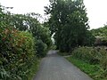
 Peter Lane - geograph.org.uk - 4691405.jpg 640 × 480 ; 118 kio
-
 Peter Lane - geograph.org.uk - 4691412.jpg 640 × 480 ; 110 kio
-
 Peter Lane - geograph.org.uk - 4691416.jpg 640 × 480 ; 95 kio
-
 Peter Lane kiln - geograph.org.uk - 3754210.jpg 4 320 × 3 240 ; 5,74 Mio
-
 Peter Lane lime kiln - geograph.org.uk - 1586406.jpg 640 × 480 ; 104 kio
-
 Peter Lane, Yealand Conyers - geograph.org.uk - 1939196.jpg 3 072 × 2 304 ; 2,29 Mio
-
 Platforms at the reed beds, Leighton Moss - geograph.org.uk - 3353767.jpg 800 × 530 ; 159 kio
-
 Pond created for wildlife - geograph.org.uk - 761304.jpg 640 × 480 ; 99 kio
-
 Pools and reed bed at Leighton Moss - geograph.org.uk - 2785554.jpg 1 500 × 1 125 ; 1,54 Mio
-
 Prehistoric cairn - geograph.org.uk - 1586413.jpg 640 × 480 ; 171 kio
-
 Priest Hutton, canal - geograph.org.uk - 2956984.jpg 1 024 × 768 ; 204 kio
-
 Priest Hutton, M6 - geograph.org.uk - 2956988.jpg 1 024 × 768 ; 126 kio
-
 Public Hide - Leighton Moss - geograph.org.uk - 1247727.jpg 640 × 480 ; 115 kio
-
 Public Hide, RSPB Leighton Moss Nature Reserve - geograph.org.uk - 2302616.jpg 600 × 450 ; 237 kio
-
 Purple Loosestrife (Lythrum salicaria), Leighton Moss - geograph.org.uk - 3582551.jpg 682 × 1 024 ; 332 kio
-
 Red Deer (Cervus elaphus) in the reedbed at Leighton Moss - geograph.org.uk - 6228489.jpg 1 600 × 1 067 ; 577 kio
-
 Red Virginia creeper on the New Inn - geograph.org.uk - 3705629.jpg 640 × 480 ; 138 kio
-
 Reed reflections at Leighton Moss - geograph.org.uk - 2704390.jpg 1 600 × 1 200 ; 455 kio
-
 Reedbeds and woodland on the Moss - geograph.org.uk - 5183242.jpg 3 000 × 2 250 ; 1,67 Mio
-
 Reeds at Leighton Moss - geograph.org.uk - 3355086.jpg 530 × 800 ; 192 kio
-
 Reeds at RSPB Leighton Moss - geograph.org.uk - 2299741.jpg 2 048 × 1 536 ; 2,19 Mio
-
 Rose Acre Lane - geograph.org.uk - 1308640.jpg 640 × 480 ; 95 kio
-
 Rose Acre Lane - geograph.org.uk - 1308645.jpg 640 × 480 ; 120 kio


,_Leighton_Moss_-_geograph.org.uk_-_6228495.jpg)
_Grit_Trays,_RSPB_Leighton_Moss_-_geograph.org.uk_-_2302639.jpg)


,_Leighton_Moss_-_geograph.org.uk_-_3582576.jpg)


,_Leighton_Moss_-_geograph.org.uk_-_3582566.jpg)


,_Leighton_Moss_-_geograph.org.uk_-_6228498.jpg)


_-_geograph.org.uk_-_4274383.jpg)
_-_geograph.org.uk_-_4274395.jpg)


_off_Peter_Lane_-_geograph.org.uk_-_4691408.jpg)


_-_geograph.org.uk_-_3303961.jpg)


,_Leighton_Moss_-_geograph.org.uk_-_3905601.jpg)


,_Leighton_Moss_-_geograph.org.uk_-_3582551.jpg)
_in_the_reedbed_at_Leighton_Moss_-_geograph.org.uk_-_6228489.jpg)


