Category:Yealand Redmayne
Aller à la navigation
Aller à la recherche
English: Yealand Redmayne is a village and former civil parish in the English county of Lancashire. It is in the City of Lancaster district. (→Yealand Redmayne)
Polski: Yealand Redmayne – wieś w Anglii, w hrabstwie Lancashire, w dystrykcie Lancaster. Leży 87 km na północny zachód od miasta Manchester i 346 km na północny zachód od Londynu. (→Yealand Redmayne)
localité britannique du comté anglais de Lancashire  | |||||
| Téléverser des médias | |||||
| Nature de l’élément |
| ||||
|---|---|---|---|---|---|
| Lieu | The Yealands, cité de Lancaster, Lancashire, Angleterre du Nord-Ouest, Angleterre | ||||
| Population |
| ||||
 | |||||
Sous-catégories
Cette catégorie comprend seulement la sous-catégorie ci-dessous.
Y
- Yealand Storrs (12 F)
Média dans la catégorie « Yealand Redmayne »
Cette catégorie comprend 239 fichiers, dont les 200 ci-dessous.
(page précédente) (page suivante)-
 'Getting some rays' - geograph.org.uk - 3752805.jpg 600 × 800 ; 155 kio
-
 'Silver' birches at Trowbarrow - geograph.org.uk - 4711815.jpg 800 × 600 ; 126 kio
-
 A new nature reserve - geograph.org.uk - 3752936.jpg 640 × 480 ; 149 kio
-
 A View of Leighton Moss - geograph.org.uk - 5689360.jpg 640 × 439 ; 85 kio
-
 A6 east of Yealand Redmayne - geograph.org.uk - 5683928.jpg 640 × 480 ; 74 kio
-
 A6 near Hazel Grove Farm - geograph.org.uk - 5683936.jpg 640 × 481 ; 49 kio
-
 A6 south at Nineteen Acre Lane crossroads - geograph.org.uk - 2961075.jpg 640 × 480 ; 98 kio
-

-
 Aerial battle above Hilderstone Moss - geograph.org.uk - 5059070.jpg 1 280 × 959 ; 646 kio
-
 Approaching Trowbarrow Quarry - geograph.org.uk - 2963228.jpg 2 592 × 1 944 ; 1,63 Mio
-
 Beck near Hawes Water - geograph.org.uk - 2840843.jpg 640 × 419 ; 415 kio
-
 Bench mark, Yealand Road Bridge, Lancaster Canal - geograph.org.uk - 3480501.jpg 640 × 480 ; 154 kio
-
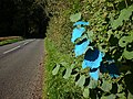 Blue hazel, Storrs Lane - geograph.org.uk - 3693441.jpg 640 × 480 ; 172 kio
-
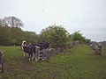
 Bluefaced Leicesters, Yealand Conyers - geograph.org.uk - 2176599.jpg 640 × 480 ; 144 kio
-
 Boat in the reeds - geograph.org.uk - 1236259.jpg 640 × 480 ; 124 kio
-
 Boulders and oak tree near West Coppice - geograph.org.uk - 4423712.jpg 800 × 600 ; 180 kio
-
 Boulders near Brackenthwaite - geograph.org.uk - 1591107.jpg 640 × 480 ; 77 kio
-
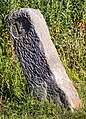
 Boundary stone by Leighton Beck^ - geograph.org.uk - 3481176.jpg 640 × 480 ; 160 kio
-
 Boundary stone, Leighton Beck - geograph.org.uk - 1591093.jpg 640 × 480 ; 161 kio
-
 Bridge 142, Lancaster Canal - geograph.org.uk - 3382513.jpg 640 × 425 ; 172 kio
-
 Bridge 143, Lancaster Canal - geograph.org.uk - 4871868.jpg 640 × 425 ; 167 kio
-
 Bridleway near the A6 - geograph.org.uk - 4896616.jpg 640 × 480 ; 139 kio
-
 Bridleway north of Nineteen Acre Lane (2) - geograph.org.uk - 4896635.jpg 720 × 540 ; 106 kio
-
 Bridleway north of Nineteen Acre Lane - geograph.org.uk - 4896229.jpg 720 × 540 ; 126 kio
-
 By Coldwell Lane - geograph.org.uk - 5780895.jpg 1 024 × 683 ; 361 kio
-
 Byre, Coldwell Parrock - geograph.org.uk - 1615416.jpg 640 × 480 ; 118 kio
-
 Canal tranquility - geograph.org.uk - 2691099.jpg 640 × 480 ; 54 kio
-
 Cattle by the footpath above Leighton Beck - geograph.org.uk - 3481194.jpg 640 × 480 ; 93 kio
-
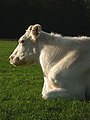
 Cattle feeding near Yealand - geograph.org.uk - 2176571.jpg 640 × 480 ; 92 kio
-
 Cattle grazing a new reserve - geograph.org.uk - 3752949.jpg 640 × 480 ; 74 kio
-
 Cattle grazing near Hawes Water - geograph.org.uk - 4275107.jpg 480 × 640 ; 92 kio
-
 Chickens by the Yealand Road Bridge - geograph.org.uk - 4277904.jpg 640 × 480 ; 84 kio
-
 Cinderbarrow - geograph.org.uk - 1737188.jpg 640 × 480 ; 74 kio
-
 Cinderbarrow picnic area - geograph.org.uk - 1615495.jpg 640 × 480 ; 68 kio
-
 Climbers at Trowbarrow - geograph.org.uk - 4848071.jpg 600 × 800 ; 158 kio
-

-

-
 Climbing 'Jomo' at Trowbarrow Quarry - geograph.org.uk - 4423647.jpg 600 × 800 ; 199 kio
-
 Climbing at Trowbarrow - geograph.org.uk - 2704361.jpg 800 × 600 ; 184 kio
-
 Coldwell Limeworks - overgrown - geograph.org.uk - 4384097.jpg 480 × 640 ; 139 kio
-
 Coldwell Parrock Nature Reserve - geograph.org.uk - 1596282.jpg 640 × 480 ; 86 kio
-
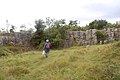
 Conservation volunteers at Trowbarrow Quarry - geograph.org.uk - 2667278.jpg 800 × 600 ; 226 kio
-
 Conservation volunteers, Trowbarrow - geograph.org.uk - 4420201.jpg 640 × 480 ; 94 kio
-
 County boundary - geograph.org.uk - 1867579.jpg 1 960 × 1 430 ; 412 kio
-
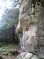 Crag on Round Top - geograph.org.uk - 3308364.jpg 1 920 × 2 560 ; 2,16 Mio
-
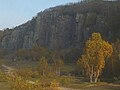
 Cringlebarrow Hill - geograph.org.uk - 3775013.jpg 2 560 × 1 920 ; 2,72 Mio
-
 Cringlebarrow Hill - geograph.org.uk - 4258564.jpg 3 456 × 4 608 ; 3,28 Mio
-

-

-
 Cut bench mark, Moss Bridge, Lancaster Canal - geograph.org.uk - 3480489.jpg 640 × 480 ; 125 kio
-

-
 Cut benchmark, Brackenthwaite Farm - geograph.org.uk - 4198688.jpg 640 × 480 ; 163 kio
-
 Cygnet on an icy Lancaster Canal - geograph.org.uk - 4277879.jpg 681 × 480 ; 111 kio
-
 Cygnet on the Lancaster Canal - geograph.org.uk - 1737157.jpg 480 × 640 ; 82 kio
-
 Dandelions under Yealand Road Bridge - geograph.org.uk - 3481045.jpg 600 × 800 ; 216 kio
-
 Deer herd east of Hawes Water - geograph.org.uk - 4423705.jpg 640 × 480 ; 155 kio
-
 Diamond Wall, Trowbarrow Quarry - geograph.org.uk - 1601796.jpg 480 × 640 ; 116 kio
-
-
 Donkeys grazing by Coldwell Lane - geograph.org.uk - 3258038.jpg 640 × 518 ; 168 kio
-
 Fallen Ash, Cringlebarrow - geograph.org.uk - 3308357.jpg 2 560 × 1 920 ; 1,41 Mio
-
 Farm Buildings at Yealand Storrs - geograph.org.uk - 6172777.jpg 800 × 600 ; 712 kio
-
 Farmland near Hilderstone - geograph.org.uk - 3815574.jpg 640 × 468 ; 25 kio
-
 Farmland south of Yealand Storrs - geograph.org.uk - 2211896.jpg 640 × 425 ; 427 kio
-
 Farmland, Yealand Redmayne - geograph.org.uk - 5780902.jpg 1 024 × 683 ; 344 kio
-
 Fell ponies at Trowbarrow (2) - geograph.org.uk - 3784531.jpg 800 × 600 ; 112 kio
-
 Fell ponies at Trowbarrow - geograph.org.uk - 3784526.jpg 600 × 800 ; 177 kio
-
 Field - geograph.org.uk - 3013426.jpg 3 008 × 2 000 ; 606 kio
-
 Field path by West Coppice - geograph.org.uk - 5474588.jpg 640 × 480 ; 113 kio
-
 Field track north of Yealand Storrs - geograph.org.uk - 3126854.jpg 640 × 480 ; 109 kio
-
 Fields by Leighton Beck - geograph.org.uk - 5253506.jpg 640 × 512 ; 239 kio
-
 Fields near Coldwell Farm - geograph.org.uk - 5253502.jpg 640 × 425 ; 190 kio
-
 Fields near Coldwell Farm - geograph.org.uk - 5253503.jpg 640 × 425 ; 150 kio
-
 Flooded car park, Yealand Village Hall - geograph.org.uk - 4780628.jpg 720 × 540 ; 95 kio
-
 Flooded field at dusk, Yealand Redmayne - geograph.org.uk - 3255418.jpg 800 × 600 ; 109 kio
-
 Footpath in Cringlebarrow Wood - geograph.org.uk - 5474597.jpg 640 × 480 ; 157 kio
-
 Footpath into Cringlebarrow Woods - geograph.org.uk - 1451908.jpg 640 × 426 ; 335 kio
-
 Footpath near Brackenthwaite - geograph.org.uk - 1591103.jpg 640 × 480 ; 85 kio
-
 Footpath over Thrang Moss - geograph.org.uk - 1601551.jpg 480 × 640 ; 58 kio
-
 Footpath through Gait Barrows Reserve - geograph.org.uk - 1451854.jpg 640 × 426 ; 268 kio
-
 Footpath through Yealand Hall Allotment - geograph.org.uk - 2037601.jpg 480 × 640 ; 130 kio
-
 Footpath to Red Bridge - geograph.org.uk - 2348869.jpg 427 × 640 ; 179 kio
-
 Footpath to Thrang Brow Lane, Yealand Storrs - geograph.org.uk - 1451869.jpg 640 × 426 ; 297 kio
-
 Footpath to Yealand Redmayne - geograph.org.uk - 2176556.jpg 640 × 480 ; 119 kio
-
 Footpath via Hilderstone to the A6 - geograph.org.uk - 3345469.jpg 2 592 × 1 944 ; 3,36 Mio
-
 Fourteen miles to Kendal - geograph.org.uk - 3345475.jpg 2 592 × 1 944 ; 2,58 Mio
-
 Gait Barrows - geograph.org.uk - 2840859.jpg 425 × 640 ; 403 kio
-
 Gait Barrows - geograph.org.uk - 2840861.jpg 640 × 425 ; 437 kio
-
 Gait Barrows - geograph.org.uk - 2840862.jpg 640 × 425 ; 347 kio
-
 Gait Barrows - geograph.org.uk - 5251025.jpg 1 920 × 1 280 ; 542 kio
-
 Gait Barrows pavement - geograph.org.uk - 3013430.jpg 3 008 × 2 000 ; 1 006 kio
-
 Gaitbarrow Nature Reserve - geograph.org.uk - 1130722.jpg 640 × 480 ; 108 kio
-
 Gaitbarrows Yew - geograph.org.uk - 1975790.jpg 1 600 × 1 503 ; 2,23 Mio
-
 Gate stile near West Coppice - geograph.org.uk - 1451850.jpg 640 × 426 ; 377 kio
-
 Gate, White Moss - geograph.org.uk - 2176594.jpg 640 × 480 ; 196 kio
-
 Glacial erratic, Coldwell Parrock - geograph.org.uk - 1358502.jpg 640 × 480 ; 139 kio
-
 Glacial erratic, Yealand Hall Allotment - geograph.org.uk - 4845300.jpg 720 × 540 ; 193 kio
-
 Grazing, Cinderbarrow - geograph.org.uk - 4690806.jpg 640 × 428 ; 40 kio
-
 Grey heron - geograph.org.uk - 4472817.jpg 1 024 × 683 ; 642 kio
-
 Greylag goose and gosling - geograph.org.uk - 3958952.jpg 1 600 × 1 202 ; 469 kio
-
 Hanging Hill looking west - geograph.org.uk - 1737046.jpg 640 × 480 ; 98 kio
-
 Hazel Grove Farm - geograph.org.uk - 4896202.jpg 720 × 450 ; 83 kio
-
 Heavy iron implement, Coldwell Lime Works - geograph.org.uk - 4384111.jpg 480 × 640 ; 216 kio
-
 Heron with Fish - geograph.org.uk - 4325974.jpg 2 514 × 2 196 ; 1,65 Mio
-
 High water on the causeway, Leighton Moss - geograph.org.uk - 1601588.jpg 480 × 640 ; 458 kio
-
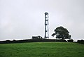
 Hilltop communication mast - geograph.org.uk - 3231951.jpg 640 × 430 ; 30 kio
-
 Hilltop Telecommunication mast - geograph.org.uk - 2637153.jpg 640 × 430 ; 33 kio
-
 In Cringlebarrow Woods - geograph.org.uk - 3308356.jpg 1 920 × 2 560 ; 2,06 Mio
-
 Keeping the workers happy - geograph.org.uk - 4119305.jpg 600 × 800 ; 227 kio
-
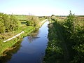 Lancaster Canal - geograph.org.uk - 1308553.jpg 640 × 480 ; 81 kio
-
 Lancaster Canal - geograph.org.uk - 4325971.jpg 3 456 × 4 608 ; 3,39 Mio
-
 Lancaster Canal at Moss Bridge - geograph.org.uk - 3438873.jpg 2 048 × 1 536 ; 551 kio
-
 Lancaster Canal Bridge 142.jpg 5 081 × 3 388 ; 24,33 Mio
-
 Lancaster Canal by M6 - geograph.org.uk - 2410078.jpg 640 × 480 ; 82 kio
-
 Lancaster Canal from Moss Bridge - geograph.org.uk - 4765827.jpg 640 × 480 ; 48 kio
-
 Lancaster Canal from Moss Bridge - June 2018 - geograph.org.uk - 5826018.jpg 7 206 × 4 750 ; 5,18 Mio
-
 Large ash tree, Yealand Storrs - geograph.org.uk - 3922902.jpg 600 × 800 ; 127 kio
-
 Leaving Gait Barrows - geograph.org.uk - 5251036.jpg 1 920 × 1 280 ; 566 kio
-
 Leighton Beck Bridge - geograph.org.uk - 1808008.jpg 640 × 480 ; 140 kio
-
 Leighton Moss in winter - geograph.org.uk - 4826849.jpg 640 × 425 ; 218 kio
-
 Leighton Moss RSPB Reserve - geograph.org.uk - 1247745.jpg 640 × 480 ; 80 kio
-
 Lime works - geograph.org.uk - 3013433.jpg 3 008 × 2 000 ; 1,06 Mio
-
 Limestone Boulder - geograph.org.uk - 3308369.jpg 2 560 × 1 920 ; 2,14 Mio
-
 Limestone boulder, Coldwell Parrock - geograph.org.uk - 3488745.jpg 800 × 600 ; 125 kio
-

-
 Limestone outcrop - geograph.org.uk - 3013417.jpg 3 008 × 2 000 ; 900 kio
-
 Limestone outcrop near Yealand Storrs - geograph.org.uk - 1490404.jpg 640 × 480 ; 168 kio
-
 Limestone outcrop on Round Top, Cringlebarrow - geograph.org.uk - 1601555.jpg 640 × 480 ; 142 kio
-
 Limestone Pavement - geograph.org.uk - 5251030.jpg 1 920 × 1 280 ; 534 kio
-
 London to Glasgow railway - geograph.org.uk - 1308561.jpg 640 × 480 ; 92 kio
-
 London to Glasgow railway - geograph.org.uk - 1308571.jpg 640 × 480 ; 105 kio
-
 Looking up the Main Wall at Trowbarrow Quarry - geograph.org.uk - 2677487.jpg 600 × 800 ; 279 kio
-

-
 Lower Hide - geograph.org.uk - 1573153.jpg 640 × 481 ; 30 kio
-
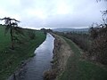
 Lowside Moss - geograph.org.uk - 3382516.jpg 640 × 425 ; 200 kio
-
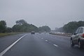 M6 south of Burton Services - geograph.org.uk - 2637154.jpg 640 × 430 ; 23 kio
-
 M6, southbound - geograph.org.uk - 3231950.jpg 640 × 430 ; 40 kio
-

-

-
 Milepost - Lancaster Canal - June 2018 - geograph.org.uk - 5826020.jpg 3 746 × 5 203 ; 3,69 Mio
-
 Milestone, Lancaster Canal - geograph.org.uk - 4871865.jpg 640 × 492 ; 207 kio
-
 Moss Bridge on the Lancaster Canal - geograph.org.uk - 5059064.jpg 1 280 × 960 ; 1,27 Mio
-
 Moss Bridge, Yealands Redmayne.jpg 2 552 × 1 890 ; 2,4 Mio
-
 Mute swan (Cygnus olor) - geograph.org.uk - 1308534.jpg 480 × 640 ; 125 kio
-
 Narrow fields at Yealand Redmayne - geograph.org.uk - 1451905.jpg 640 × 426 ; 233 kio
-
 New access gate in Yealand Hall Allotment - geograph.org.uk - 1451872.jpg 640 × 426 ; 342 kio
-
 New fingerpost, Yealand Storrs - geograph.org.uk - 3922119.jpg 800 × 600 ; 174 kio
-
 North end of Trowbarrow Quarry - geograph.org.uk - 2963224.jpg 2 592 × 1 944 ; 1,63 Mio
-
 Northern marsh orchid at Coldwell Parrock - geograph.org.uk - 3541122.jpg 600 × 800 ; 129 kio
-
 Old lime kiln, Coldwell Parrock - geograph.org.uk - 1596296.jpg 480 × 640 ; 133 kio
-
-
 Old Walls, Cringlebarrow Woods - geograph.org.uk - 3308361.jpg 2 560 × 1 920 ; 1,45 Mio
-
 On Thrang Brow - geograph.org.uk - 5251041.jpg 1 920 × 1 280 ; 564 kio
-
 Paleokarst surface, Trowbarrow LNR - geograph.org.uk - 4437992.jpg 600 × 800 ; 176 kio
-
 Pasture and cows - geograph.org.uk - 3013422.jpg 3 008 × 2 000 ; 713 kio
-
 Path and sign, West Coppice - geograph.org.uk - 1591122.jpg 640 × 480 ; 147 kio
-

-
 Permissive footpath, White Moss - geograph.org.uk - 5066870.jpg 640 × 425 ; 234 kio
-
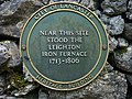 Plaque for Leighton iron furnace - geograph.org.uk - 3692426.jpg 640 × 480 ; 152 kio
-
 Pump, Yealand Redmayne - geograph.org.uk - 3382523.jpg 640 × 425 ; 173 kio
-
 Redundant squeeze stile above Storrs Farm - geograph.org.uk - 4275101.jpg 640 × 480 ; 167 kio
-
 Reflections of a hole in the sky - geograph.org.uk - 5610113.jpg 800 × 600 ; 43 kio
-
 Repaired drystone wall, Storrs Lane - geograph.org.uk - 4078195.jpg 640 × 480 ; 195 kio
-
 Rivet benchmark, Leighton Beck Bridge - geograph.org.uk - 4423684.jpg 480 × 640 ; 147 kio
-
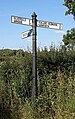
 Road junction - geograph.org.uk - 2037596.jpg 640 × 480 ; 157 kio
-
 Road junction - geograph.org.uk - 2037619.jpg 640 × 444 ; 155 kio
-
 Rock climber on the Main Wall, Trowbarrow - geograph.org.uk - 4843483.jpg 800 × 609 ; 192 kio
-
 Rock climbers at Trowbarrow - geograph.org.uk - 2704351.jpg 480 × 640 ; 107 kio
-
 Rock climbers on the Main Wall, Trowbarrow - geograph.org.uk - 4844043.jpg 600 × 800 ; 207 kio
-
 Round Top, Cringlebarrow - geograph.org.uk - 1601575.jpg 640 × 480 ; 48 kio
-
 Ruin at Cinderbarrow - geograph.org.uk - 1737168.jpg 640 × 480 ; 88 kio
-
 Ruined barn near Tarn Lane - geograph.org.uk - 4277988.jpg 640 × 480 ; 83 kio
-
 Rust stains, Trowbarrow - geograph.org.uk - 5246372.jpg 540 × 720 ; 207 kio
-
 Shap granite erratic near Burton Services - geograph.org.uk - 3480445.jpg 640 × 480 ; 131 kio
-
 Shed Yealand Redmayne - geograph.org.uk - 104912.jpg 640 × 480 ; 66 kio
-
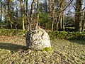
 Shelter Stone and autumn colours, Trowbarrow - geograph.org.uk - 4711829.jpg 800 × 600 ; 203 kio
-
 Sign to Thrang Moss - geograph.org.uk - 5474592.jpg 640 × 480 ; 89 kio
-
 Sign, Coldwell Parrock - geograph.org.uk - 1596292.jpg 480 × 640 ; 86 kio
-
 Silverdale Road, Yealand Redmayne - geograph.org.uk - 6172772.jpg 800 × 533 ; 554 kio
-
 Slag from the Leighton Iron Furnace, Back Wood - geograph.org.uk - 4392245.jpg 800 × 600 ; 224 kio
-
 Slate plaque, Yealand School - geograph.org.uk - 4274372.jpg 818 × 480 ; 129 kio
-
 Small Crag, Round Top - geograph.org.uk - 3308355.jpg 1 920 × 2 560 ; 1,22 Mio
-
 Spring in field near Hawes Water - geograph.org.uk - 1975802.jpg 1 600 × 1 200 ; 2,08 Mio
-
 Spring in field near Hawes Water - geograph.org.uk - 1975828.jpg 1 600 × 1 200 ; 1,85 Mio
-
 Spring near Brackenthwaite - geograph.org.uk - 1591097.jpg 480 × 640 ; 111 kio
-
 Spring on White Moss - geograph.org.uk - 4896210.jpg 720 × 540 ; 92 kio
-
 Squeeze stile, Nineteen Acre Lane - geograph.org.uk - 2176567.jpg 480 × 640 ; 179 kio
-
 Squeeze stile, Yealand Redmayne - geograph.org.uk - 2176568.jpg 480 × 640 ; 124 kio
-
 Stile near East Coppice, Gait Barrows - geograph.org.uk - 1591115.jpg 480 × 640 ; 74 kio
-
 Storrs Lane - geograph.org.uk - 6172851.jpg 800 × 533 ; 620 kio
-
 Storrs Lane near Leighton Moss - geograph.org.uk - 6172853.jpg 800 × 533 ; 754 kio
-
 Storrs Moss (Leighton Moss) - geograph.org.uk - 1602992.jpg 640 × 480 ; 31 kio
-
 The Assagai Wall, Trowbarrow Quarry - geograph.org.uk - 1602987.jpg 480 × 640 ; 90 kio
-
 The Causeway, Leighton Moss - geograph.org.uk - 1586433.jpg 480 × 640 ; 131 kio
-
 The Fossil Wall at Trowbarrow Quarry - geograph.org.uk - 2677472.jpg 609 × 800 ; 234 kio
-
 The Front wall at Trowbarrow Quarry - geograph.org.uk - 2677466.jpg 600 × 800 ; 170 kio
-
 The Lancaster Canal - geograph.org.uk - 5059089.jpg 1 280 × 960 ; 1,04 Mio
-
 The Shelter Stone at Trowbarrow Quarry - geograph.org.uk - 2464483.jpg 640 × 480 ; 152 kio
-
 The summit of Trowbarrow (the hill)^ - geograph.org.uk - 1602977.jpg 640 × 480 ; 110 kio
-
 The top of Trowbarrow Quarry - geograph.org.uk - 1601803.jpg 480 × 640 ; 79 kio
-
 The Trowbarrow Shelter Stone - geograph.org.uk - 5246364.jpg 800 × 600 ; 177 kio


_-_geograph.org.uk_-_4896635.jpg)


_-_geograph.org.uk_-_3784531.jpg)


_and_Yellow_Wall,_Trowbarrow_Quarry_-_geograph.org.uk_-_1358544.jpg)


_-_geograph.org.uk_-_1308534.jpg)


,_Lancaster_Canal_(geograph_7296333).jpg)


_-_geograph.org.uk_-_1602992.jpg)


%5E_-_geograph.org.uk_-_1602977.jpg)

