Category:Yelvertoft
Naar navigatie springen
Naar zoeken springen
plaats in Northamptonshire  | |||||
| Media uploaden | |||||
| Is een | |||||
|---|---|---|---|---|---|
| Locatie | West Northamptonshire, Northamptonshire, East Midlands, Engeland | ||||
| Inwonertal |
| ||||
| Oppervlakte |
| ||||
 | |||||
Ondercategorieën
Deze categorie bevat de volgende 4 subcategorieën, van de 4 in totaal.
K
- Knightley Arms, Yelvertoft (5 B)
Y
- Yelvertoft War Memorial (7 B)
Media in categorie "Yelvertoft"
Deze categorie bevat de volgende 175 bestanden, van in totaal 175.
-
 A field of broad beans - geograph.org.uk - 5440753.jpg 640 × 480; 138 kB
-

-
 Barn near Yelvertoft - geograph.org.uk - 3909109.jpg 640 × 480; 64 kB
-
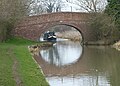
 Bridge 17 - geograph.org.uk - 3110018.jpg 2.988 × 1.935; 1,19 MB
-
 Bridge 17, from the east - geograph.org.uk - 5538777.jpg 1.024 × 768; 203 kB
-
-
 Bridge 18 - geograph.org.uk - 3110019.jpg 2.985 × 1.840; 908 kB
-
 Bridge 19 - geograph.org.uk - 3110436.jpg 3.072 × 2.048; 1,42 MB
-
 Bridge 20, from the south - geograph.org.uk - 5538805.jpg 1.024 × 768; 191 kB
-
 Bridge 20, Grand Union Canal (Leicester section) - geograph.org.uk - 5563113.jpg 1.024 × 768; 219 kB
-
 Bridge 26 - geograph.org.uk - 3110925.jpg 3.072 × 2.048; 1,95 MB
-
 Bridge across the M1 motorway - geograph.org.uk - 4756714.jpg 800 × 571; 193 kB
-
 Bridleway from Crick to Yelvertoft - geograph.org.uk - 3322990.jpg 640 × 480; 98 kB
-
 Canada geese, north of Crackshill Farm - geograph.org.uk - 5563153.jpg 1.024 × 614; 130 kB
-
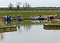
 Canal east of Yelvertoft in Northamptonshire - geograph.org.uk - 5871183.jpg 1.280 × 885; 1,26 MB
-
 Canal side house is trapezium - geograph.org.uk - 3110463.jpg 3.028 × 1.938; 1,19 MB
-
 Churchyard path, All Saints, Yelvertoft - geograph.org.uk - 5563124.jpg 767 × 1.024; 244 kB
-
 Clay Barn Bridge (No 26), from the north-west - geograph.org.uk - 5538816.jpg 1.024 × 768; 182 kB
-
-
-
 Clay Barn Bridge No 26 - geograph.org.uk - 4594935.jpg 800 × 555; 128 kB
-

-
 Crick Road - geograph.org.uk - 3909104.jpg 640 × 480; 99 kB
-
 Crick Road - geograph.org.uk - 3909114.jpg 640 × 480; 96 kB
-

-
 Derelict farm building - geograph.org.uk - 4756698.jpg 800 × 560; 125 kB
-
 Elkington Road - geograph.org.uk - 3909127.jpg 640 × 480; 74 kB
-
 Elkington Road - geograph.org.uk - 3909132.jpg 640 × 480; 70 kB
-
 Elkington Road, Yelvertoft - geograph.org.uk - 5440744.jpg 640 × 480; 139 kB
-
 Entering Yelvertoft - geograph.org.uk - 3909121.jpg 640 × 480; 96 kB
-
 Entering Yelvertoft - geograph.org.uk - 3909128.jpg 640 × 480; 85 kB
-
 Entrance to Yelvertoft Marina - geograph.org.uk - 3656599.jpg 640 × 427; 58 kB
-
 Entrance to Yelvertoft Marina - geograph.org.uk - 4763261.jpg 800 × 574; 92 kB
-

-
 Farm track (bridleway) near Glebe Farm - geograph.org.uk - 3909149.jpg 640 × 480; 107 kB
-
 Farm track near the Grand Union Canal - geograph.org.uk - 4595316.jpg 800 × 620; 166 kB
-
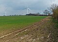
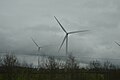
 Farmland and wind turbines - geograph.org.uk - 3909147.jpg 640 × 480; 34 kB
-
 Farmland near Yelvertoft Wind Farm - geograph.org.uk - 4756746.jpg 800 × 587; 145 kB
-
 Farmland north of Yelvertoft - geograph.org.uk - 3909167.jpg 640 × 480; 55 kB
-
 Fence along the High Street, Yelvertoft - geograph.org.uk - 4763063.jpg 800 × 600; 175 kB
-
 Field entrance off Elkington Road - geograph.org.uk - 3909124.jpg 640 × 480; 72 kB
-
 Flint Hill Bridge No 18 - geograph.org.uk - 4763258.jpg 800 × 573; 133 kB
-

-

-
-
 Footbridge over the M1 - geograph.org.uk - 4689764.jpg 640 × 356; 27 kB
-
 Footbridge over the M1 - geograph.org.uk - 4711876.jpg 640 × 359; 30 kB
-
 Footpath Bridge north of Crick in Northamptonshire - geograph.org.uk - 5869824.jpg 1.280 × 836; 1,23 MB
-
 Grand Union Canal at Yelvertoft - geograph.org.uk - 1885594.jpg 1.600 × 1.200; 527 kB
-
 Grand Union Canal at Yelvertoft - geograph.org.uk - 4595517.jpg 800 × 528; 156 kB
-
 Grand Union Canal at Yelvertoft - geograph.org.uk - 4763253.jpg 800 × 537; 157 kB
-

-

-
 Grand Union Canal in Yelvertoft - geograph.org.uk - 4763069.jpg 800 × 557; 147 kB
-
 Grand Union Canal near Yelvertoft - geograph.org.uk - 4143200.jpg 4.320 × 3.240; 2,97 MB
-
 Grand Union Canal near Yelvertoft - geograph.org.uk - 4595320.jpg 800 × 600; 142 kB
-
 Grand Union Canal near Yelvertoft - geograph.org.uk - 4595505.jpg 800 × 580; 180 kB
-
 Grand Union Canal, Leicester Section - geograph.org.uk - 3456044.jpg 640 × 480; 79 kB
-
 Grand Union Canal, Leicester Section - geograph.org.uk - 3456049.jpg 640 × 480; 84 kB
-
-

-

-

-
-

-

-
 GU Leicester Bridge 18 - geograph.org.uk - 2347855.jpg 640 × 480; 105 kB
-
 Hillmorton-Watling Street - geograph.org.uk - 695996.jpg 640 × 480; 87 kB
-
 House and cottages, Yelvertoft - geograph.org.uk - 5440735.jpg 640 × 428; 105 kB
-
 Leicester Canal, near Yelvertoft - geograph.org.uk - 2646096.jpg 1.280 × 856; 245 kB
-
 Leicester section Bridge 20 - 'Ware Fishermen'^ - geograph.org.uk - 3110548.jpg 3.008 × 1.996; 1,34 MB
-
 Looking south along the A5 - geograph.org.uk - 4753466.jpg 800 × 554; 106 kB
-
 M1 motorway near Lilbourne - geograph.org.uk - 4756750.jpg 800 × 616; 146 kB
-

-
 M1 southbound - geograph.org.uk - 3586505.jpg 640 × 445; 30 kB
-
-

-

-

-
 Narrowboats on the Grand Union Canal - geograph.org.uk - 4763255.jpg 800 × 602; 158 kB
-
 New slipway, south side of Yelvertoft Marina - geograph.org.uk - 5538789.jpg 1.024 × 768; 114 kB
-
 Oilseed rape crop - geograph.org.uk - 3909130.jpg 640 × 480; 77 kB
-

-

-
 Pasture south-east of Yelvertoft in Northamptonshire - geograph.org.uk - 5869946.jpg 1.600 × 835; 1,18 MB
-
 Private road to the A5 Watling Street - geograph.org.uk - 4753467.jpg 800 × 592; 207 kB
-
 Public bridleway next to the M1 motorway - geograph.org.uk - 4756753.jpg 800 × 592; 159 kB
-
 Radio masts near the Rugby Radio Station - geograph.org.uk - 4756682.jpg 800 × 619; 139 kB
-
 Railway Waggon used as Allotment Shed - geograph.org.uk - 300084.jpg 640 × 424; 195 kB
-
 Raised pavement, High Street, Yelvertoft - geograph.org.uk - 5563128.jpg 1.024 × 768; 283 kB
-
 Shenley Farm next to the M1 motorway - geograph.org.uk - 4756751.jpg 800 × 537; 115 kB
-
 Slipway at Yelvertoft Marina - geograph.org.uk - 4595538.jpg 800 × 545; 154 kB
-
 Stanford Road - geograph.org.uk - 3909171.jpg 640 × 480; 76 kB
-

-

-
 The Grand Union Canal - geograph.org.uk - 2105672.jpg 4.000 × 3.000; 2,86 MB
-
 The High Street in Yelvertoft - geograph.org.uk - 4605568.jpg 800 × 591; 148 kB
-
 The M1 runs under a bridge by Shenley Farm - geograph.org.uk - 6300992.jpg 2.700 × 2.025; 295 kB
-
 The road to Elkington from Yelvertoft - geograph.org.uk - 3271546.jpg 2.592 × 1.944; 1,29 MB
-
 The road to Yelvertoft - geograph.org.uk - 3271504.jpg 2.592 × 1.944; 1,62 MB
-

-
 Track to Shenley Farm - geograph.org.uk - 4756705.jpg 800 × 568; 102 kB
-
 Village Water Pump - geograph.org.uk - 300024.jpg 424 × 640; 141 kB
-
 Wind Farm by the M1 - geograph.org.uk - 4517352.jpg 2.296 × 1.293; 1,4 MB
-
 Wind farm by the M1 - geograph.org.uk - 4689761.jpg 640 × 508; 17 kB
-
 Wind farm by the M1 - geograph.org.uk - 4689763.jpg 640 × 426; 29 kB
-
 Wind Turbines near Yelvertoft - geograph.org.uk - 4599742.jpg 1.200 × 787; 192 kB
-
 Roman Catholic Church, Yelvertoft - geograph.org.uk - 112614.jpg 640 × 480; 103 kB
-
 Sundial on Reading Room wall - geograph.org.uk - 300037.jpg 640 × 424; 149 kB
-
 Yelvertoft - Flint Hill Farm - geograph.org.uk - 59869.jpg 640 × 480; 126 kB
-
 Yelvertoft - geograph.org.uk - 202258.jpg 640 × 480; 102 kB
-
 Yelvertoft - Primary School - geograph.org.uk - 59872.jpg 640 × 480; 128 kB
-
 Yelvertoft - Yew Tree Farm - geograph.org.uk - 60403.jpg 640 × 480; 121 kB
-
 Yelvertoft Allotments - geograph.org.uk - 2697027.jpg 640 × 480; 109 kB
-
 Yelvertoft and its wind farm - geograph.org.uk - 3640821.jpg 3.264 × 2.448; 3,53 MB
-
 Yelvertoft bridge.JPG 3.072 × 2.304; 2,35 MB
-
 Yelvertoft Bridleway - geograph.org.uk - 2697038.jpg 640 × 480; 97 kB
-
 Yelvertoft Bridleway - geograph.org.uk - 2697049.jpg 640 × 480; 93 kB
-
 Yelvertoft Butchers Shop - geograph.org.uk - 2697053.jpg 640 × 504; 63 kB
-
 Yelvertoft Congregational Church - geograph.org.uk - 2694322.jpg 640 × 480; 69 kB
-
 Yelvertoft Farmland - geograph.org.uk - 3428828.jpg 1.024 × 768; 183 kB
-
 Yelvertoft Farmland - geograph.org.uk - 3428847.jpg 1.024 × 768; 161 kB
-
 Yelvertoft Farmland - geograph.org.uk - 3428875.jpg 1.024 × 768; 191 kB
-
 Yelvertoft High Street - geograph.org.uk - 2697107.jpg 640 × 480; 78 kB
-
 Yelvertoft High Street - geograph.org.uk - 3271527.jpg 2.592 × 1.944; 1,44 MB
-
 Yelvertoft High Street - geograph.org.uk - 3442417.jpg 1.024 × 786; 169 kB
-
 Yelvertoft High Street.JPG 3.072 × 2.304; 2,35 MB
-
 Yelvertoft Manor House - geograph.org.uk - 2694421.jpg 640 × 480; 83 kB
-
 Yelvertoft Marina - geograph.org.uk - 1984521.jpg 640 × 480; 76 kB
-
 Yelvertoft Marina - geograph.org.uk - 1984581.jpg 640 × 480; 63 kB
-
 Yelvertoft Marina - geograph.org.uk - 2697072.jpg 640 × 433; 62 kB
-
 Yelvertoft Post Office - geograph.org.uk - 2698891.jpg 640 × 583; 82 kB
-
 Yelvertoft Primary School - geograph.org.uk - 3909140.jpg 640 × 456; 84 kB
-
 Yelvertoft pump inscription.JPG 3.072 × 2.304; 2,11 MB
-
 Yelvertoft Reading Room - geograph.org.uk - 5563140.jpg 1.024 × 768; 213 kB
-
 Yelvertoft Reading Room.JPG 3.072 × 2.304; 1,55 MB
-
 Yelvertoft Road - geograph.org.uk - 3909176.jpg 640 × 480; 70 kB
-
 Yelvertoft Road Bridge No 20 - geograph.org.uk - 4595451.jpg 800 × 600; 157 kB
-

-
 Yelvertoft Roman Catholic Church - geograph.org.uk - 2698884.jpg 640 × 480; 95 kB
-
 Yelvertoft sign.JPG 3.072 × 2.304; 2,06 MB
-

-
 Yelvertoft village pump.JPG 2.304 × 3.072; 2,42 MB
-
-
 Yelvertoft Wind Farm - geograph.org.uk - 3428904.jpg 1.600 × 1.200; 405 kB
-
 Yelvertoft, Domesday Community - geograph.org.uk - 4165842.jpg 851 × 1.280; 250 kB
-
 Yelvertoft, High Street - geograph.org.uk - 1740028.jpg 640 × 480; 51 kB
-
 Yelvertoft, reading room - geograph.org.uk - 1740024.jpg 640 × 480; 75 kB
-
 Yelvertoft, The Old Gable - geograph.org.uk - 1740032.jpg 640 × 480; 49 kB
-
 Yelvertoft, village pump - geograph.org.uk - 1740019.jpg 480 × 640; 85 kB
-
 Yelvertoft-Elkington Road - geograph.org.uk - 2694144.jpg 640 × 480; 61 kB
-
 Yelvertoft-Elkington Road - geograph.org.uk - 2697088.jpg 640 × 480; 59 kB
-
 Yelvertoft-Grand Union Canal - geograph.org.uk - 1996821.jpg 640 × 480; 87 kB
-
 Yelvertoft-Grand Union Canal - geograph.org.uk - 1996833.jpg 640 × 480; 95 kB
-
 Yelvertoft-Grand Union Canal - geograph.org.uk - 2694120.jpg 640 × 480; 82 kB
-
 A Change in Direction. - geograph.org.uk - 466109.jpg 640 × 480; 111 kB
-
 Cracks Hill - geograph.org.uk - 299984.jpg 640 × 424; 150 kB
-
 Crick - geograph.org.uk - 198221.jpg 640 × 480; 122 kB
-
 Elkington - geograph.org.uk - 198854.jpg 640 × 480; 195 kB
-
 Gated Byway. - geograph.org.uk - 466099.jpg 640 × 480; 148 kB
-
 Hillmorton Radio Masts - geograph.org.uk - 685623.jpg 640 × 480; 63 kB
-
 Hillmorton-Watling Street - geograph.org.uk - 695987.jpg 640 × 480; 79 kB
-
 Lilbourne - geograph.org.uk - 112809.jpg 640 × 480; 79 kB
-
 Lilbourne - geograph.org.uk - 112813.jpg 640 × 480; 70 kB
-
 Lilbourne - geograph.org.uk - 72015.jpg 640 × 480; 142 kB
-
 Radio masts - geograph.org.uk - 39051.jpg 640 × 480; 103 kB
-
 Sheep grazing in canal field - geograph.org.uk - 300010.jpg 640 × 424; 162 kB
-
 Yelvertoft - geograph.org.uk - 155853.jpg 640 × 480; 119 kB
-
 Yelvertoft - geograph.org.uk - 198228.jpg 640 × 480; 126 kB
-
 Yelvertoft - geograph.org.uk - 60535.jpg 640 × 480; 197 kB
-
 Yelvertoft - geograph.org.uk - 84732.jpg 640 × 480; 114 kB
-
 Yelvertoft - geograph.org.uk - 84739.jpg 640 × 480; 107 kB
-
 Yelvertoft-Shenley Farm - geograph.org.uk - 684391.jpg 640 × 480; 56 kB
-
 Yelvertoft-Shenley Farm - geograph.org.uk - 684405.jpg 640 × 480; 58 kB
-
 Yelvertoft-Shenley Farm - geograph.org.uk - 687360.jpg 640 × 480; 61 kB


_-_geograph.org.uk_-_5563113.jpg)


,_from_the_north-west_-_geograph.org.uk_-_5538816.jpg)


_near_Glebe_Farm_-_geograph.org.uk_-_3909149.jpg)


