Category:Zangon Kataf LGA
Vai alla navigazione
Vai alla ricerca
area del governo locale in Nigeria  | |||||
| Carica un file multimediale | |||||
| Istanza di |
| ||||
|---|---|---|---|---|---|
| Luogo | Kaduna, Nigeria | ||||
| Organo legislativo |
| ||||
| Organo esecutivo |
| ||||
| Popolazione |
| ||||
| Superficie |
| ||||
 | |||||
Sottocategorie
Questa categoria contiene le 8 sottocategorie indicate di seguito, su un totale di 8.
A
- Ashong Ashyui (empty)
- Atak Njei (6 F)
K
- Kanai District (4 F)
M
- Madakiya (16 F)
S
- Samaru Kataf (6 F)
Z
- Zonkwa (1 F)
File nella categoria "Zangon Kataf LGA"
Questa categoria contiene 49 file, indicati di seguito, su un totale di 49.
-
 A block of classrooms.jpg 4 000 × 3 000; 4,66 MB
-
 A Church Entrance.jpg 4 000 × 3 000; 4,42 MB
-
 A cow breastfeeding her calf.jpg 4 272 × 2 848; 3,01 MB
-
 A plain land with dry grass.jpg 3 872 × 2 592; 3,29 MB
-
 A pond with stones.jpg 3 872 × 2 592; 3,99 MB
-
 A small made pond.jpg 3 872 × 2 592; 4,7 MB
-
 A stagnant river.jpg 3 872 × 2 592; 2,73 MB
-
 A tree on top a rock.jpg 3 872 × 2 592; 3,01 MB
-
 A tree with its roots outside.jpg 3 872 × 2 592; 4,68 MB
-
 Abandoned classrooms.jpg 4 000 × 3 000; 6,17 MB
-
 An Open farm land at Kurmin Masara.jpg 4 496 × 3 000; 3,86 MB
-
 Asharuwa dancers at Ayet 2023.jpg 3 264 × 2 448; 1,83 MB
-
 Bakin Kogi Bridge.jpg 4 928 × 3 264; 3,43 MB
-
 Bakin Kogi bridge.jpg 4 000 × 3 000; 4,68 MB
-
 Bakin Kogi River.jpg 4 928 × 3 264; 3,41 MB
-
 Bakin kogi River.jpg 4 496 × 3 000; 3,58 MB
-
 Bakin-Kogi River.jpg 4 000 × 3 000; 4,15 MB
-
 Banana trees in a sugar cane farm.jpg 3 872 × 2 592; 3,75 MB
-
 Chapel, St. Charles Borromeo Minor Seminary, Ataat.jpg 6 000 × 4 000; 3,57 MB
-
 Children playing in a mud.jpg 3 872 × 2 592; 4,2 MB
-
 Cloudy sky at Atak Mawai.jpg 3 104 × 3 104; 6,34 MB
-
 Crop field by Kabyiek Tityong Waterfalls 1.jpg 6 000 × 4 000; 11,32 MB
-
 Crop field by Kabyiek Tityong Waterfalls 2.jpg 6 000 × 4 000; 11,81 MB
-
 Dilapidated classrooms.jpg 4 000 × 3 000; 5,19 MB
-
 Gate, St. Charles Borromeo Minor Seminary, Ataat.jpg 6 000 × 4 000; 5,32 MB
-
 Grave, Ataknjei.jpg 4 160 × 3 120; 4,58 MB
-
 Hazy hills at Aduwan.jpg 4 496 × 3 000; 3,11 MB
-
 Hazy weather at Abvon.jpg 4 496 × 3 000; 3,84 MB
-
 Hazy weather situation at Wadon.jpg 4 496 × 3 000; 3,82 MB
-
 Houses along Madakiya Road 2.jpg 6 000 × 4 000; 5,33 MB
-
 Houses along Madakiya Road.jpg 6 000 × 4 000; 5,3 MB
-
 Kabyiek Tityong Waterfall 9.jpg 6 000 × 4 000; 13,22 MB
-
 Kabyiek tityong waterfall a.jpg 6 000 × 4 000; 7,03 MB
-
 Mabatado Silk Cotton Tree.jpg 1 823 × 2 536; 1,74 MB
-
 Railway bridge by Kabyiek Tityong Waterfall.jpg 6 000 × 4 000; 5,15 MB
-
 Railway bridge by Kabyiek Tityong Waterfalls 2.jpg 6 000 × 4 000; 8,16 MB
-
 Rocks at a bridge construction site.jpg 4 272 × 2 848; 4,34 MB
-
 Signpost, St. Charles Borromeo Minor Seminary, Ataat.jpg 6 000 × 4 000; 5,61 MB
-
 Stream in Abvon Ayagan.jpg 4 272 × 2 848; 4,27 MB
-
 Sunrise at Bakin kogi River.jpg 4 272 × 2 848; 3,48 MB
-
 Sunset at Abet.jpg 4 272 × 2 848; 2,96 MB
-
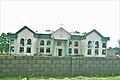
 The A̱gwatyap Palace.jpg 4 000 × 3 000; 4,87 MB
-
 Tree in a plain field.jpg 4 272 × 2 848; 3,86 MB
-
 Tree with dry branches.jpg 4 272 × 2 848; 3,45 MB
-
 Tree's on rocky hill.jpg 4 272 × 2 848; 3,43 MB
-
 Tsotson-tat drummers.jpg 2 448 × 3 264; 2,96 MB
-
 Valley with shrubs.jpg 4 272 × 2 848; 4,23 MB
-
 Withered trees.jpg 3 456 × 4 608; 6,95 MB
-
 Zangon Kataf Wikivoyage Banner.jpg 4 000 × 571; 1,56 MB


