File:日本石川群震地图.png
跳至導覽
跳至搜尋

預覽大小:800 × 432 像素。 其他解析度:320 × 173 像素 | 640 × 345 像素 | 1,277 × 689 像素。
原始檔案 (1,277 × 689 像素,檔案大小:152 KB,MIME 類型:image/png)
說明
說明
添加單行說明來描述出檔案所代表的內容
摘要
[編輯]| 描述 |
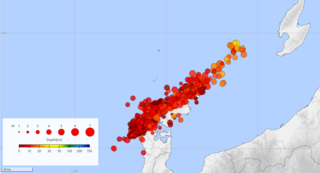
中文(简体):日本石川群震地图 |
| 日期 | |
| 來源 | https://www.data.jma.go.jp/eqdb/data/shindo/index.html |
| 作者 | 日本气象厅 |
授權條款
[編輯]This image was produced by the 氣象廳. The legal notice (archive) stated that all the images published on their website is compatible with the Creative Commons Attribution 4.0 License, which means that all the images on this website is published under the Creative Commons Attribution 4.0 License unless otherwise specified.
此檔案採用創用CC 姓名標示 4.0 國際授權條款。 姓名標示: 氣象廳
|
 |

檔案歷史
點選日期/時間以檢視該時間的檔案版本。
| 日期/時間 | 縮圖 | 尺寸 | 用戶 | 備註 | |
|---|---|---|---|---|---|
| 目前 | 2024年2月14日 (三) 03:27 | | 1,277 × 689(152 KB) | Qbulakema114(對話 | 貢獻) | Uploaded a work by 日本气象厅 from https://www.data.jma.go.jp/eqdb/data/shindo/index.html with UploadWizard |
無法覆蓋此檔案。
檔案用途
沒有使用此檔案的頁面。
全域檔案使用狀況
以下其他 wiki 使用了這個檔案:
- en.wikipedia.org 的使用狀況
- ja.wikipedia.org 的使用狀況
- ko.wikipedia.org 的使用狀況
- th.wikipedia.org 的使用狀況
- www.wikidata.org 的使用狀況
- zh.wikipedia.org 的使用狀況