File:115th United States Congress Congressional Districts.pdf
跳至導覽
跳至搜尋

此 PDF 檔案的 JPG 預覽的大小:800 × 593 像素。 其他解析度:320 × 237 像素 | 640 × 475 像素 | 1,024 × 759 像素 | 1,280 × 949 像素 | 2,560 × 1,898 像素 | 6,675 × 4,950 像素。
原始檔案 (6,675 × 4,950 像素,檔案大小:18.44 MB,MIME 類型:application/pdf)
說明
說明
添加單行說明來描述出檔案所代表的內容
| 描述 |
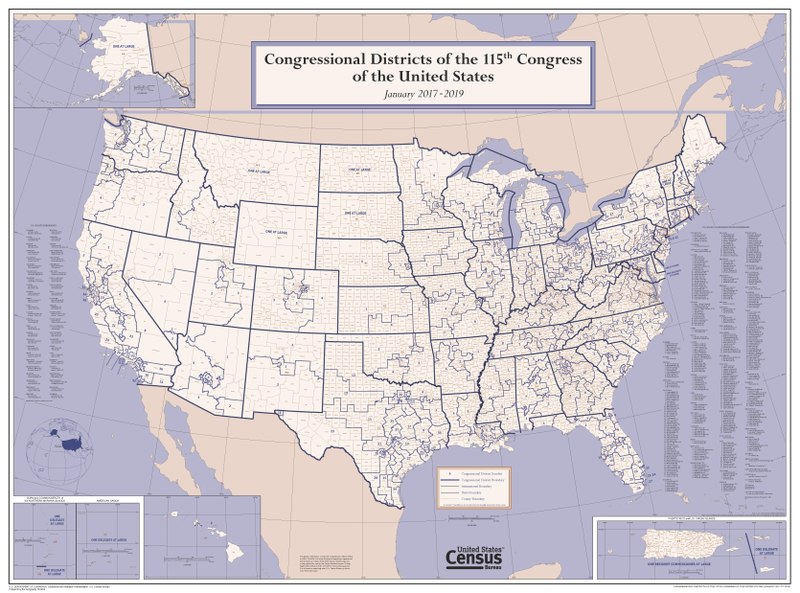
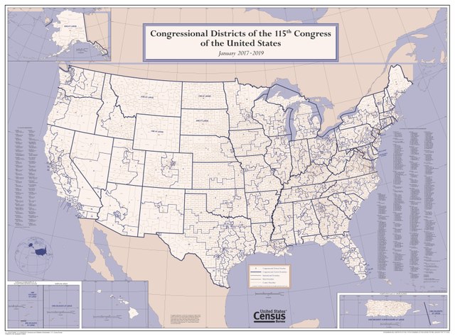
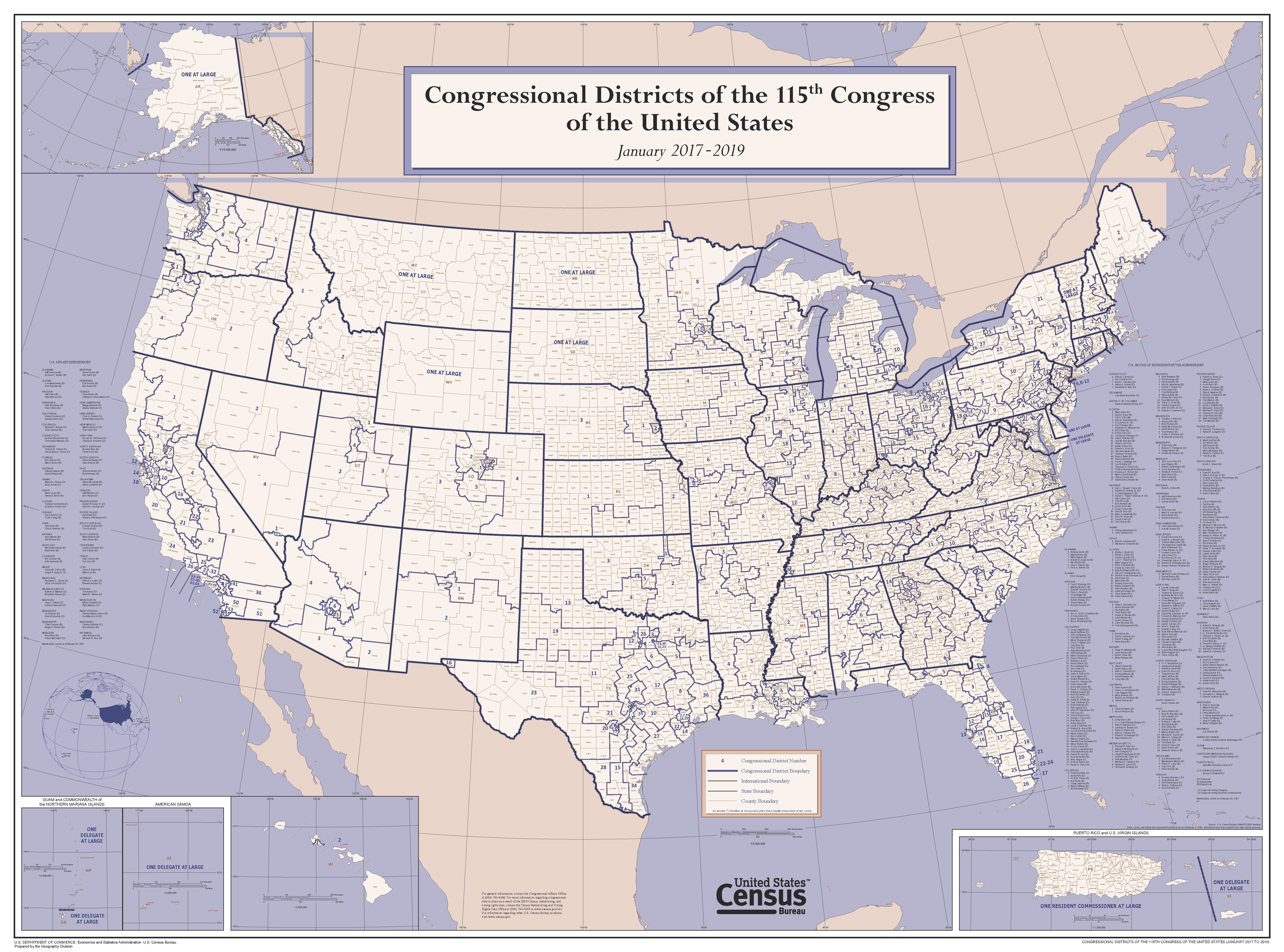
English: This wall map depicts congressional district boundaries in effect for the 115th Congress of the United States (January 2017-2019). The map includes county names and boundaries for each state, the District of Columbia, Puerto Rico, American Samoa, Guam, the Commonwealth of the Northern Mariana Islands, and U.S. Virgin Islands. The map also includes a listing of the names of all members of the 115th Congress, as of January 10, 2017. |
|||
| 日期 | ||||
| 來源 | https://www2.census.gov/geo/maps/cong_dist/uswall/cd115/CD115_US_WallMap.pdf | |||
| 作者 | U.S. Census Bureau | |||
| 授權許可 (重用此檔案) |
|

檔案歷史
點選日期/時間以檢視該時間的檔案版本。
| 日期/時間 | 縮圖 | 尺寸 | 使用者 | 備註 | |
|---|---|---|---|---|---|
| 目前 | 2017年9月27日 (三) 04:02 |  | 6,675 × 4,950(18.44 MB) | Kingofthedead(留言 | 貢獻) | {{Information |Description ={{en|1=This wall map depicts congressional district boundaries in effect for the 115th Congress of the United States (January 2017-2019). The map includes county names and boundaries for each state, the District of Columb... |
無法覆蓋此檔案。
檔案用途
全域檔案使用狀況
以下其他 wiki 使用了這個檔案:
- ar.wikipedia.org 的使用狀況
- en.wikipedia.org 的使用狀況
- nl.wikipedia.org 的使用狀況
- zh.wikipedia.org 的使用狀況