File:12F Feb 2 2013.jpg
跳转到导航
跳转到搜索

本预览的尺寸:538 × 599像素。 其他分辨率:215 × 240像素 | 431 × 480像素 | 689 × 768像素 | 919 × 1,024像素 | 1,839 × 2,048像素 | 5,620 × 6,260像素。
原始文件 (5,620 × 6,260像素,文件大小:3.57 MB,MIME类型:image/jpeg)
说明
说明
添加一行文字以描述该文件所表现的内容
摘要
[编辑]
| 描述 |
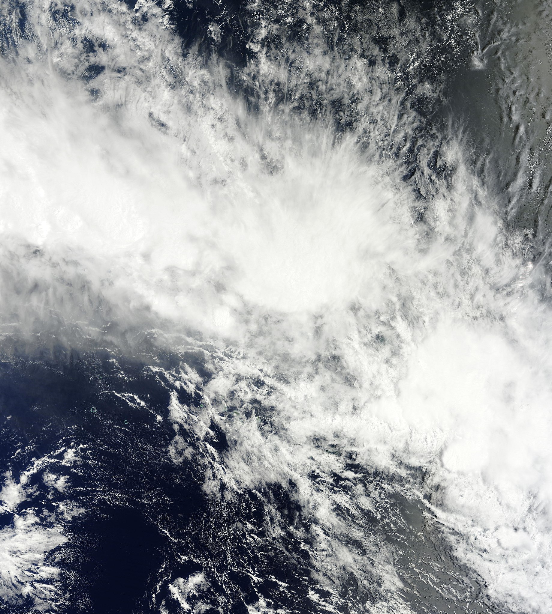
English: Tropical Disturbance 12F over waters 150 miles (250 km) north-east of Mauke in the Cook Islands. |
| 日期 | |
| 来源 | http://lance-modis.eosdis.nasa.gov/cgi-bin/mapserv.cgi?map_layer[Terra250]=DATA+terr_250m_2013033.vrt&map=rrglobal_terra_250m.map&LAYERS=Terra250m_MODIS-bands1,4,3&mode=map&imgext=-156.7784+-21.1121+-144.4298+-7.3572&mapext=-156.7784+-21.1121+-144.4298+-7.3572&map_size=5620.6645425580355+6260.764679107875&imgx=5620.6645425580355&imgy=6260.764679107875&imgxy=5620.6645425580355+6260.764679107875&map_imagetype=JPEG&map.extension=jpg |
| 作者 | LANCE-MODIS/NASA |
许可协议
[编辑]
| 本文件完全由NASA创作,在美国属于公有领域。根据NASA的版权方针,NASA的材料除非另有声明否则不受版权保护。(参见Template:PD-USGov/zh、NASA版权方针页面或JPL图片使用方针。) | ||
 |
警告:
|
文件历史
点击某个日期/时间查看对应时刻的文件。
| 日期/时间 | 缩略图 | 大小 | 用户 | 备注 | |
|---|---|---|---|---|---|
| 当前 | 2013年2月10日 (日) 14:19 | | 5,620 × 6,260(3.57 MB) | BAI1-Spec(留言 | 贡献) | {{subst:Upload marker added by en.wp UW}} {{Information |Description = {{en|Tropical Disturbance 12F over waters 150 miles (250 km) north-east of Mauke in the Cook Islands.}} |Source = http://lance-modis.eosdis.nasa.gov/cgi-bin/mapserv.cgi?map_layer[Te... |
您不可以覆盖此文件。
文件用途
没有页面使用本文件。
全域文件用途
以下其他wiki使用此文件:
- de.wikipedia.org上的用途
- zh.wikipedia.org上的用途