File:1598 map of the Polar Regions by Willem Barentsz.jpg
跳转到导航
跳转到搜索

本预览的尺寸:800 × 592像素。 其他分辨率:320 × 237像素 | 640 × 474像素 | 1,024 × 758像素 | 1,280 × 948像素 | 2,560 × 1,896像素 | 13,719 × 10,160像素。
原始文件 (13,719 × 10,160像素,文件大小:30.66 MB,MIME类型:image/jpeg)
说明
说明
添加一行文字以描述该文件所表现的内容
1598 map of the Polar Regions by Willem Barentsz
摘要
[编辑]| 警告 | 部分浏览器在浏览此图片的完整大小时可能会遇到困难:该图片中有数量巨大的像素点,可能无法完全载入或者导致您的浏览器停止响应。 |
|---|
| 描述 |
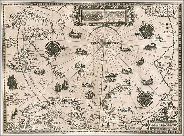
English: 1598 map of the Polar Regions by Willem Barentsz
Latina: Deliniatio cartae trium navigationum per Batavos, ad Septentrionalem plagam, Norvegiae, Moscoviae, et novae Semblae, et perque fretum Weygatis Nassovicum dictum, ac juxta Groenlandiam, sub altitudine 80. graduum nec non adiacentium partium Tartariae, promontorij Tabin, freti Anian atque regionis Bargi et partis Americae versus orientem, Authore Wilhelmo Bernardo Amstelredamo experissimo pilota.
Nederlands: Beschryvinghe vande drie seylagien door de Hollanders gedaen ande Noordt syde van Noorweghen, Moscovia, nova Sembla, ende door de Weygats ofte Strate de Nassou so mede het' deel van Groenlandt op de 80. graeden ende de omleggende grensen van Tartaryen, ende de Capo de Tabin ende des landtschaps Bargi, so oock het Oostersche deel van America: door Willem Barents van Amstelredam de vermaerde Piloot |
| 日期 | |
| 来源 | Barry Lawrence Rare Maps, from an original 1598 print. |
| 作者 | Original charts by Willem Barentsz, map drawn by Cornelis Claesz ("Cornelius Nicolai"), engraved by Baptista van Doetecum ("Baptista a Doetechum") |
| 其他版本 |
|
.jpg)

_door_Willem_Barendsz_(titel_op_object),_NG-800.jpg)


许可协议
[编辑]
|
本作品在其来源国以及其他著作权期限是作者逝世后70年或以下的国家和地区属于公有领域。 | |
| 本文件已被确认为免除已知的著作权法限制(包括所有相关权利)。 | |
| 注解 | 该图片含有注解:在维基媒体共享资源上查看注解 |
文件历史
点击某个日期/时间查看对应时刻的文件。
| 日期/时间 | 缩略图 | 大小 | 用户 | 备注 | |
|---|---|---|---|---|---|
| 当前 | 2020年3月22日 (日) 18:42 | | 13,719 × 10,160(30.66 MB) | Balkanique(留言 | 贡献) | Uploaded a work by Willem Barentsz from https://www.raremaps.com/gallery/detail/59238/deliniatio-cartae-trium-navigationum-per-batavos-ad-septent-barentsz with UploadWizard |
您不可以覆盖此文件。
文件用途
以下9个页面使用本文件:
- Arctic
- File:Barents third voyage.jpg
- File:Barentskartet, 1598 (12068020364).jpg
- File:Barentsz Full Map.jpg
- File:Barentsz arctic map.jpg
- File:Forminsket utgave av Barentskartet - no-nb krt 00487.jpg
- File:Kaart van de landen rond de poolcirkel met de drie reizen van de Nederlanders, 1598 Beschrijvinghe van de drie seylagien door de Hollanders gedaen ande Noordt syde van Noorweghen, Moscovia, nova Sembla, ende door het de, RP-P-OB-80.320.jpg
- File:Kaart van het Noordpoolgebied, 1598 Beschrijvinghe van de drie seylagien door de Hollanders gedaan (..) door Willem Barendsz (titel op object), NG-800.jpg
- File:Pontanus 1611 Arctic Map.jpg
全域文件用途
以下其他wiki使用此文件:
- ar.wikipedia.org上的用途
- ast.wikipedia.org上的用途
- ca.wikipedia.org上的用途
- cs.wikipedia.org上的用途
- da.wikipedia.org上的用途
- de.wikipedia.org上的用途
- en.wikipedia.org上的用途
- es.wikipedia.org上的用途
- fr.wikipedia.org上的用途
- hy.wikipedia.org上的用途
- is.wikipedia.org上的用途
- it.wikipedia.org上的用途
- ja.wikipedia.org上的用途
- la.wikipedia.org上的用途
- nl.wikipedia.org上的用途
- no.wikipedia.org上的用途
- pl.wikipedia.org上的用途
- pt.wikipedia.org上的用途
- sl.wikipedia.org上的用途
- sr.wikipedia.org上的用途
- uk.wikipedia.org上的用途
- vi.wikipedia.org上的用途
- zh.wikipedia.org上的用途
分类:
- Third voyage of Willem Barentsz
- History of Dutch sea fisheries
- 1598 maps
- 1598 maps of Russia
- Historical maps of Spitsbergen
- Old maps of Scandinavia
- Maps of Novaya Zemlya
- Old maps of the Arctic
- Old maps of the White Sea
- Maps of the Barents Sea
- Maps of the Greenland Sea
- Old maps of the Arctic Ocean
- Old maps of Svalbard
- 1590s maps of Norway
- 1590s maps of Sweden
- 1590s maps of Denmark
- 1590s maps of Iceland
- 1590s maps of Greenland
- 1590s maps of Scotland
- Magnetic pole
- Strait of Anian
- Davis Strait
- Frobisher Bay
- Terra incognita
- Phantom islands
- Latin-language maps
- Dutch-language maps
- Animals on maps
- Whales on maps
- Monsters on maps
- Seals in art
- Maps of the Kara Sea
- Maps of the Beaufort Sea
- Maps of Baffin Bay
- Maps of the East Siberian Sea
- Maps of the Laptev Sea
- Maps of the Chukchi Sea
- 1590s maps of Finland
- Baptista van Doetecum
- Cornelis Claesz
- Maps of voyages
- Maps of the North Pole
- Reindeer sleds in art
- Northern Sea Route
- 16th-century maps of the Arctic