File:1748 map - An Accurate Chart of the Mediterranean and Adriatic Seas; with the Archipelago & Part of the Black Sea.jpg
Aller à la navigation
Aller à la recherche

Taille de cet aperçu : 800 × 399 pixels. Autres résolutions : 320 × 160 pixels | 640 × 319 pixels | 1 024 × 511 pixels | 1 280 × 639 pixels | 2 560 × 1 277 pixels | 14 020 × 6 996 pixels.
Fichier d’origine (14 020 × 6 996 pixels, taille du fichier : 13,19 Mio, type MIME : image/jpeg)
Légendes
Légendes
Ajoutez en une ligne la description de ce que représente ce fichier
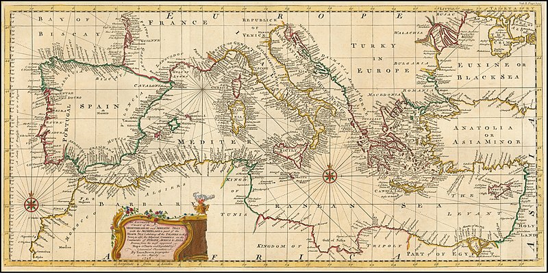
1748 map - An Accurate Chart of the Mediterranean and Adriatic Seas; with the Archipelago & Part of the Black Sea
Description[modifier]
| Avertissement | Certains navigateurs peuvent avoir des difficultés à afficher cette image à sa résolution complète : elle possède un nombre de pixels singulièrement élevé et peut ne pas se charger correctement ou faire planter votre navigateur. |
|---|
| Description |
English: 1748 map - An Accurate Chart of the Mediterranean and Adriatic Seas; with the Archipelago & Part of the Black Sea |
|||||||||||||||||||||||
| Date | ||||||||||||||||||||||||
| Source | https://www.raremaps.com/gallery/detail/57309/an-accurate-chart-of-the-mediterranean-and-adriatic-seas-wi-bowen | |||||||||||||||||||||||
| Auteur |
|
|||||||||||||||||||||||

Conditions d’utilisation[modifier]
|
Cette œuvre est également dans le domaine public dans tous les pays pour lesquels le droit d’auteur a une durée de vie de 70 ans ou moins après la mort de l’auteur. Cette œuvre est dans le domaine public aux États-Unis car elle a été publiée avant le 1er janvier 1929. | |
| Ce fichier a été identifié comme étant exempt de restrictions connues liées au droit d’auteur, y compris tous les droits connexes et voisins. | |
Historique du fichier
Cliquer sur une date et heure pour voir le fichier tel qu'il était à ce moment-là.
| Date et heure | Vignette | Dimensions | Utilisateur | Commentaire | |
|---|---|---|---|---|---|
| actuel | 20 février 2020 à 20:12 | | 14 020 × 6 996 (13,19 Mio) | Balkanique (d | contributions) | User created page with UploadWizard |
Vous ne pouvez pas remplacer ce fichier.
Utilisations locales du fichier
Les 73 pages suivantes utilisent ce fichier :
- User:Magog the Ogre/Multilingual legend/2020 February 20-29
- File:1747 Baghdad detail New and Accurate Map of Persia by Emanuel Bowen.png
- File:1747 Bokara detail New and Accurate Map of Persia by Emanuel Bowen.png
- File:1747 Bowen Map of the North Atlantic Islands, Greenland, Iceland, Faroe Islands (Maelstrom) - Geographicus - OldGreenland-bowen-1747.jpg
- File:1747 Cabul detail New and Accurate Map of Persia by Emanuel Bowen.png
- File:1747 Candahar detail New and Accurate Map of Persia by Emanuel Bowen.png
- File:1747 Samarkand detail New and Accurate Map of Persia by Emanuel Bowen.png
- File:1748 map - An Accurate Chart of the Mediterranean and Adriatic Seas; with the Archipelago & Part of the Black Sea.jpg
- File:A New and Accurate Map of Africa. Drawn from the best & most approved Modern Maps and Charts and regulated by Astronomical Observations by Eman Bowen CTASC.jpg
- File:A SEQUEL of the Seat of WAR in the WEST INDIES, Containing - Emanuel Bowen, 1740 - BL Maps K.Top.124.21 (BLL01018640977).jpg
- File:A correct draught of the North Pole and of all the countries hitherto discovered intercepted between the pole and the parallel of 50 degrees.jpg
- File:A new & accurate map of the island of Cuba. A new & accurate map of the islands of Hispaniola or St. Domingo and Porto Rico. LOC 74693277.jpg
- File:An Accurate Map of Hereford Shire Divided into its Hundreds, Emanuel Bowen... 1755 pub. I. Tinney.jpg
- File:Bowen, Emanuel. Anatolia, Syria. 1747. (A).jpg
- File:Bowen, Emanuel. Anatolia, Syria. 1747. (B).jpg
- File:Bowen, Emanuel. Anatolia, Syria. 1747. (C).jpg
- File:Bowen, Emanuel. Anatolia, Syria. 1747.jpg
- File:Bowen, Emanuel. Anatolia, Syria. 1747 (D).jpg
- File:Bowen, Emanuel. Persia, adjacent countries. 1747.jpg
- File:Bowen, Emanuel. Persia, adjacent countries. 1747 (A).jpg
- File:Bowen, Emanuel. Persia, adjacent countries. 1747 (B).jpg
- File:Bowen, Emanuel. Persia, adjacent countries. 1747 (BA).jpg
- File:Bowen, Emanuel. Persia, adjacent countries. 1747 (BB).jpg
- File:Bowen, Emanuel. Persia, adjacent countries. 1747 (BC).jpg
- File:Bowen, Emanuel. Persia, adjacent countries. 1747 (C).jpg
- File:Bowen, Emanuel. Persia, adjacent countries. 1747 (D).jpg
- File:Bowen, Emanuel. Persia, adjacent countries. 1747 (DA).jpg
- File:Bowen, Emanuel. Persia, adjacent countries. 1747 (DB).jpg
- File:Bowen, Emanuel. Persia, adjacent countries. 1747 (DC).jpg
- File:Bowen, Emanuel. Persia, adjacent countries. 1747 (E).jpg
- File:Bowen, Emanuel; Orbeliani, Sulxan-Saba. A new and accurate map of the Caspian Sea. 1747. (A).jpg
- File:Bowen, Emanuel; Orbeliani, Sulxan-Saba. A new and accurate map of the Caspian Sea. 1747.jpg
- File:Bowen - Britannia Depicta (Berkshire).jpg
- File:Bowen - Britannia Depicta (The West Riding of Yorkshire).jpg
- File:Bowen - Britannica Depicta (Cardigan).jpg
- File:Bowen Mexico or New Spain 1752 UTA.jpg
- File:Broxash Hundred in An Accurate Map of Hereford Shire Divided into its Hundreds, Emanuel Bowen... 1755 pub. I. Tinney.jpg
- File:Emanuel Bowen, A MAP of TURKY, LITTLE TARTARY, and the Countries between the EUXINE and CASPIAN SEAS (FL36011262 2906444).jpg
- File:Emanuel Bowen, A New and accurate map of the Western parts of Barbary. containing Fez, Morocco, Algiers, Tunis & Biledulgerid (FL13726059 2495215).jpg
- File:Emanuel Bowen, A map of the journey in the wilderness and of the conquest and partition of the Land of Canaan by the Children of Israel (FL37121857 3897963).jpg
- File:Emanuel Bowen, A map of the kingdoms of Judah and Israel, according to this history (FL37121862 3897965).jpg
- File:Emanuel Bowen, A new & accurate map of the North Pole (FL37810584 3150547).jpg
- File:Emanuel Bowen, A new and accurate map of Anatolia or Asia Minor (FL35868071 2714634).jpg
- File:Emanuel Bowen, A new and accurate map of Nubia & Abissinia (FL13723585 2493169).jpg
- File:Emanuel Bowen, A new and accurate map of Turkey in Asia, Arabia &c (FL36010819 2716604).jpg
- File:Emanuel Bowen, A plan of the city of Jerusalem according to the description (FL36012270 3897952).jpg
- File:Emanuel Bowen, An accurate map of Turkey in Asia Arabia & c (FL35865298 2491810).jpg
- File:Emanuel Bowen, An accurate map of Turkey in Europe with Hungary, Transilvania and Little Tartary (FL35069274 2528013).jpg
- File:Emanuel Bowen, Nieuwe en naukeurige kaart van Arabien Asiatisch Turkyen enz (FL33131150 2490903).jpg
- File:Emanuel Bowen, Nieuwe kaart van China (FL25569918 2467595).jpg
- File:Ewias Lacy Hundred in An Accurate Map of Hereford Shire Divided into its Hundreds, Emanuel Bowen... 1755 pub I. Tinney.jpg
- File:From a map by Emanuel Bowen, 1744.jpg
- File:Greytree Hundred in An Accurate Map of Hereford Shire Divided into its Hundreds, Emanuel Bowen... 1755 pub. I. Tinney.jpg
- File:Grimsworth Hundred in An Accurate Map of Hereford Shire Divided into its Hundreds, Emanuel Bowen... 1755 pub. I. Tinney.jpg
- File:Huntington Hundred in An Accurate Map of Hereford Shire Divided into its Hundreds, Emanuel Bowen... 1755 pub. I. Tinney.jpg
- File:Little Birch in Wormlow Hundred in An Accurate Map of Hereford Shire Divided into its Hundreds, Emanuel Bowen... 1755 pub. I. Tinney.jpg
- File:Map of the Arctic, 1780s.jpeg
- File:Map of the Arctic, 1780s - B&W.jpeg
- File:New and accurate map of Persia.jpg
- File:Persian(IRAN) Empire 1747.jpg
- File:Radlow Hundred in An Accurate Map of Hereford Shire Divided into its Hundreds, Emanuel Bowen... 1755 pub. I. Tinney.jpg
- File:Safavid Persian Empire.jpg
- File:Safavid Persian Empire cropped - Caucasus.jpg
- File:Sayer Accurate Map of North America 1775 UTA (bottom).jpg
- File:Sayer Accurate Map of North America 1775 UTA (top).jpg
- File:Stretford Hundred in An Accurate Map of Hereford Shire Divided into its Hundreds, Emanuel Bowen... 1755 pub. I. Tinney.jpg
- File:Webtree Hundred in An Accurate Map of Hereford Shire Divided into its Hundreds, Emanuel Bowen... 1755 pub. I. Tinney.jpg
- File:Wigmore Hundred in An Accurate Map of Hereford Shire Divided into its Hundreds, Emanuel Bowen... 1755 pub. I. Tinney.jpg
- File:Wolphy Hundred in An Accurate Map of Hereford Shire Divided into its Hundreds, Emanuel Bowen... 1755 pub. I. Tinney.jpg
- File:Wormlow Hundred in An Accurate Map of Hereford Shire Divided into its Hundreds, Emanuel Bowen... 1755 pub. I. Tinney.jpg
- File:گیلان در نقشه امپراطوری افشاریه سال 1747 میادی.jpg
- Category:Emanuel Bowen
- Creator:Emanuel Bowen
_-_Geographicus_-_OldGreenland-bowen-1747.jpg)
.jpg)
.jpg)
.jpg)
.jpg)
.jpg)
.jpg)
.jpg)
.jpg)
.jpg)
.jpg)
.jpg)
.jpg)
.jpg)
.jpg)
.jpg)
.jpg)
.jpg)
.jpg)
.jpg)
.jpg)
.jpg)
.jpg)
.jpg)
.jpg)
.jpg)
.jpg)
.jpg)
.jpg)
.jpg)
.jpg)
.jpg)
.jpg)
.jpg)
_Empire_1747.jpg)
.jpg)
.jpg)
Utilisations du fichier sur d’autres wikis
Les autres wikis suivants utilisent ce fichier :
- Utilisation sur ar.wikipedia.org
- Utilisation sur fr.wikipedia.org
- Utilisation sur sh.wikipedia.org
- Utilisation sur uk.wikipedia.org
- Utilisation sur www.wikidata.org