File:1928 Okeechobee Flood.png
Aller à la navigation
Aller à la recherche
Taille de cet aperçu : 626 × 600 pixels. Autres résolutions : 251 × 240 pixels | 501 × 480 pixels | 855 × 819 pixels.
Fichier d’origine (855 × 819 pixels, taille du fichier : 172 kio, type MIME : image/png)
Légendes
Légendes
Ajoutez en une ligne la description de ce que représente ce fichier
Description[modifier]
| Description |
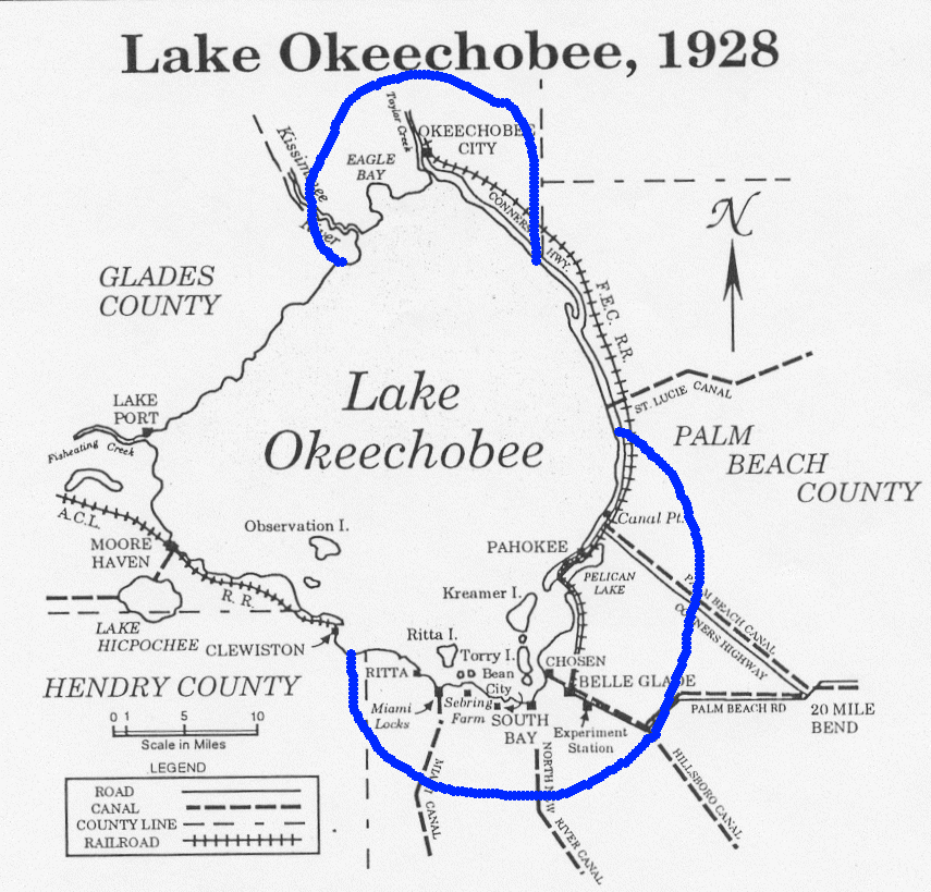
English: Map showing the area of the flood caused by the 1928 Okeechobee hurricane. Ironically, residents of Torry Island, on the south side of the lake, owe their survival to the resulting flood. Note: The Palm Beach County label is misplaced. North of Canal Point has been in Martin County since 1925. |
| Date | |
| Source | From http://www.srh.noaa.gov/mfl/newpage/Okeechobee.htm. |
| Auteur | NOAA |
Conditions d’utilisation[modifier]
Cette image est dans le domaine public car son contenu provient de la
National Oceanic and Atmospheric Administration , réalisé par un employé dans le cadre de ses activités professionnelles.
|

|
Cette image (de type old map) devrait être recréée dans un format vectoriel, en tant que fichier SVG. Cela offrirait plusieurs avantages : voir Commons:Media for cleanup pour plus d'informations. Si une version SVG de cette image est déjà disponible, merci de bien vouloir l'envoyer. Après cela, remplacez ce modèle par {{vector version available|nouveau nom d'image.svg}}.
|
Historique du fichier
Cliquer sur une date et heure pour voir le fichier tel qu'il était à ce moment-là.
| Date et heure | Vignette | Dimensions | Utilisateur | Commentaire | |
|---|---|---|---|---|---|
| actuel | 7 octobre 2005 à 08:33 | | 855 × 819 (172 kio) | Jdorje~commonswiki (d | contributions) | Map showing the area of the flood caused by the 1928 Okeechobee hurricane. From [http://www.srh.noaa.gov/mfl/newpage/Okeechobee.htm]. |
Vous ne pouvez pas remplacer ce fichier.
Utilisations locales du fichier
Aucune page n’utilise ce fichier.
Utilisations du fichier sur d’autres wikis
Les autres wikis suivants utilisent ce fichier :
- Utilisation sur de.wikipedia.org
- Utilisation sur en.wikipedia.org
- Utilisation sur fr.wikipedia.org
- Utilisation sur ja.wikipedia.org
- Utilisation sur pl.wikipedia.org
- Utilisation sur zh.wikipedia.org