File:19th Special Forces Group Land Navigation Training.jpg
跳至導覽
跳至搜尋
預覽大小:800 × 532 像素。 其他解析度:320 × 213 像素 | 640 × 426 像素 | 1,024 × 681 像素 | 1,440 × 958 像素。
原始檔案 (1,440 × 958 像素,檔案大小:204 KB,MIME 類型:image/jpeg)
說明
說明
添加單行說明來描述出檔案所代表的內容
摘要
[編輯]
| 描述 |
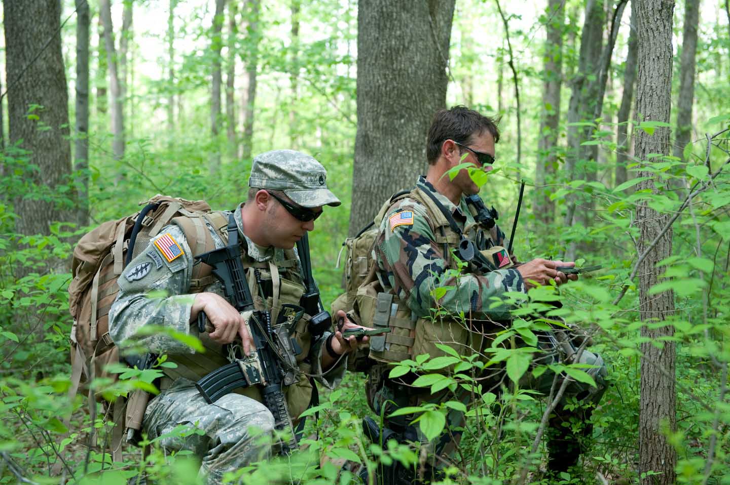
English: Soldiers with 2nd Battalion, 19th Special Forces Group check their course with compasses during a foot patrol while training at Camp Atterbury Joint Maneuver Training Center, Ind., May 12. Despite the advent of GPS navigational technology, which these soldiers do utilize, the lensatic compass remains the most reliable tool for land navigation. |
| 日期 | |
| 來源 | http://www.soc.mil/UNS/Photo/2011/2011/album/slides/402774.html |
| 作者 | United States Army |
授權條款
[編輯]
此作品在美國屬於公有領域,因為其是由美國政府的官員或僱員,基於其個人公務目的製作的作品,參考美國法典第17篇第1章第105條。
注意︰本模板僅適用於美國聯邦政府的原創作品,不適用於任何美國州、屬地、聯邦個體、縣、市或任何次級政府的作品。本模板也不適用於1978年以後由美國郵政署出版的郵票圖案(參看美國版權局實踐綱領第313.6(C)(1)條)。也不適用於部分美國硬幣;參看美國鑄幣局使用條款。 |
 | |
| 此作品無已知的著作權限制,亦不受所有相關和鄰接的權利限制。 | ||
檔案歷史
點選日期/時間以檢視該時間的檔案版本。
| 日期/時間 | 縮圖 | 尺寸 | 使用者 | 備註 | |
|---|---|---|---|---|---|
| 目前 | 2011年6月22日 (三) 00:22 | | 1,440 × 958(204 KB) | TomPointTwo~commonswiki(留言 | 貢獻) |
無法覆蓋此檔案。
檔案用途
沒有使用此檔案的頁面。
全域檔案使用狀況
以下其他 wiki 使用了這個檔案:
- en.wikipedia.org 的使用狀況
- ru.wikipedia.org 的使用狀況
- zh.wikipedia.org 的使用狀況
詮釋資料
分類:
- 19th Special Forces Group (United States)
- Land navigation
- Army Combat Uniform in 2011
- MOLLE armor carriers
- Tactical backpacks
- Hydration packs
- Male humans with M4 carbine
- Elcan Specter
- Camouflaged firearms
- People using compasses
- People with M9 pistol
- Pistols in holster
- Battle Dress Uniform in 2011
- Combat Integrated Releasable Armor System
- Glowsticks