File:2010 Sandstorm over Eastern China.jpg
跳转到导航
跳转到搜索

本预览的尺寸:720 × 600像素。 其他分辨率:288 × 240像素 | 576 × 480像素 | 922 × 768像素 | 1,229 × 1,024像素 | 2,458 × 2,048像素 | 4,800 × 4,000像素。
原始文件 (4,800 × 4,000像素,文件大小:2.88 MB,MIME类型:image/jpeg)
说明
说明
添加一行文字以描述该文件所表现的内容
摘要
[编辑]
| 描述 |
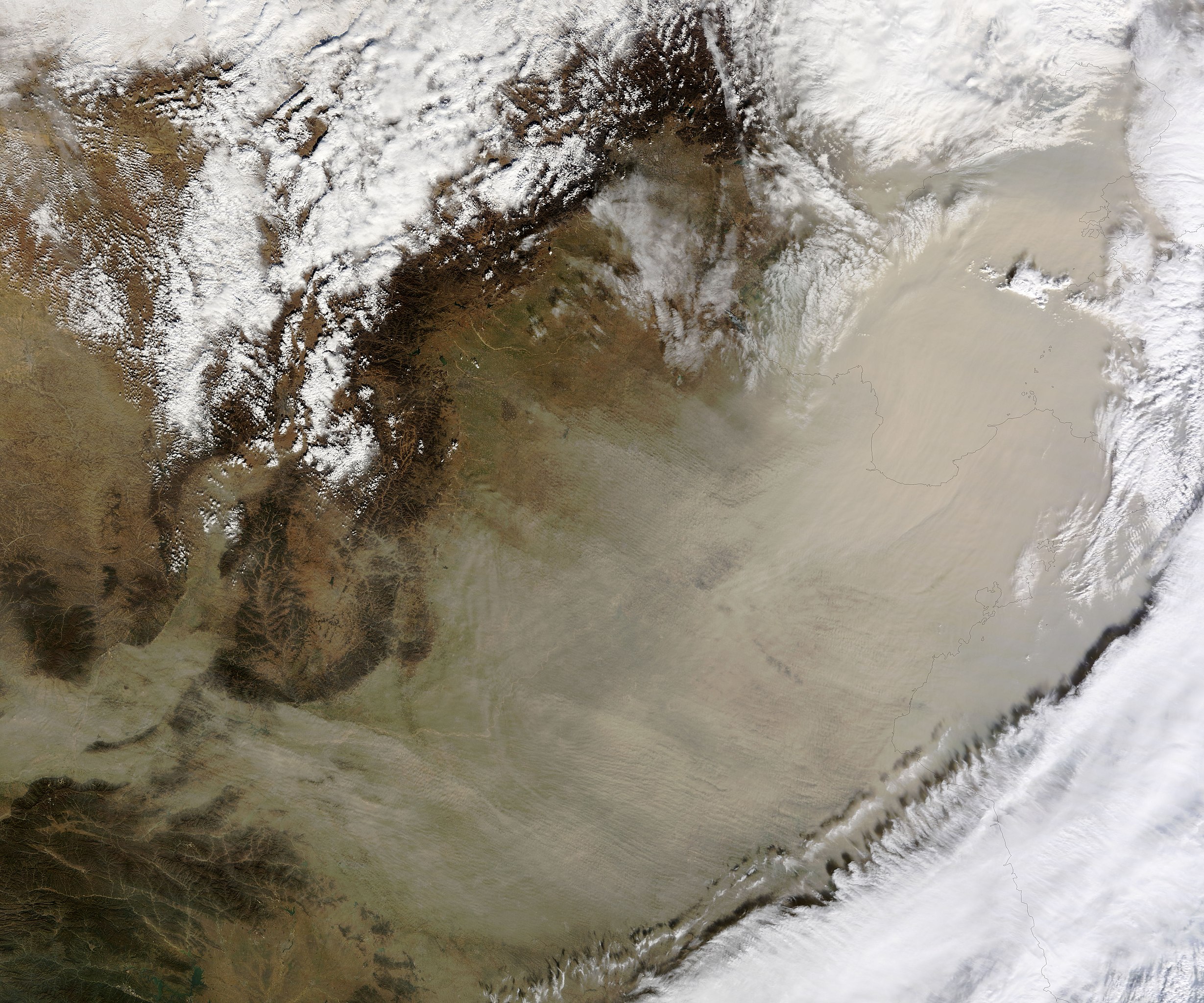
English: On November 11, 2010, a wall of sand blew across eastern China. The airborne sand entirely hides much of the North China Plain, Shandong Peninsula, and the Bo Hai from view in this true colour image. |
| 日期 | |
| 来源 | NASA Earth Observatory |
| 作者 | Jeff Schmaltz |
Image captured by the Moderate Resolution Imaging Spectroradiometer (MODIS) on NASA’s Terra satellite. Image courtesy of the MODIS Rapid Response Team at NASA GSFC.
许可协议
[编辑]
| 本文件完全由NASA创作,在美国属于公有领域。根据NASA的版权方针,NASA的材料除非另有声明否则不受版权保护。(参见Template:PD-USGov/zh、NASA版权方针页面或JPL图片使用方针。) | ||
 |
警告:
|
| 註解 | 該圖片含有註解:在維基媒體共享資源上查看註解 |
文件历史
点击某个日期/时间查看对应时刻的文件。
| 日期/时间 | 缩略图 | 大小 | 用户 | 备注 | |
|---|---|---|---|---|---|
| 当前 | 2010年11月12日 (五) 11:06 | | 4,800 × 4,000(2.88 MB) | Originalwana(留言 | 贡献) | {{Information |Description={{en|1=On November 11, 2010, a wall of sand blew across eastern China. The airborne sand entirely hides much of the North China Plain, Shandong Peninsula, and the Bo Hai from view in this true colour image. }} |Source=[http://ea |
您不可以覆盖此文件。
文件用途
以下页面使用本文件:
全域文件用途
以下其他wiki使用此文件:
- ar.wikipedia.org上的用途
- en.wikipedia.org上的用途
- ja.wikipedia.org上的用途
- zh.wikipedia.org上的用途