File:2016年12月起大溫哥華主要公共交通路線圖.svg
跳去導覽
跳去搵嘢

呢個「SVG」檔案嘅呢個「PNG」預覽嘅大細:512 × 246 像素。 第啲解像度:320 × 154 像素 | 640 × 308 像素 | 1,024 × 492 像素 | 1,280 × 615 像素 | 2,560 × 1,230 像素。
原本檔案 (SVG檔案,表面大細: 512 × 246 像素,檔案大細:275 KB)
Captions
Captions
Add a one-line explanation of what this file represents
摘要[編輯]
| 描述 |
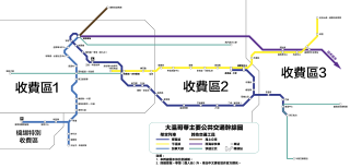
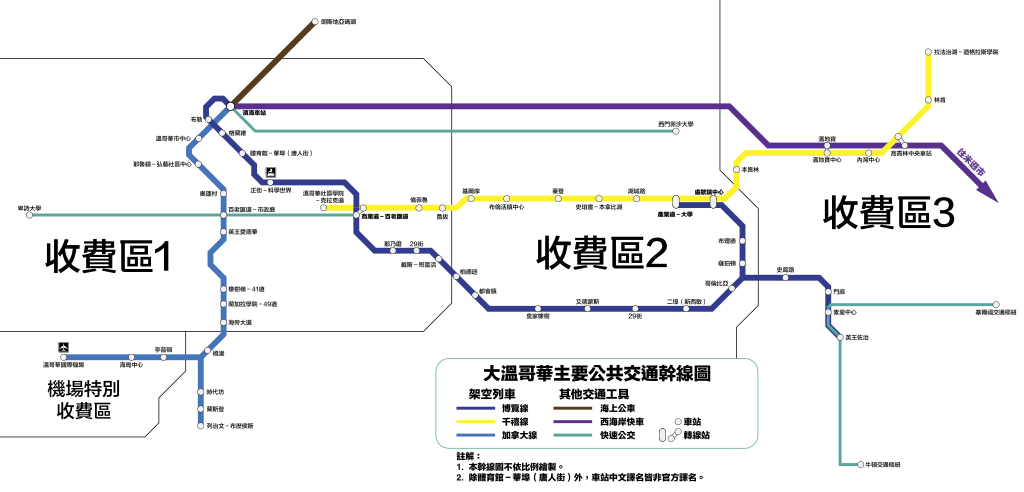
Français : Le plan du réseau des routes importantes du transport en commun à Grand Vancouver, y compris le SkyTrain, le West Coast Express, le SeaBus et les B-Lignes. |
|||||
| 日期 | ||||||
| 來源 | 自己作品 | |||||
| 作者 | Cedric tsan cantonais | |||||
| SVG genesis | This W3C-invalid map was created with Adobe Illustrator.
|


協議[編輯]
我,呢份作品嘅作者,決定用以下許可發佈呢件作品:
This file is licensed under the Creative Commons Attribution-Share Alike 4.0 International license.
- 你可以:
- 去分享 – 複製、發佈同傳播呢個作品
- 再改 – 創作演繹作品
- 要遵照下面嘅條件:
- 署名 – 你一定要畀合適嘅表彰、畀返指向呢個授權條款嘅連結,同埋寫明有無改過嚟。你可以用任何合理方式去做,但唔可以用任何方式暗示授權人認可咗你或者你嘅使用方式。
- 相同方式分享 – 如果你用任何方式改過呢個作品,你必須要用返原本或者相似嘅條款發佈。
檔案歷史
撳個日期/時間去睇響嗰個時間出現過嘅檔案。
| 日期/時間 | 縮圖 | 尺寸 | 用戶 | 註解 | |
|---|---|---|---|---|---|
| 現時 | 2016年12月14號 (三) 20:48 | | 512 × 246(275 KB) | Cedric tsan cantonais(傾偈 | 貢獻) | 加條新開嘅B線公交車。 |
| 2016年11月16號 (三) 16:13 |  | 512 × 246(265 KB) | Cedric tsan cantonais(傾偈 | 貢獻) | 漏徂個車站,唔好意思。 | |
| 2016年11月16號 (三) 06:34 |  | 512 × 246(258 KB) | Cedric tsan cantonais(傾偈 | 貢獻) | User created page with UploadWizard |
你無得衾咗個檔案。
檔案用途
以下嘅8版用到呢個檔:
- User:Chumwa/OgreBot/Potential transport maps/2016 December 11-20
- User:Chumwa/OgreBot/Potential transport maps/2016 November 11-20
- User:Chumwa/OgreBot/Public transport information/2016 December 11-20
- User:Chumwa/OgreBot/Public transport information/2016 November 11-20
- User:Chumwa/OgreBot/Transport Maps/2016 December 11-20
- User:Chumwa/OgreBot/Transport Maps/2016 November 11-20
- User:Chumwa/OgreBot/Travel and communication maps/2016 December 11-20
- User:Chumwa/OgreBot/Travel and communication maps/2016 November 11-20
全域檔案使用情況
下面嘅維基都用緊呢個檔案:
- zh.wikipedia.org嘅使用情況