File:2016 Presidential Election by County.svg
Salta a la navegació
Salta a la cerca

Mida d'aquesta previsualització PNG del fitxer SVG: 800 × 507 píxels. Altres resolucions: 320 × 203 píxels | 640 × 405 píxels | 1.024 × 649 píxels | 1.280 × 811 píxels | 2.560 × 1.621 píxels | 990 × 627 píxels.
Fitxer original (fitxer SVG, nominalment 990 × 627 píxels, mida del fitxer: 983 Ko)
Llegendes
Llegendes
Afegeix una explicació d'una línia del que representa aquest fitxer
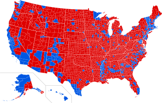
Red Donald Trump Blue Hillary Clinton
Resum[modifica]
| Descripció |
English: 2016 Presidential Election by County |
||||
| Data | |||||
| Font |
This file was derived from: USA Counties.svg |
||||
| Autor | Ali Zifan | ||||
| Altres versions |
[]
|


.svg)
.svg)


Llicència[modifica]
Jo, el titular dels drets d'autor d'aquest treball, el public sota la següent llicència:
This file is licensed under the Creative Commons Attribution-Share Alike 4.0 International license.
- Sou lliure de:
- compartir – copiar, distribuir i comunicar públicament l'obra
- adaptar – fer-ne obres derivades
- Amb les condicions següents:
- reconeixement – Heu de donar la informació adequada sobre l'autor, proporcionar un enllaç a la llicència i indicar si s'han realitzat canvis. Podeu fer-ho amb qualsevol mitjà raonable, però de cap manera no suggereixi que l'autor us dóna suport o aprova l'ús que en feu.
- compartir igual – Si modifiqueu, transformeu, o generareu amb el material, haureu de distribuir les vostres contribucions sota una llicència similar o una de compatible com l'original
Historial del fitxer
Cliqueu una data/hora per veure el fitxer tal com era aleshores.
| Data/hora | Miniatura | Dimensions | Usuari/a | Comentari | |
|---|---|---|---|---|---|
| actual | 04:42, 4 gen 2017 | | 990 × 627 (983 Ko) | Oganesson007 (discussió | contribucions) | minor update |
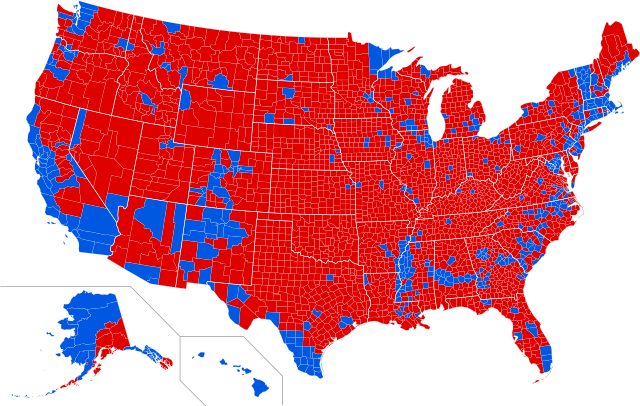
| 04:05, 4 gen 2017 |  | 990 × 627 (983 Ko) | Oganesson007 (discussió | contribucions) | Alaska by County + Reduced size + Clean up | |
| 04:06, 26 des 2016 |  | 990 × 627 (1,08 Mo) | TL565 (discussió | contribucions) | Reverted to version as of 21:50, 14 December 2016 (UTC) | |
| 23:55, 25 des 2016 |  | 990 × 627 (1,27 Mo) | TL565 (discussió | contribucions) | Fix Fort Bend county, TX | |
| 00:59, 15 des 2016 |  | 990 × 627 (1,24 Mo) | WikiBunny2K1 (discussió | contribucions) | Correctly colored some counties | |
| 00:02, 15 des 2016 |  | 990 × 627 (1,24 Mo) | WikiBunny2K1 (discussió | contribucions) | Fix to the shape errors | |
| 21:50, 14 des 2016 |  | 990 × 627 (1,08 Mo) | WikiBunny2K1 (discussió | contribucions) | Updated Dutchess County. Can anyone fix the white border near Virginia? It's a bit off from where it's supposed to be. | |
| 01:23, 14 des 2016 |  | 990 × 627 (1,08 Mo) | WikiBunny2K1 (discussió | contribucions) | Fixed Alaska | |
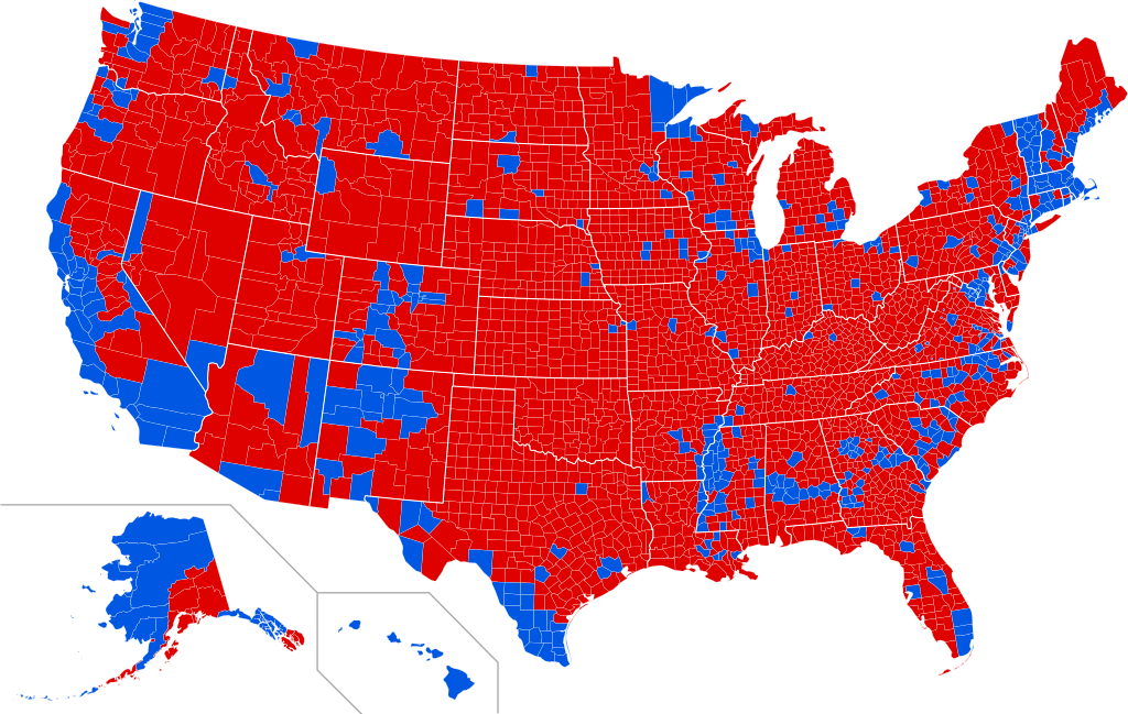
| 11:50, 13 des 2016 |  | 990 × 627 (939 Ko) | TL565 (discussió | contribucions) | Corrections | |
| 22:03, 12 des 2016 |  | 990 × 627 (936 Ko) | Tdl1060 (discussió | contribucions) | Sauk County, Wisconsin voted for Trump https://www.co.sauk.wi.us/sites/default/files/fileattachments/2016november8generalelectionofficialresults.pdf |
No podeu sobreescriure aquest fitxer.
Ús del fitxer
Les 29 pàgines següents utilitzen aquest fitxer:
- User:Magog the Ogre/Political maps/2016 April 1-10
- User:Magog the Ogre/Political maps/2016 December 11-20
- User:Magog the Ogre/Political maps/2016 December 21-31
- User:Magog the Ogre/Political maps/2016 November 1-10
- User:Magog the Ogre/Political maps/2017 January 1-10
- User:Oganesson007/Contributions
- User:OgreBot/Watercraft/2016 December 12
- User:OgreBot/Watercraft/2016 December 15
- User:OgreBot/Watercraft/2016 December 25
- User:OgreBot/Watercraft/2016 December 26
- User:OgreBot/Watercraft/2017 January 4
- File:2016 Presidential Election by County.svg
- File:2016 Presidential Election by County (Percentage of the Vote).svg (fitxer redirigit)
- File:2016 Presidential Election by County (Red-Blue-Purple View).png
- File:2016 Presidential Election by County (Red-Blue-Purple View).svg
- File:2016 Presidential Election by County - Clinton.svg
- File:2016 Presidential Election by County - Trump.svg
- File:2016 Presidential Election by State - Clinton.svg
- File:2016 Presidential Election by State - Trump.svg
- File:2016 Presidential Election by Vote Distribution Among States.svg
- File:2016 United States presidential election - Percentage of votes cast for Gary Johnson by county.svg
- File:2016 United States presidential election results map by county.svg
- File:Cartogram—2016 Electoral Vote.svg
- File:ElectoralCollege2016.svg
- File:Results by state, shaded according to winning candidate's percentage of the vote 2016.svg
- File:U.S. 2012 to 2016 presidential election swing.svg
- File:U.S. 2012 to 2016 presidential election swing (relative).svg
- File:United States presidential election, 2016 Cartogram.png
- Template:United States presidential election maps, 2016
.svg&redirect=no)
.png)
.svg)
Ús global del fitxer
Utilització d'aquest fitxer en altres wikis:
- Utilització a bg.wikipedia.org
- Utilització a ca.wikipedia.org
- Utilització a da.wikipedia.org
- Utilització a de.wikipedia.org
- Utilització a en.wikipedia.org
- Utilització a en.wikiquote.org
- Utilització a fa.wikipedia.org
- Utilització a fo.wikipedia.org
- Utilització a frr.wikipedia.org
- Utilització a fr.wikipedia.org
- Utilització a hu.wikipedia.org
- Utilització a it.wikipedia.org
- Utilització a ja.wikipedia.org
- Utilització a ko.wikipedia.org
- Utilització a mk.wikipedia.org
- Utilització a pt.wikipedia.org
- Utilització a sk.wikipedia.org
- Utilització a sv.wikipedia.org
- Utilització a uk.wikipedia.org