File:2022 Arkansas gubernatorial election results map by county.svg
跳至導覽
跳至搜尋

此 SVG 檔案的 PNG 預覽的大小:685 × 600 像素。 其他解析度:274 × 240 像素 | 548 × 480 像素 | 877 × 768 像素 | 1,170 × 1,024 像素 | 2,340 × 2,048 像素 | 810 × 709 像素。
原始檔案 (SVG 檔案,表面大小:810 × 709 像素,檔案大小:45 KB)
說明
說明
添加單行說明來描述出檔案所代表的內容
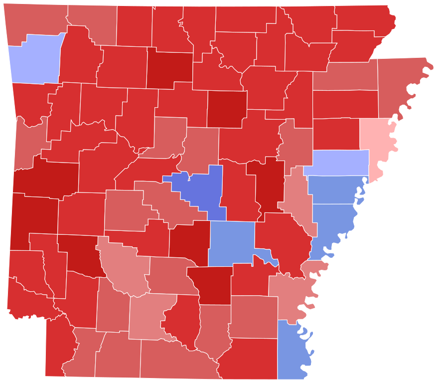
Arkansas 2022 Governor Results by County
摘要
[編輯]| 描述 |
English: Counties shaded in order of party performance |
| 日期 | |
| 來源 | 自己的作品 |
| 作者 | Gordfather69 |

授權條款
[編輯]
| 此地圖不符合著作權的資格,因此屬於公有領域,因為其完全包含公共財產資訊,不包含原作者身份。詳情參見Commons:Threshold of originality § Maps。
|
檔案歷史
點選日期/時間以檢視該時間的檔案版本。
| 日期/時間 | 縮圖 | 尺寸 | 用戶 | 備註 | |
|---|---|---|---|---|---|
| 目前 | 2023年7月24日 (一) 06:49 | | 810 × 709(45 KB) | Putitonamap98(對話 | 貢獻) | shapes |
| 2022年12月1日 (四) 01:25 |  | 744 × 655(383 KB) | Elli(對話 | 貢獻) | update Lee County (results certified: https://www.nytimes.com/interactive/2022/11/08/us/elections/results-arkansas-governor.html) | |
| 2022年11月27日 (日) 02:12 |  | 744 × 655(384 KB) | JudgeHowardFoushee(對話 | 貢獻) | Changed shape + updated Phillips County | |
| 2022年11月10日 (四) 07:15 |  | 198 × 181(45 KB) | Putitonamap98(對話 | 貢獻) | updated | |
| 2022年11月10日 (四) 03:57 |  | 198 × 181(45 KB) | Putitonamap98(對話 | 貢獻) | updated | |
| 2022年11月9日 (三) 16:45 |  | 198 × 181(45 KB) | Gordfather69(對話 | 貢獻) | Uploaded own work with UploadWizard |
無法覆蓋此檔案。
檔案用途
下列4個頁面有用到此檔案:
全域檔案使用狀況
以下其他 wiki 使用了這個檔案:
- arz.wikipedia.org 的使用狀況
- en.wikipedia.org 的使用狀況
- zh.wikipedia.org 的使用狀況