File:2nd century BCE Tamil Brahmi inscription Arittapatti Madurai India.jpg
原始文件 (4,032 × 3,024像素,文件大小:2.98 MB,MIME类型:image/jpeg)
说明
说明
摘要
[编辑]
| 描述 |
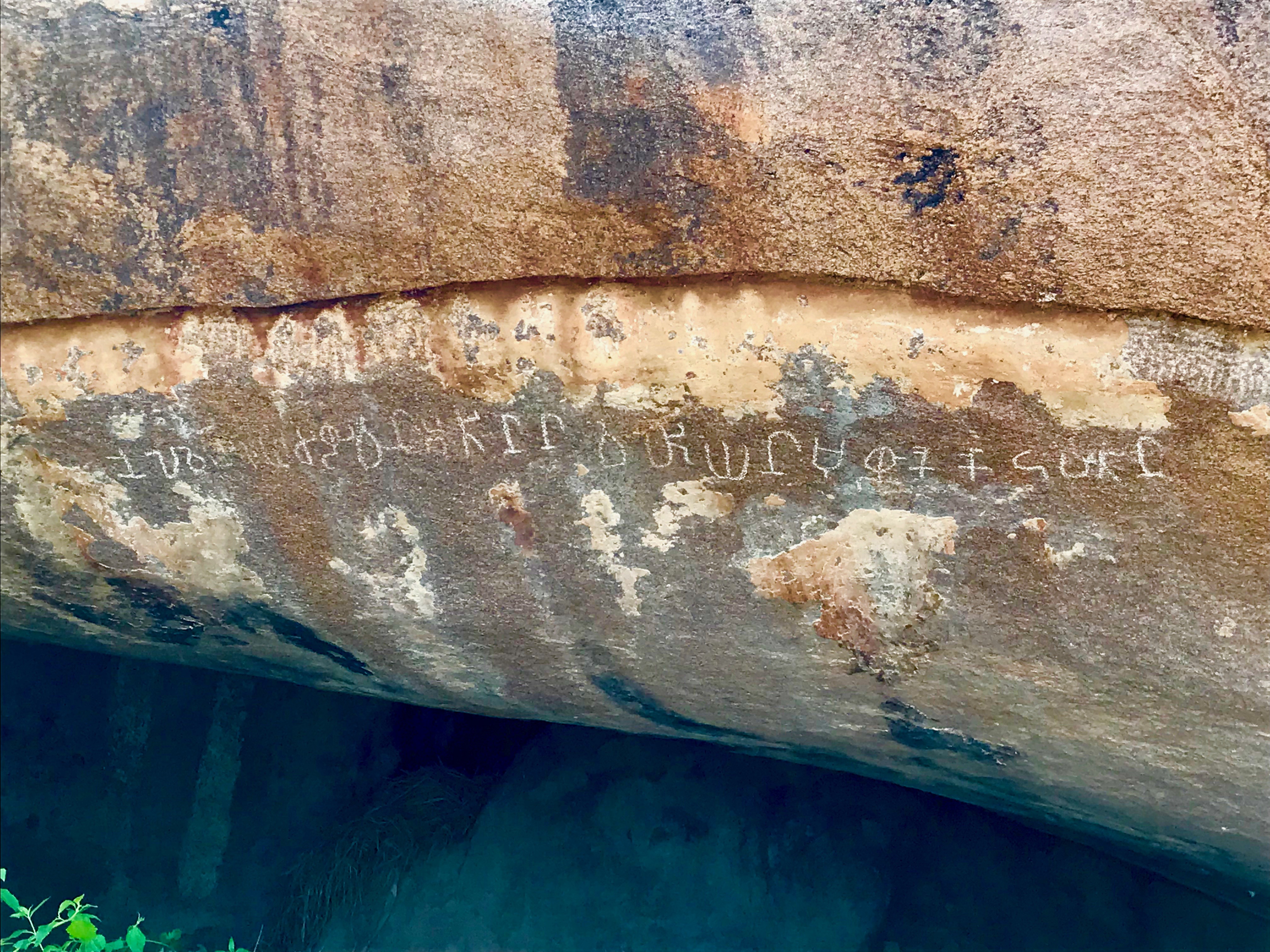
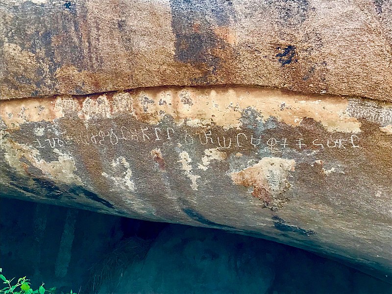
English: Arittapatti is also called Aritapatti or Pancha Pandava Padukkai from the Mahabharata legends.
Arittapatti is a village set near a rocky hill about 25 kilometers northeast of Madurai. It has one of the oldest known Tamil Brahmi inscriptions, as well the oldest known Shaivism-related Lakulisha iconography in Tamil Nadu and Jain monuments. The above Tamil Brahmi inscription is dated to about the 2nd-century BCE. It is located near the Jain tirthankara relief with Vatteluttu script inscription. Since this rounded script emerged and came into use in and after 6th-century, the tirthankara relief was likely carved into the rock about 800 or 900 years later. This, along with the 7th-century rock-cut Shiva temple on the western side of same rocky hills in the same village (but a long walk) attests to the use of this site in ancient Tamil lands for centuries. For further discussion of the Tamil Brahmi inscription, please see K. V. Raman and Y. Subbarayalu (1971), A new Tamil-Brahmi Inscription in Arittapatti, Journal of Indian History, Volume XLIX, pp. 229-232 |
| 日期 | |
| 来源 | 自己的作品 |
| 作者 | Ms Sarah Welch |
| 相机位置 | | 在以下服务上查看本图像和附近其他图像: OpenStreetMap |
|---|
许可协议
[编辑]
- 您可以自由地:
- 共享 – 复制、发行并传播本作品
- 修改 – 改编作品
- 惟须遵守下列条件:
- 署名 – 您必须对作品进行署名,提供授权条款的链接,并说明是否对原始内容进行了更改。您可以用任何合理的方式来署名,但不得以任何方式表明许可人认可您或您的使用。
- 相同方式共享 – 如果您再混合、转换或者基于本作品进行创作,您必须以与原先许可协议相同或相兼容的许可协议分发您贡献的作品。
文件历史
点击某个日期/时间查看对应时刻的文件。
| 日期/时间 | 缩略图 | 大小 | 用户 | 备注 | |
|---|---|---|---|---|---|
| 当前 | 2018年10月9日 (二) 02:26 | | 4,032 × 3,024(2.98 MB) | Ms Sarah Welch(留言 | 贡献) | User created page with UploadWizard |
您不可以覆盖此文件。
文件用途
没有页面使用本文件。
全域文件用途
以下其他wiki使用此文件:
- ar.wikipedia.org上的用途
- bn.wikipedia.org上的用途
- en.wikipedia.org上的用途
- hi.wikipedia.org上的用途
- id.wikipedia.org上的用途
- ml.wikipedia.org上的用途
- www.wikidata.org上的用途
- zh.wikipedia.org上的用途