File:600x748-Carte-de-l'Irlande-R.jpg
跳至導覽
跳至搜尋

預覽大小:481 × 600 像素。 其他解析度:192 × 240 像素 | 600 × 748 像素。
原始檔案 (600 × 748 像素,檔案大小:108 KB,MIME 類型:image/jpeg)
說明
說明
添加單行說明來描述出檔案所代表的內容
| 描述 |
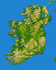
Français : Carte topographique d'Irlande redimenssionnée pour la géolocalisation |
||||
| 日期 | Wikisoft* @@@-fr 07:52, 11 December 2010 (UTC) | ||||
| 來源 |
NASA SRTM |
||||
| 作者 | Wikisoft* @@@-fr 07:52, 11 December 2010 (UTC) | ||||
| 授權許可 (重用此檔案) |
|
||||
| 其他版本 |
|


檔案歷史
點選日期/時間以檢視該時間的檔案版本。
| 日期/時間 | 縮圖 | 尺寸 | 使用者 | 備註 | |
|---|---|---|---|---|---|
| 目前 | 2010年12月11日 (六) 07:52 | | 600 × 748(108 KB) | Wikisoft*(留言 | 貢獻) | {{Information |Description={{fr|1=Carte topographique d'Irlande redimenssionnée pour la géolocalisation}} |Source=NASA SRTM (redimenssionée pour la géolocalisation) |Author=~~~~ |Date=~~~~ |Permission={{GFDL-GMT}} |other_versions=[[Category:Maps o |
無法覆蓋此檔案。
檔案用途
下列3個頁面有用到此檔案:
全域檔案使用狀況
以下其他 wiki 使用了這個檔案:
- arz.wikipedia.org 的使用狀況
- en.wikipedia.org 的使用狀況
- eo.wikipedia.org 的使用狀況
- es.wikipedia.org 的使用狀況
- it.wikipedia.org 的使用狀況
- Achill Island
- Benbulben
- Isole Aran
- Omey Island
- Errigal
- Croagh Patrick
- Carrantuohill
- Capo Malin
- Baia di Donegal
- Baia di Galway
- Capo Mizen
- Baia di Clew
- Clare Island
- Lough Gill
- Killary Harbour
- Lough Corrib
- Lough Derg
- Árainn Mhór
- Mweelrea
- Lough Conn
- Lough Cullin
- Oileán Thoraigh
- Inis Mór
- Inis Meáin
- Inis Oírr
- Isole Skellig
- Skellig Michael
- Little Skellig
- Inishtrahull
檢視此檔案的更多全域使用狀況。