File:78.96268E 36.26053N nasa kanxiwar.jpg
跳转到导航
跳转到搜索
本预览的尺寸:800 × 492像素。 其他分辨率:320 × 197像素 | 640 × 394像素 | 990 × 609像素。
原始文件 (990 × 609像素,文件大小:200 KB,MIME类型:image/jpeg)
说明
说明
添加一行文字以描述该文件所表现的内容
摘要
[编辑]
| 描述 |
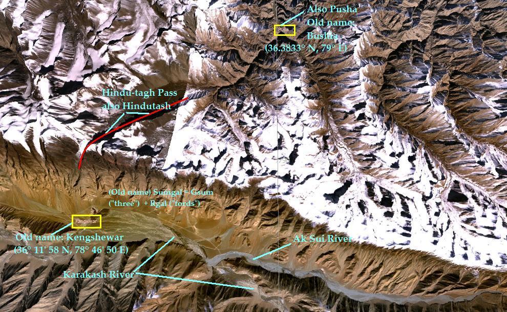
English: NASA WorldWind screen shot of the Karakash River Region in China showing the Hindu-tagh
pass, and the towns of Kangxiwar (formerly Sumgal) and Pusa (also Pusha, formerly Bushia). Annoted by Fowler&fowler«Talk» 12:54, 10 July 2007 (UTC) |
| 来源 | NASA |
| 作者 | NASA |
许可协议
[编辑]
| 本文件完全由NASA创作,在美国属于公有领域。根据NASA的版权方针,NASA的材料除非另有声明否则不受版权保护。(参见Template:PD-USGov/zh、NASA版权方针页面或JPL图片使用方针。) | ||
 |
警告:
|
原始上传日志
[编辑]
The original description page was here. All following user names refer to en.wikipedia.
- 2007-07-10 12:54 Fowler&fowler 990×609× (205072 bytes) Nasa WorldWind screen shot of the Karakash River Region in China showing the Hindu-tagh pass, and the towns of Kangxiwar (formerly Sumgal) and Pusa (also Pusha, formerly Bushia). Annoted by ~~~~
文件历史
点击某个日期/时间查看对应时刻的文件。
| 日期/时间 | 缩略图 | 大小 | 用户 | 备注 | |
|---|---|---|---|---|---|
| 当前 | 2010年1月19日 (二) 21:48 | | 990 × 609(200 KB) | File Upload Bot (Magnus Manske)(留言 | 贡献) | {{BotMoveToCommons|en.wikipedia|year={{subst:CURRENTYEAR}}|month={{subst:CURRENTMONTHNAME}}|day={{subst:CURRENTDAY}}}} {{Information |Description={{en|NASA WorldWind screen shot of the Karakash River Region in China showing the Hindu-tagh pass, and the t |
您不可以覆盖此文件。
文件用途
没有页面使用本文件。
全域文件用途
以下其他wiki使用此文件:
- ar.wikipedia.org上的用途
- en.wikipedia.org上的用途
- hi.wikipedia.org上的用途
- it.wikipedia.org上的用途
- pnb.wikipedia.org上的用途
- zh.wikipedia.org上的用途