File:88.43153W 49.95886N Nipigon Lake.png
跳至導覽
跳至搜尋

預覽大小:731 × 599 像素。 其他解析度:293 × 240 像素 | 585 × 480 像素 | 1,000 × 820 像素。
原始檔案 (1,000 × 820 像素,檔案大小:657 KB,MIME 類型:image/png)
說明
說明
添加單行說明來描述出檔案所代表的內容
| 描述 |
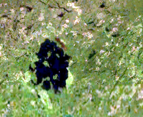
English: Nipigon Lake from a Space |
|||
| 日期 | ||||
| 來源 | World Wind | |||
| 作者 | World Wind | |||
| 授權許可 (重用此檔案) |
|

檔案歷史
點選日期/時間以檢視該時間的檔案版本。
| 日期/時間 | 縮圖 | 尺寸 | 用戶 | 備註 | |
|---|---|---|---|---|---|
| 目前 | 2023年9月21日 (四) 00:01 | | 1,000 × 820(657 KB) | TCfanssos(對話 | 貢獻) | Reverted to version as of 18:27, 2 September 2011 (UTC) |
| 2023年9月20日 (三) 23:59 |  | 740 × 1,041(1.31 MB) | TCfanssos(對話 | 貢獻) | Closeup | |
| 2011年9月2日 (五) 18:27 |  | 1,000 × 820(657 KB) | Alex Spade(對話 | 貢獻) | Photoshop - Adjustments / Autolevels | |
| 2010年7月31日 (六) 00:53 |  | 1,000 × 820(532 KB) | Pauk(對話 | 貢獻) | {{Information |Description={{en|Nipigon Lake from a Space}} |Source=World Wind |Date=July 31, 2010 |Author=World Wind |Permission={{PD-WorldWind}} |other_versions= }} Category:Lake Nipigon |
無法覆蓋此檔案。
檔案用途
沒有使用此檔案的頁面。
全域檔案使用狀況
以下其他 wiki 使用了這個檔案:
- az.wikipedia.org 的使用狀況
- bg.wikipedia.org 的使用狀況
- ceb.wikipedia.org 的使用狀況
- en.wikipedia.org 的使用狀況
- fi.wikipedia.org 的使用狀況
- ja.wikipedia.org 的使用狀況
- kk.wikipedia.org 的使用狀況
- ko.wikipedia.org 的使用狀況
- lv.wikipedia.org 的使用狀況
- nl.wikipedia.org 的使用狀況
- pl.wikipedia.org 的使用狀況
- ru.wikipedia.org 的使用狀況
- sv.wikipedia.org 的使用狀況
- zh.wikipedia.org 的使用狀況