File:A map of the Eastern boundary of France to illustrate Article III in The First Peace of Paris 30th May 1814.jpg
Ir a la navegación
Ir a la búsqueda
Tamaño de esta previsualización: 752 × 600 píxeles. Otras resoluciones: 301 × 240 píxeles | 602 × 480 píxeles | 963 × 768 píxeles | 1280 × 1021 píxeles | 2091 × 1668 píxeles.
Archivo original (2091 × 1668 píxeles; tamaño de archivo: 1,87 MB; tipo MIME: image/jpeg)
Leyendas
Leyendas
Añade una explicación corta acerca de lo que representa este archivo
Resumen
[editar]
| Descripción |
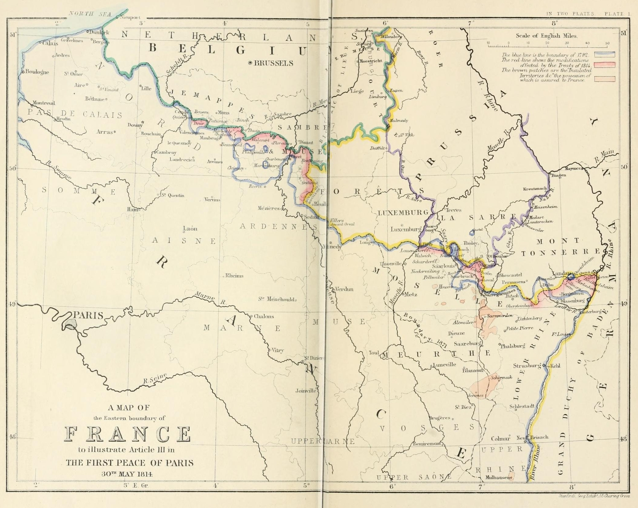
English: A map of the Eastern boundary of France to illustrate Article III in The First Peace of Paris 30th May 1814 |
| Fecha | |
| Fuente | Edward Hertslet (1875). The map of Europe by treaty; showing the various political and territorial changes which have taken place since the general peace of 1814, London, Butterworths. p. opposite 28, 351 |
| Autor | Edward Hertslet; and Stafford's Geng Estab, 55 Charing Cross |
Licencia
[editar]
|
Este material está en dominio público en los demás países donde el derecho de autor se extiende por 70 años (o menos) tras la muerte del autor. Esta obra está en el dominio público en los Estados Unidos porque fue publicada (o registrada con la Oficina del Derecho de Autor de los E.E. U.U.) antes del 1 de enero de 1929. | |
| Esta obra ha sido identificada como libre de las restricciones conocidas en virtud del derecho de autor, incluyendo todos los derechos conexos. | |
Historial del archivo
Haz clic sobre una fecha y hora para ver el archivo tal como apareció en ese momento.
| Fecha y hora | Miniatura | Dimensiones | Usuario | Comentario | |
|---|---|---|---|---|---|
| actual | 21:31 3 sep 2014 | | 2091 × 1668 (1,87 MB) | PBS (discusión | contribs.) | User created page with UploadWizard |
No puedes sobrescribir este archivo.
Usos del archivo
No hay páginas que enlacen a este archivo.
Uso global del archivo
Las wikis siguientes utilizan este archivo:
- Uso en en.wikipedia.org
- Uso en es.wikipedia.org
- Uso en fr.wikipedia.org
- Uso en he.wikipedia.org
- Uso en it.wikipedia.org
- Uso en ja.wikipedia.org
- Uso en pnb.wikipedia.org
- Uso en sl.wikipedia.org
- Uso en sr.wikipedia.org
- Uso en sv.wikipedia.org
- Uso en tt.wikipedia.org
- Uso en ur.wikipedia.org