File:Abraham Ortelius - Tvrcici imperii descriptio.jpg
跳转到导航
跳转到搜索

本预览的尺寸:800 × 591像素。 其他分辨率:320 × 236像素 | 640 × 473像素 | 1,024 × 756像素 | 1,280 × 946像素 | 2,560 × 1,891像素 | 3,085 × 2,279像素。
原始文件 (3,085 × 2,279像素,文件大小:2.64 MB,MIME类型:image/jpeg)
说明
说明
添加一行文字以描述该文件所表现的内容
摘要
[编辑]| 作者 | ||||||||||||||||||||||||
| 描述 |
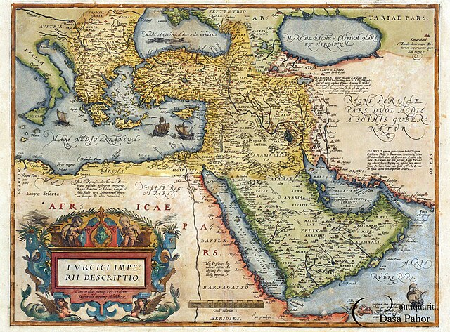
English: An engraved map and coloured by hand. It is part of A. Ortelius's atlas Teatrum Orbis Terarum, Antwerp, 1570, map no. 50
Română: Hartă gravată în aramă colorată de mână. Face parte din atlasul lui A. Ortelius, Theatrum Orbis Terrarum, Anvers, 1570, harta numărul 50 |
|||||||||||||||||||||||
| 日期 | 1570年 | |||||||||||||||||||||||
| 藏于 |
|
|||||||||||||||||||||||
| 来源/摄影师 | Muzeul Național al Hărților și Cărții Vechi, Romania | |||||||||||||||||||||||
| 其他版本 | https://www.muzeulhartilor.ro/wp-content/uploads/2017/11/a-ortelius-turcia.jpg | |||||||||||||||||||||||

.JPG)
许可协议
[编辑]
|
本作品在其来源国以及其他著作权期限是作者逝世后100年或以下的国家和地区属于公有领域。 | |
| 本文件已被确认为免除已知的著作权法限制(包括所有相关权利)。 | |
文件历史
点击某个日期/时间查看对应时刻的文件。
| 日期/时间 | 缩略图 | 大小 | 用户 | 备注 | |
|---|---|---|---|---|---|
| 当前 | 2015年11月30日 (一) 01:53 | | 3,085 × 2,279(2.64 MB) | Hairy Dude(留言 | 贡献) | higher resolution, from [http://www.pahor.de/middle-east-ottoman-empire-turcici-imperii-descriptio.html Antiquariat Daša Pahor] |
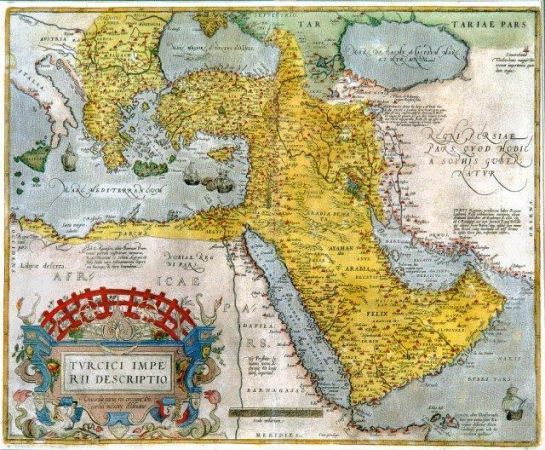
| 2010年8月29日 (日) 16:49 |  | 640 × 528(131 KB) | Strainu(留言 | 贡献) |
您不可以覆盖此文件。
文件用途
以下5个页面使用本文件:
全域文件用途
以下其他wiki使用此文件:
- ar.wikipedia.org上的用途
- azb.wikipedia.org上的用途
- az.wikipedia.org上的用途
- ca.wikipedia.org上的用途
- cs.wikipedia.org上的用途
- de.wikipedia.org上的用途
- el.wikipedia.org上的用途
- en.wikipedia.org上的用途
- es.wikipedia.org上的用途
- et.wikipedia.org上的用途
- fa.wikipedia.org上的用途
- fr.wikipedia.org上的用途
- he.wikipedia.org上的用途
- id.wikipedia.org上的用途
- it.wikipedia.org上的用途
- ja.wikipedia.org上的用途
- ms.wikipedia.org上的用途
- nl.wikipedia.org上的用途
- pt.wikipedia.org上的用途
- ru.wikipedia.org上的用途
- si.wikipedia.org上的用途
- sr.wikipedia.org上的用途
- tr.wikipedia.org上的用途
- www.wikidata.org上的用途
- zh.wikipedia.org上的用途
元数据
分类:
- 16th-century maps of the Black Sea
- National museum of maps and rare books, Bucharest
- Theatrum Orbis Terrarum
- 1570 maps of the Ottoman Empire
- 16th-century maps of the Caucasus
- 16th-century maps of the Near East
- Old maps showing the whole Near East
- 16th-century maps of the Caspian Sea
- 16th-century maps of Arabia