File:Africa de l'Oèst (fin sègle XVIII).png
Zur Navigation springen
Zur Suche springen

Größe dieser Vorschau: 800 × 397 Pixel. Weitere Auflösungen: 320 × 159 Pixel | 640 × 318 Pixel | 1.192 × 592 Pixel.
Originaldatei (1.192 × 592 Pixel, Dateigröße: 172 KB, MIME-Typ: image/png)
Bildtexte
Kurzbeschreibungen
Ergänze eine einzeilige Erklärung, was diese Datei darstellt.
Beschreibung[Bearbeiten]
.png&action=edit§ion=1)
| Beschreibung |
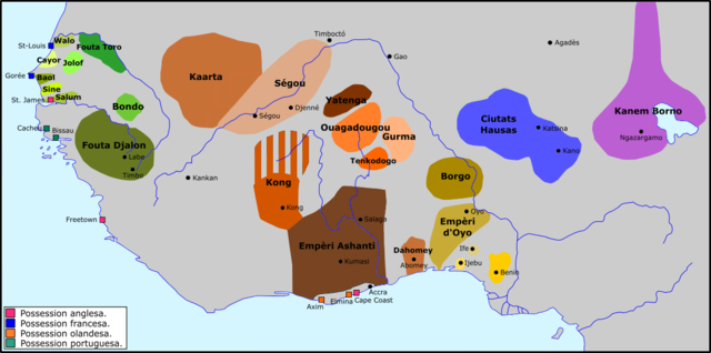
Occitan : Africa de l'Oèst a la fin dau sègle XVIII. |
| Datum | |
| Quelle | Eigenes Werk |
| Urheber | Nicolas Eynaud |
Lizenz[Bearbeiten]
.png&action=edit§ion=2)
Ich, der Urheber dieses Werkes, veröffentliche es unter der folgenden Lizenz:
Diese Datei ist lizenziert unter der Creative-Commons-Lizenz „Namensnennung – Weitergabe unter gleichen Bedingungen 4.0 international“.
- Dieses Werk darf von dir
- verbreitet werden – vervielfältigt, verbreitet und öffentlich zugänglich gemacht werden
- neu zusammengestellt werden – abgewandelt und bearbeitet werden
- Zu den folgenden Bedingungen:
- Namensnennung – Du musst angemessene Urheber- und Rechteangaben machen, einen Link zur Lizenz beifügen und angeben, ob Änderungen vorgenommen wurden. Diese Angaben dürfen in jeder angemessenen Art und Weise gemacht werden, allerdings nicht so, dass der Eindruck entsteht, der Lizenzgeber unterstütze gerade dich oder deine Nutzung besonders.
- Weitergabe unter gleichen Bedingungen – Wenn du das Material wiedermischst, transformierst oder darauf aufbaust, musst du deine Beiträge unter der gleichen oder einer kompatiblen Lizenz wie das Original verbreiten.
Dateiversionen
Klicke auf einen Zeitpunkt, um diese Version zu laden.
| Version vom | Vorschaubild | Maße | Benutzer | Kommentar | |
|---|---|---|---|---|---|
| aktuell | 12:47, 24. Dez. 2015 | | 1.192 × 592 (172 KB) | Nicolas Eynaud (Diskussion | Beiträge) | User created page with UploadWizard |
Du kannst diese Datei nicht überschreiben.
Dateiverwendung
Keine Seiten verwenden diese Datei.
Globale Dateiverwendung
Die nachfolgenden anderen Wikis verwenden diese Datei:
- Verwendung auf ar.wikipedia.org
- Verwendung auf de.wikipedia.org
- Verwendung auf en.wikipedia.org
- Verwendung auf es.wikipedia.org
- Verwendung auf fi.wikipedia.org
- Verwendung auf fr.wikipedia.org
- Verwendung auf it.wikipedia.org
- Verwendung auf oc.wikipedia.org
- Verwendung auf ru.wikipedia.org
- Verwendung auf sv.wikipedia.org
- Verwendung auf sw.wikipedia.org
- Verwendung auf uk.wikipedia.org
- Verwendung auf vi.wikipedia.org
Metadaten
.png&oldid=873545782)
Kategorien:
- Maps of the history of Mauritania
- Maps of the history of Senegal
- Maps of the history of the Gambia
- Maps of the history of Liberia
- Maps of the history of Guinea
- Maps of the history of Sierra Leone
- Maps of the history of Ghana
- Maps of the history of Togo
- Maps of the history of Benin
- Maps of the history of Nigeria
- Maps of the history of Chad
- Maps of the history of Niger
- Maps of the history of Burkina Faso
- Maps of the history of Ivory Coast
- Maps of 18th-century Africa
- Futa Tooro
- Kong Empire