File:Africa satellite plane (cropped-egypt).jpg
ナビゲーションに移動
検索に移動
このプレビューのサイズ: 666 × 600 ピクセル。 その他の解像度: 267 × 240 ピクセル | 533 × 480 ピクセル | 853 × 768 ピクセル | 1,137 × 1,024 ピクセル | 1,325 × 1,193 ピクセル。
元のファイル (1,325 × 1,193 ピクセル、ファイルサイズ: 240キロバイト、MIME タイプ: image/jpeg)
キャプション
キャプション
このファイルの内容を1行で記述してください
| 解説 |
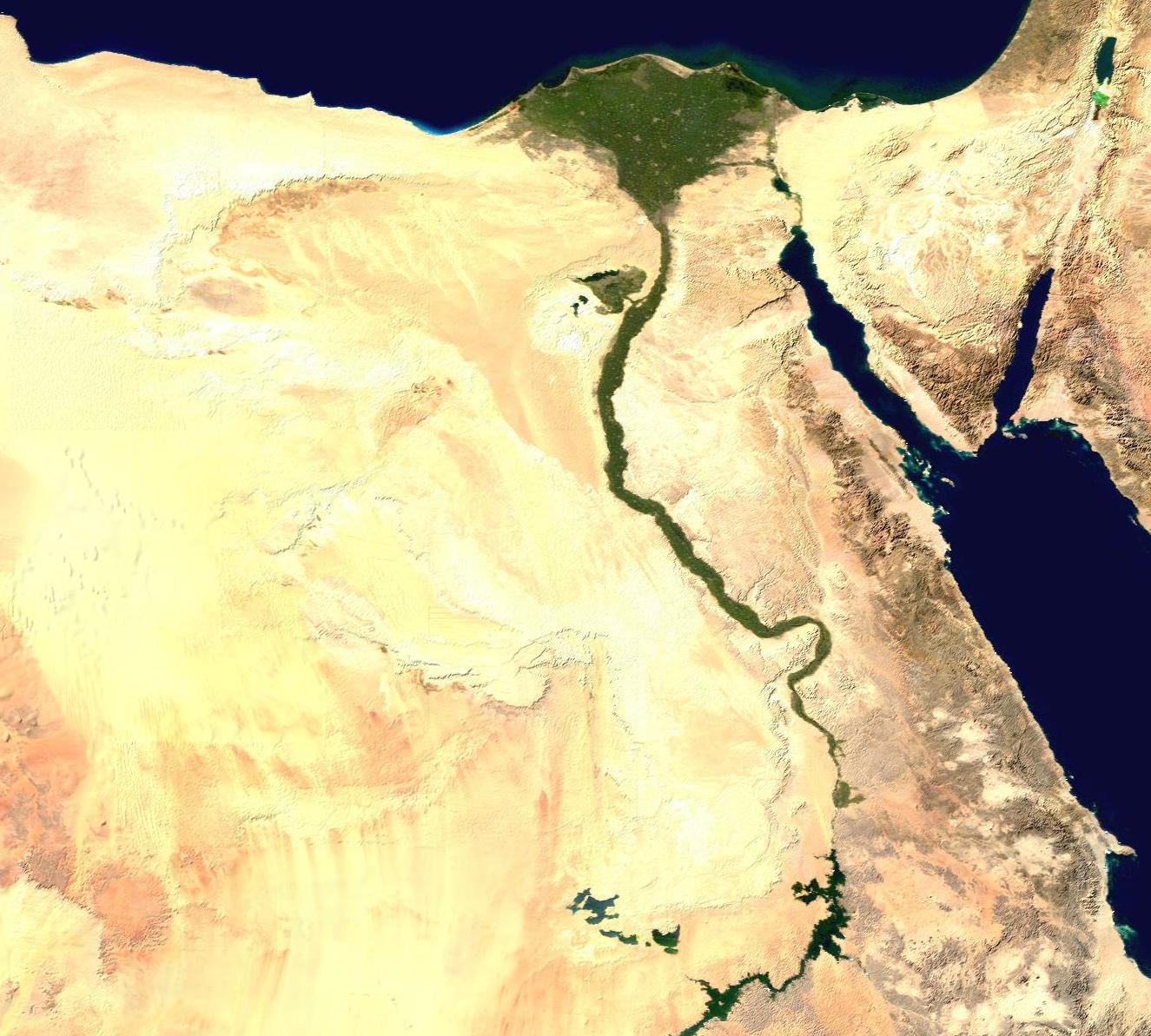
English: A composed satellite photograph of Africa. |
| 原典 |
The image is from [1] ("Blue Marble: Land Surface, Shallow Water, and Shaded Topography ", 2002). I took the two 21600x21600 images, land_shallow_topo_west.tif and land_shallow_topo_east.tif, and composed them. I cropped the resulting image at 8460x8900+19400+6200. Regarding the source data of the original, NASA-Blue Marble file, it is being exaplained [2] that it
|
| 作者 | NASA |
| その他のバージョン |
 |

| このファイルはアメリカ航空宇宙局(NASA)によって作成されたものです。NASAの著作権の方針では、特記事項が無い場合、NASAの資料はパブリックドメインとなります。 (詳しくはTemplate:PD-USGov、NASAの著作権の方針について(英語)又はジェット推進研究所(JPL)の画像使用に関するガイドライン(英語)をご覧ください。) |
||
 |
注意事項:
|
ファイルの履歴
過去の版のファイルを表示するには、その版の日時をクリックしてください。
| 日付と時刻 | サムネイル | 寸法 | 利用者 | コメント | |
|---|---|---|---|---|---|
| 現在の版 | 2021年8月1日 (日) 18:46 | | 1,325 × 1,193 (240キロバイト) | Ruwaym (トーク | 投稿記録) | File:Africa satellite plane.jpg cropped 84 % horizontally, 87 % vertically using CropTool with precise mode. |
このファイルは上書きできません。
ファイルの使用状況
以下のページがこのファイルを使用しています:
グローバルなファイル使用状況
以下に挙げる他のウィキがこの画像を使っています:
- ar.wikiquote.org での使用状況
.jpg&oldid=785938199)