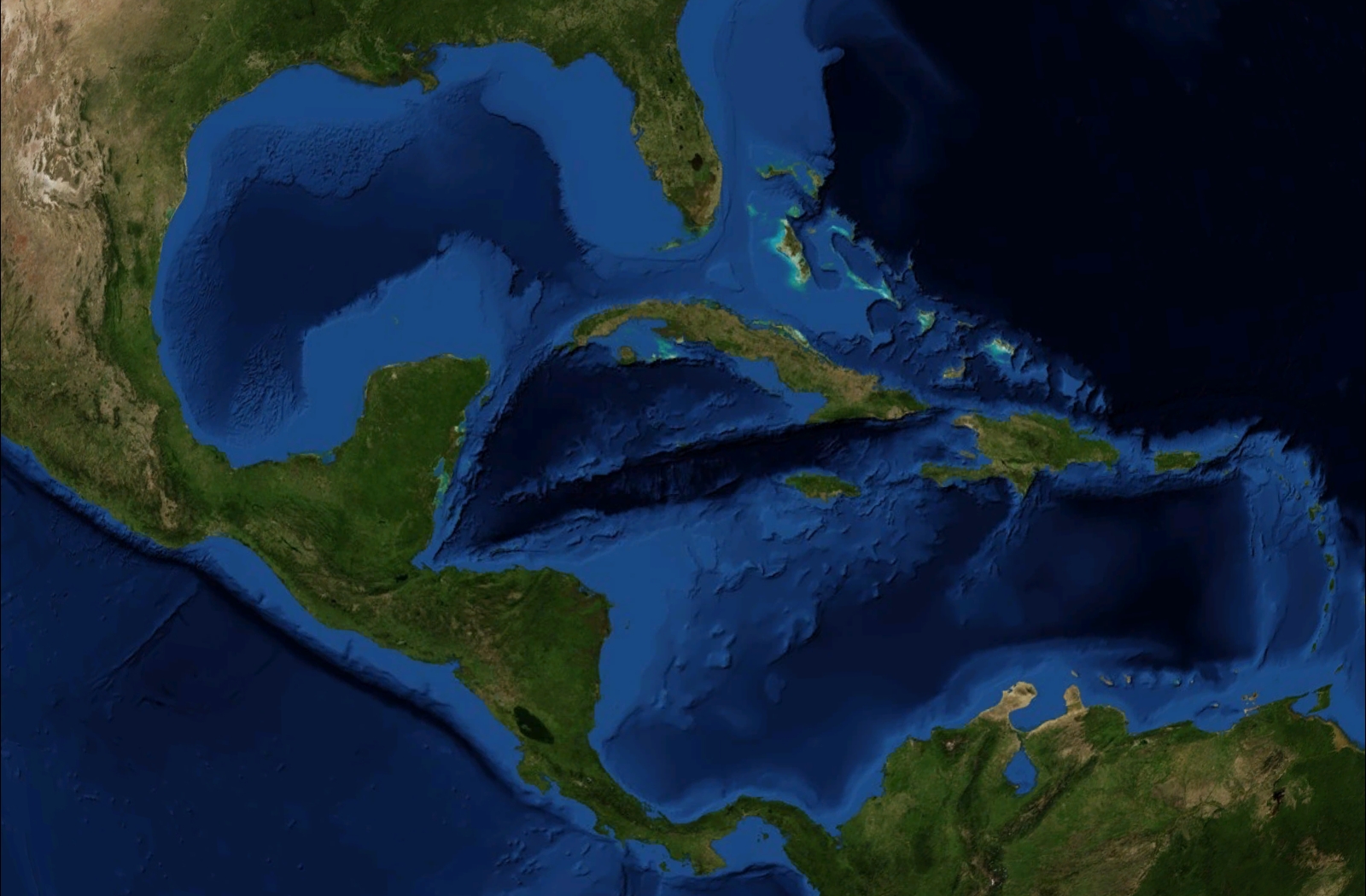
File:Amerikanisches Mittelmeer NASA World Wind Globe.jpg
Here nagîvasyonê
Here lêgerînê
Mezinahiya vê pêşdîtinê: 800 × 525 pîksel. Resolusyonên din: 320 × 210 pîksel | 640 × 420 pîksel | 1024 × 672 pîksel | 1280 × 840 pîksel | 1600 × 1050 pîksel.
Dosyeya orjînal (1600 × 1050 pixel, mezinbûnê data: 753 KB, MIME-typ: image/jpeg)
Captions
Captions
Add a one-line explanation of what this file represents
| Danasîn | Satellite pictures, from NASA World Wind Globe, version 1.4 |
| Dîrok | |
| Çavkanî | Min çêkir |
| Xwedî | ILA-boy |
| Destûr (Dîsa bikaranînê vê dosyeye) |
GNU General Public License |
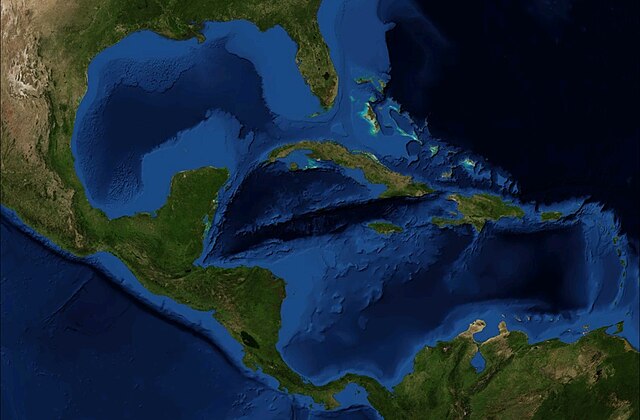
| Guhartoyên din | Derivative works of this file: Caribbean Sea labeled ru.jpg |
| This image is in the public domain because it is a screenshot from NASA’s globe software World Wind using a public domain layer, such as Blue Marble, MODIS, Landsat, SRTM, USGS or GLOBE.
|
 |
Dîroka daneyê
Ji bo dîtina guhartoya wê demê bişkoka dîrokê bitikîne.
| Dîrok/Katjimêr | Wêneyê biçûk | Mezinahî | Bikarhêner | Şirove | |
|---|---|---|---|---|---|
| niha | 16:30, 22 hezîran 2008 | | 1600 x 1050 (753 KB) | ILA-boy (gotûbêj | beşdarî) | {{Information |Description=Satellite pictures, from NASA World Wind Globe, version 1.4 |Source=own work |Date=June 2008 |Author=ILA-boy |Permission=GNU General Public License |other_versions= }} {{GPL}} Category:Satellite pictures |
Tu nikarî cardin li ser vê dosyeyê binivîsînî.
Bikaranîna pelê
Ev 10 rûpel li jêr vê dosyeyê bi kar tînin:
- Caribbean Sea
- User:ILA-boy/gallery
- File:Amerikanisches Mittelmeer NASA World Wind Globe .jpg (beralîkirina pelê)
- File:Serranilla Bank marked satellite map.png
- Category:Caribbean Sea
- Category:Gulfs of the Caribbean Sea
- Category:Olivella minuta
- Category:Shipwrecks in the Caribbean
- Category:Tributaries of the Caribbean Sea
Bikaranîna gerdûnî ya pelê
Ev wîkiyên di rêzê de vê pelê bi kar tînin:
- Bikaranîna di af.wikipedia.org de
- Bikaranîna di an.wikipedia.org de
- Bikaranîna di ar.wikipedia.org de
- Bikaranîna di ast.wikipedia.org de
- Bikaranîna di bm.wikipedia.org de
- Bikaranîna di cbk-zam.wikipedia.org de
- Bikaranîna di ceb.wikipedia.org de
- Bikaranîna di cs.wikipedia.org de
- Bikaranîna di diq.wikipedia.org de
- Bikaranîna di en.wikipedia.org de
- Bikaranîna di es.wikipedia.org de
- Bikaranîna di es.wikivoyage.org de
- Bikaranîna di fa.wikipedia.org de
- Bikaranîna di glk.wikipedia.org de
- Bikaranîna di gl.wikipedia.org de
- Bikaranîna di hr.wikipedia.org de
- Bikaranîna di id.wikipedia.org de
- Bikaranîna di it.wikipedia.org de
- Bikaranîna di ja.wikipedia.org de
- Bikaranîna di jv.wikipedia.org de
- Bikaranîna di kcg.wikipedia.org de
- Bikaranîna di ku.wikipedia.org de
- Bikaranîna di nds.wikipedia.org de
- Bikaranîna di no.wikipedia.org de
- Bikaranîna di os.wikipedia.org de
- Bikaranîna di pl.wikipedia.org de
- Bikaranîna di pt.wikipedia.org de
Zêdetir bikaranîna global a vê pelê bibîne.