File:Ardennen03.png
跳至導覽
跳至搜尋
預覽大小:716 × 600 像素。 其他解析度:287 × 240 像素 | 573 × 480 像素 | 917 × 768 像素 | 1,095 × 917 像素。
原始檔案 (1,095 × 917 像素,檔案大小:150 KB,MIME 類型:image/png)
說明
說明
添加單行說明來描述出檔案所代表的內容
| 描述 |
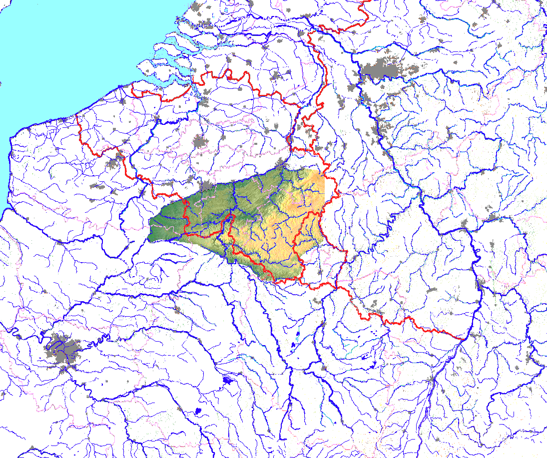
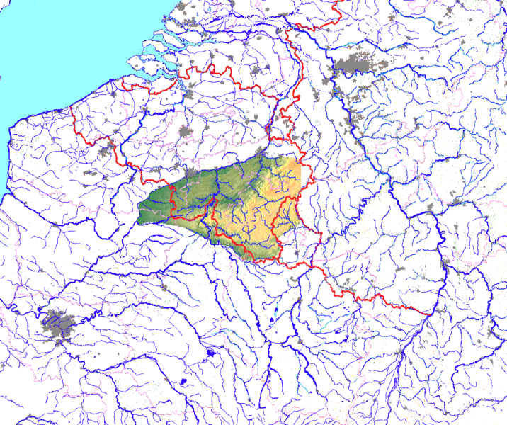
English: Location of Ardenne mountains, lecel coloured, in Belgium, France and Luxembourg
Deutsch: Lage der Ardennen, in Höhenschichtfarben, in Belgien, Frankreich und Luxemburg |
| 日期 | |
| 來源 | 自己的作品 and Google maps for free |
| 作者 | Ulamm |
| 授權許可 (重用此檔案) |
此檔案採用共享創意 姓名標示-相同方式分享 3.0 未在地化版本授權條款。
|
Die Flüsse sind per Hand nachgezogen. The rivers have been recountered by hand.
檔案歷史
點選日期/時間以檢視該時間的檔案版本。
| 日期/時間 | 縮圖 | 尺寸 | 用戶 | 備註 | |
|---|---|---|---|---|---|
| 目前 | 2010年11月16日 (二) 01:23 | | 1,095 × 917(150 KB) | Ulamm(對話 | 貢獻) | {{Information |Description={{en|1=Location of Ardenne mountains, lecel coloured, in Belgium, France and Luxembourg}} {{de|1=Lage der Ardennen, in Höhenschichtfarben, in Belgien, Frankreich und Luxemburg}} |Source={{own}} and Google maps for free |Author= |
無法覆蓋此檔案。
檔案用途
沒有使用此檔案的頁面。
全域檔案使用狀況
以下其他 wiki 使用了這個檔案:
- bg.wikipedia.org 的使用狀況
- ca.wikipedia.org 的使用狀況
- da.wikipedia.org 的使用狀況
- de.wikipedia.org 的使用狀況
- el.wiktionary.org 的使用狀況
- en.wikipedia.org 的使用狀況
- eu.wikipedia.org 的使用狀況
- fi.wikipedia.org 的使用狀況
- fr.wikipedia.org 的使用狀況
- he.wikipedia.org 的使用狀況
- lv.wikipedia.org 的使用狀況
- mk.wikipedia.org 的使用狀況
- ms.wikipedia.org 的使用狀況
- nl.wikipedia.org 的使用狀況
- no.wikipedia.org 的使用狀況
- pl.wiktionary.org 的使用狀況
- stq.wikipedia.org 的使用狀況
- www.wikidata.org 的使用狀況
- zh.wikipedia.org 的使用狀況