File:Arrondissement Brussels-Periphery Belgium Map.PNG
跳转到导航
跳转到搜索
没有更高的分辨率。
Arrondissement_Brussels-Periphery_Belgium_Map.PNG (270 × 203像素,文件大小:5 KB,MIME类型:image/png)
说明
说明
添加一行文字以描述该文件所表现的内容
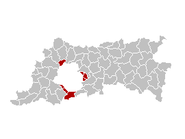
English: Map of the former Arrondissement of Brussels-Periphery in the Province of Flemish Brabant, Belgium.
Nederlands: Kaart van het voormalige arrondissement Brussel-Randgemeenten in de provincie Vlaams-Brabant.
Français : Carte indiquant la localisation de l'ancien arronddissement de Bruxelles-Périphérie dans la Province de Brabant-Flamand.
| 本作品已被作者Ganchelkas释出到公有领域。这适用于全世界。 在一些国家这可能不合法;如果是这样的话,那么: |
I changed the colors of this map, based on the work of w:nl:Gebruiker:LennartBolks/kaartenhoekje, which is also in the public domain.
文件历史
点击某个日期/时间查看对应时刻的文件。
| 日期/时间 | 缩略图 | 大小 | 用户 | 备注 | |
|---|---|---|---|---|---|
| 当前 | 2007年3月31日 (六) 13:45 | | 270 × 203(5 KB) | Ganchelkas~commonswiki(留言 | 贡献) | {{en|Map of the former Arrondissement of Brussels-Periphery in the Province of Flemish Brabant, Belgium.}} {{nl|Kaart van het voormalige arrondissement Brussel-Randgemeenten in de provincie Vlaams-Brabant.}} {{fr|Carte indiquant la localisation de l'ancie |
您不可以覆盖此文件。
文件用途
没有页面使用本文件。
全域文件用途
以下其他wiki使用此文件:
- ar.wikipedia.org上的用途
- ast.wikipedia.org上的用途
- ca.wikipedia.org上的用途
- de.wikipedia.org上的用途
- en.wikipedia.org上的用途
- es.wikipedia.org上的用途
- fr.wikipedia.org上的用途
- fr.wiktionary.org上的用途
- ko.wikipedia.org上的用途
- nl.wikipedia.org上的用途
- ro.wikipedia.org上的用途
- sco.wikipedia.org上的用途
- sl.wikipedia.org上的用途
- vi.wikipedia.org上的用途
- www.wikidata.org上的用途
- zh-yue.wikipedia.org上的用途
- zh.wikipedia.org上的用途