File:Asia-Pacific map1.png
跳至導覽
跳至搜尋

預覽大小:800 × 352 像素。 其他解析度:320 × 141 像素 | 640 × 282 像素 | 1,427 × 628 像素。
原始檔案 (1,427 × 628 像素,檔案大小:19 KB,MIME 類型:image/png)
說明
說明
添加單行說明來描述出檔案所代表的內容
Asia map
摘要
[編輯]
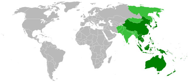
| 描述 | Map showing countries within the Asia-Pacific region. The definition of the region is fairly ambiguous. |
| 日期 | |
| 來源 | Image:BlankMap-World.png |
| 作者 | ASDFGH |
授權條款
[編輯]
| 我,此作品的版權所有人,釋出此作品至公共領域。此授權條款在全世界均適用。 這可能在某些國家不合法,如果是的話: 我授予任何人有權利使用此作品於任何用途,除受法律約束外,不受任何限制。 |
檔案歷史
點選日期/時間以檢視該時間的檔案版本。
| 日期/時間 | 縮圖 | 尺寸 | 用戶 | 備註 | |
|---|---|---|---|---|---|
| 目前 | 2022年7月19日 (二) 11:23 | | 1,427 × 628(19 KB) | Weaveravel(對話 | 貢獻) | As per Asia-Pacific eng article |
| 2008年11月10日 (一) 18:10 |  | 1,427 × 628(31 KB) | ASDFGHJ(對話 | 貢獻) | == Summary == {{Information |Description=Map showing countries within the Asia-Pacific region. The definition of the region is fairly ambiguous. |Source=Image:BlankMap-World.png |Date=10th November, 20 |
無法覆蓋此檔案。
檔案用途
沒有使用此檔案的頁面。
全域檔案使用狀況
以下其他 wiki 使用了這個檔案:
- cs.wikipedia.org 的使用狀況
- de.wikipedia.org 的使用狀況
- es.wikipedia.org 的使用狀況
- ja.wikipedia.org 的使用狀況
- ms.wikipedia.org 的使用狀況
- ps.wikipedia.org 的使用狀況
- tl.wikipedia.org 的使用狀況
- uk.wikipedia.org 的使用狀況
- wuu.wikipedia.org 的使用狀況
- zh-min-nan.wikipedia.org 的使用狀況
- zh.wikipedia.org 的使用狀況