File:Atlantic Ocean laea location map.svg
Zur Navigation springen
Zur Suche springen

Gröössi vor PNG-Vorschou vor SVG-Datei: 491 × 599 Pixel. Wyteri Ufflösige: 197 × 240 Pixel | 393 × 480 Pixel | 629 × 768 Pixel | 839 × 1.024 Pixel | 1.679 × 2.048 Pixel | 709 × 865 Pixel.
Originaldatei (SVG-Datei, Basisgrößi: 709 × 865 Pixel, Dateigrößi: 274 KB)
Bildtexte
Kurzbeschreibungen
Ergänze eine einzeilige Erklärung, was diese Datei darstellt.
Bschryybig
[ändere]
| Bschryybig |
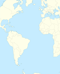
English: Relief location map of Atlantic_Ocean.
|
| Datum | |
| Quälle | Eigeni Arbet |
| Urheber | Tentotwo |
Shell script for generating the map using GMT archive copy at the Wayback Machine
[ändere]
#!/bin/sh

# Set common options
PROJECTION=A-35.0/0.0/180/19.998266666666666c
REGION=-147.58842045747764/-48.58942183011819/77.58842045747762/48.589421830118205r
FILENAME=Atlantic_Ocean_laea_location_map.ps

# Get Natural Earth datafiles
echo "Downloading datafiles from naturalearthdata.com"
wget -nv -nc \
 http://www.naturalearthdata.com/http//www.naturalearthdata.com/download/110m/physical/110m-coastline.zip\
 http://www.naturalearthdata.com/http//www.naturalearthdata.com/download/110m/physical/110m-land.zip\
 http://www.naturalearthdata.com/http//www.naturalearthdata.com/download/110m/cultural/110m-admin-0-boundary-lines.zip
echo "...done\n"

echo "Inflating archives"
unzip 110m\*.zip
echo "...done\n"

echo "Converting shapefiles to GMT"
ogr2ogr -F GMT 110m_land.gmt 110m_land.shp
ogr2ogr -F GMT 110m_coastline.gmt 110m_coastline.shp
ogr2ogr -F GMT 110m_borders.gmt ne_110m_admin_0_boundary_lines_land.shp
echo "...done\n"

echo "Creating maps"
GMT psxy -m -J$PROJECTION -R$REGION -Bg15 -P --PAGE_COLOR=198/236/255  --POLAR_CAP=none --BASEMAP_TYPE=plain --BASEMAP_AXES=NESW --FRAME_PEN=0.15p,black 110m_land.gmt -K -G254/254/233 > $FILENAME
GMT psxy -m -J$PROJECTION -R$REGION 110m_coastline.gmt -O -K -W0.535p,9/120/171  >> $FILENAME
GMT psxy -m -J$PROJECTION -R$REGION 110m_borders.gmt -O -W100/100/100  >> $FILENAME
echo "...done\n"

echo "You can now open $FILENAME in Inkscape to clean up the file and save it as SVG. You should add an ocean coloured background and simplify the graticules using CTRL+L."

gv $FILENAME
Lizänzierig
[ändere]
Ich haa s Urheberrächt an däm Wärch un vereffetlig s dodermit unter däre Lizänz:
Die Datei isch lizänziert unter dr Creative-Commons-Lizenz Namensnännig – Wytergab unter glyche Bedingige 3.0 nit portiert.
- Du derfsch:
- des Wärch an anderi wytergee – des Wärch kopiere, verbreite un ibertrage
- des Wärch verändere – des Wärch aapasse
- Unter däne Bedingige:
- Namenännig – Du muesch aagmässeni Aagabe zum Urheber un dr Rächt mache, e Link zue dr Lizänz zuefiege un aagee, eb Änderige gmacht wore sin. Die Aagabe chenne in ere aagmässene Art gmacht wäre, aber nit eso, ass dr Yydruck entstoht, ass dr Lizänzgeber Dii oder Dyy Gebruch vum Wärch unterstitze un guetheiße.
- Wytergab unter glyche Bedingige – Wänn du des Wärch veränderesch, umwandlesch oder druf ufböusch, no derfsch s Ergebnis nume unter dr glyche oder ere kumpatible Lizänz wie s Orginal vereffetlige.
Dateiversione
Klick uf e Zytpunkt zu aazeige, wie s dert usgsäh het.
| Version vom | Vorschaubild | Mäß | Benutzer | Kommentar | |
|---|---|---|---|---|---|
| aktuell | 21:19, 31. Jan. 2012 | | 709 × 865 (274 KB) | Tentotwo (Diskussion | Byträg) | Corrected colour of black sea |
| 21:17, 31. Jan. 2012 |  | 709 × 865 (298 KB) | Tentotwo (Diskussion | Byträg) | Included border of South Sudan | |
| 13:38, 31. Jan. 2012 |  | 709 × 865 (248 KB) | Tentotwo (Diskussion | Byträg) | Removed grid line | |
| 13:36, 31. Jan. 2012 |  | 709 × 865 (239 KB) | Tentotwo (Diskussion | Byträg) |
Du chasch die Datei nit iberschryybe.
Verwändig vu dr Datei
Die 3 Syte bruuche die Datei:
Wältwyti Dateinutzig
Die andere Wikis bruche die Datei:
- Gebruch uf af.wikipedia.org
- Gebruch uf als.wikipedia.org
- Gebruch uf ar.wikipedia.org
- Gebruch uf ast.wikipedia.org
- Gebruch uf azb.wikipedia.org
- Gebruch uf be-tarask.wikipedia.org
- Gebruch uf be.wikipedia.org
- Gebruch uf ceb.wikipedia.org
- Plantilya:Location map Atlantic Ocean
- South Point
- Scotts Hill
- Saddle Hill
- The Ridge
- Pillar Rock
- James Bay
- Castle Hill
- Bird Island
- North Point
- West Point
- Sandy Point
- Black Point
- Powell Point
- Black Rock
- Egg Island
- East Point
- White Rock
- White Point
- Whale Point
- Long Point
- The Bluff
- Middle Point
- Crown Point
- Channel Rock
- Cave Point
- Blue Hill
- South West Point
Wältwyti Verwändig vu däre Datei aaluege.