File:Atlantic Ocean laea location map.svg
跳去導覽
跳去搵嘢

呢個「SVG」檔案嘅呢個「PNG」預覽嘅大細:491 × 599 像素。 第啲解像度:197 × 240 像素 | 393 × 480 像素 | 629 × 768 像素 | 839 × 1,024 像素 | 1,679 × 2,048 像素 | 709 × 865 像素。
原本檔案 (SVG檔案,表面大細: 709 × 865 像素,檔案大細:274 KB)
Captions
Captions
Add a one-line explanation of what this file represents
摘要[編輯]
| 描述 |
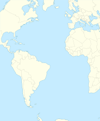
English: Relief location map of Atlantic_Ocean.
|
| 日期 | |
| 來源 | 自己作品 |
| 作者 | Tentotwo |
Shell script for generating the map using GMT archive copy at the Wayback Machine[編輯]
#!/bin/sh

# Set common options
PROJECTION=A-35.0/0.0/180/19.998266666666666c
REGION=-147.58842045747764/-48.58942183011819/77.58842045747762/48.589421830118205r
FILENAME=Atlantic_Ocean_laea_location_map.ps

# Get Natural Earth datafiles
echo "Downloading datafiles from naturalearthdata.com"
wget -nv -nc \
 http://www.naturalearthdata.com/http//www.naturalearthdata.com/download/110m/physical/110m-coastline.zip\
 http://www.naturalearthdata.com/http//www.naturalearthdata.com/download/110m/physical/110m-land.zip\
 http://www.naturalearthdata.com/http//www.naturalearthdata.com/download/110m/cultural/110m-admin-0-boundary-lines.zip
echo "...done\n"

echo "Inflating archives"
unzip 110m\*.zip
echo "...done\n"

echo "Converting shapefiles to GMT"
ogr2ogr -F GMT 110m_land.gmt 110m_land.shp
ogr2ogr -F GMT 110m_coastline.gmt 110m_coastline.shp
ogr2ogr -F GMT 110m_borders.gmt ne_110m_admin_0_boundary_lines_land.shp
echo "...done\n"

echo "Creating maps"
GMT psxy -m -J$PROJECTION -R$REGION -Bg15 -P --PAGE_COLOR=198/236/255  --POLAR_CAP=none --BASEMAP_TYPE=plain --BASEMAP_AXES=NESW --FRAME_PEN=0.15p,black 110m_land.gmt -K -G254/254/233 > $FILENAME
GMT psxy -m -J$PROJECTION -R$REGION 110m_coastline.gmt -O -K -W0.535p,9/120/171  >> $FILENAME
GMT psxy -m -J$PROJECTION -R$REGION 110m_borders.gmt -O -W100/100/100  >> $FILENAME
echo "...done\n"

echo "You can now open $FILENAME in Inkscape to clean up the file and save it as SVG. You should add an ocean coloured background and simplify the graticules using CTRL+L."

gv $FILENAME
協議[編輯]
我,呢份作品嘅作者,決定用以下許可發佈呢件作品:
呢個檔案用共享創意 姓名標示-非商業性-相同方式分享3.0 未本地化版本條款授權。
- 你可以:
- 去分享 – 複製、發佈同傳播呢個作品
- 再改 – 創作演繹作品
- 要遵照下面嘅條件:
- 署名 – 你一定要畀合適嘅表彰、畀返指向呢個授權條款嘅連結,同埋寫明有無改過嚟。你可以用任何合理方式去做,但唔可以用任何方式暗示授權人認可咗你或者你嘅使用方式。
- 相同方式分享 – 如果你用任何方式改過呢個作品,你必須要用返原本或者相似嘅條款發佈。
檔案歷史
撳個日期/時間去睇響嗰個時間出現過嘅檔案。
| 日期/時間 | 縮圖 | 尺寸 | 用戶 | 註解 | |
|---|---|---|---|---|---|
| 現時 | 2012年1月31號 (二) 21:19 | | 709 × 865(274 KB) | Tentotwo(傾偈 | 貢獻) | Corrected colour of black sea |
| 2012年1月31號 (二) 21:17 |  | 709 × 865(298 KB) | Tentotwo(傾偈 | 貢獻) | Included border of South Sudan | |
| 2012年1月31號 (二) 13:38 |  | 709 × 865(248 KB) | Tentotwo(傾偈 | 貢獻) | Removed grid line | |
| 2012年1月31號 (二) 13:36 |  | 709 × 865(239 KB) | Tentotwo(傾偈 | 貢獻) |
你無得衾咗個檔案。
檔案用途
以下嘅3版用到呢個檔:
全域檔案使用情況
下面嘅維基都用緊呢個檔案:
- af.wikipedia.org嘅使用情況
- als.wikipedia.org嘅使用情況
- ar.wikipedia.org嘅使用情況
- ast.wikipedia.org嘅使用情況
- azb.wikipedia.org嘅使用情況
- be-tarask.wikipedia.org嘅使用情況
- be.wikipedia.org嘅使用情況
- ceb.wikipedia.org嘅使用情況
- Plantilya:Location map Atlantic Ocean
- South Point
- Scotts Hill
- Saddle Hill
- The Ridge
- Pillar Rock
- James Bay
- Castle Hill
- Bird Island
- North Point
- West Point
- Sandy Point
- Black Point
- Powell Point
- Black Rock
- Egg Island
- East Point
- White Rock
- White Point
- Whale Point
- Long Point
- The Bluff
- Middle Point
- Crown Point
- Channel Rock
- Cave Point
- Blue Hill
- South West Point
- White Bluff
- Sandy Bay
- George Island
睇呢個檔案嘅更多全域使用情況。