File:Balkans-political-map-small.png
Here nagîvasyonê
Here lêgerînê
Versyonekî jê mezintir tune.
Balkans-political-map-small.png (507 × 488 pixel, mezinbûnê data: 12 KB, MIME-typ: image/png)
Captions
Captions
Add a one-line explanation of what this file represents
Danasîn[biguhêre]

|
This file requires updating. Please see the talk page for more information. In doing so, you could add a timestamp to the file.
|
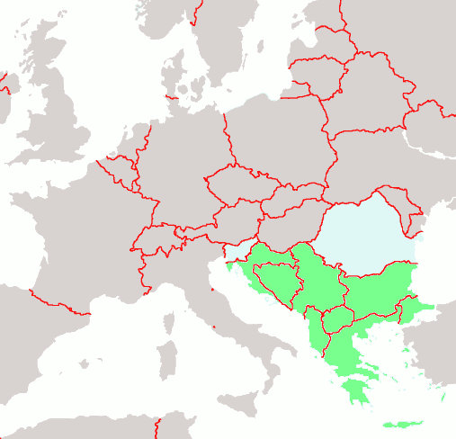
Political map of the Balkans
map of Europe by Brion VIBBER: the Balkans are highlighted in green
| I, the copyright holder of this work, release this work into the public domain. This applies worldwide. In some countries this may not be legally possible; if so: I grant anyone the right to use this work for any purpose, without any conditions, unless such conditions are required by law. |
Dîroka daneyê
Ji bo dîtina guhartoya wê demê bişkoka dîrokê bitikîne.
| Dîrok/Katjimêr | Wêneyê biçûk | Mezinahî | Bikarhêner | Şirove | |
|---|---|---|---|---|---|
| niha | 22:18, 29 çiriya paşîn 2004 | | 507 x 488 (12 KB) | Mschlindwein (gotûbêj | beşdarî) | Political map of the Balkans |
Tu nikarî cardin li ser vê dosyeyê binivîsînî.
Bikaranîna pelê
Rûpelekî ku ji vê dosyeyê bi kar tîne nîne.
Bikaranîna gerdûnî ya pelê
Ev wîkiyên di rêzê de vê pelê bi kar tînin:
- Bikaranîna di arz.wikipedia.org de
- Bikaranîna di as.wikipedia.org de
- Bikaranîna di bat-smg.wikipedia.org de
- Bikaranîna di bn.wikipedia.org de
- Bikaranîna di bs.wikipedia.org de
- Bikaranîna di ckb.wikipedia.org de
- Bikaranîna di cs.wikipedia.org de
- Bikaranîna di de.wikipedia.org de
- Bikaranîna di el.wikipedia.org de
- Bikaranîna di en.wikipedia.org de
- Bikaranîna di eo.wikipedia.org de
- Bikaranîna di it.wikipedia.org de
- Bikaranîna di ja.wikipedia.org de
- Bikaranîna di jv.wikipedia.org de
- Bikaranîna di ku.wiktionary.org de
- Bikaranîna di lad.wikipedia.org de
- Bikaranîna di li.wikipedia.org de
- Bikaranîna di lmo.wikipedia.org de
- Bikaranîna di lt.wikipedia.org de
- Bikaranîna di mzn.wikipedia.org de
- Bikaranîna di nl.wikipedia.org de
- Bikaranîna di oc.wikipedia.org de
- Bikaranîna di pl.wiktionary.org de
- Bikaranîna di sh.wikipedia.org de
- Bikaranîna di sr.wikinews.org de