File:Balkans 1265.jpg
Balkans_1265.jpg (600 × 422 piksel, fayl həcmi: 75 KB, MIME növü: image/jpeg)
Captions
Captions
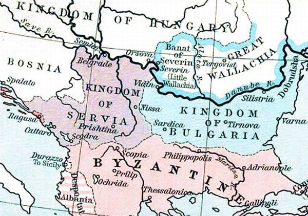
| İzah | States in the Balkans in the 13th century (1265). The Historical Atlas, William R. Shepherd, 1911. | ||||
| Tarix | (UTC) | ||||
| Mənbə | |||||
| Müəllif |
|
||||
| İcazə (Faylın təkrar istifadəsi) |
|
||||
| Digər versiyalar |
 |
||||
Orijinal yükləmə gündəliyi[redaktə]
This image is a derivative work of the following images:
- File:ShepherdByzempire1265.jpg licensed with PD-old
- 2009-07-12T16:26:21Z Alex:D 1144x900 (287421 Bytes) whitened
- 2009-07-12T16:17:18Z Alex:D 1144x900 (287421 Bytes) whitened
- 2009-07-12T16:12:47Z Alex:D 1144x900 (287421 Bytes) whitened
- 2004-12-21T13:40:55Z Mschlindwein 1144x900 (278685 Bytes) Map, The Byzantine Empire, 1265. The Historical Atlas, William R. Shepherd, 1911.
Uploaded with derivativeFX
Faylın tarixçəsi
Faylın əvvəlki versiyasını görmək üçün gün/tarix bölməsindəki tarixlərə klikləyin.
| Tarix/Vaxt | Kiçik şəkil | Ölçülər | İstifadəçi | Şərh | |
|---|---|---|---|---|---|
| indiki | 15:28, 16 noyabr 2022 | | 600 × 422 (75 KB) | Gyalu22 (müzakirə | töhfələr) | You can't redraw the atlas |
| 15:24, 20 may 2016 |  | 748 × 900 (614 KB) | Julieta39 (müzakirə | töhfələr) | Details : see discussion file | |
| 21:16, 27 yanvar 2010 |  | 600 × 422 (75 KB) | Mladifilozof (müzakirə | töhfələr) | {{Information |Description=States in the Balkans in the 13th century (1265). The Historical Atlas, William R. Shepherd, 1911. |Source=*File:ShepherdByzempire1265.jpg |Date=2010-01-27 21:14 (UTC) |Author=*File:ShepherdByzempire1265.jpg: William |
Siz bu faylı yenidən yükləyə bilməzsiniz.
Fayl keçidləri
Aşağıdakı 2 səhifə bu faylı istifadə edir:
Faylın qlobal istifadəsi
Bu fayl aşağıdakı vikilərdə istifadə olunur:
- be.wikipedia.org layihəsində istifadəsi
- bg.wikipedia.org layihəsində istifadəsi
- cs.wikipedia.org layihəsində istifadəsi
- de.wikipedia.org layihəsində istifadəsi
- el.wikipedia.org layihəsində istifadəsi
- en.wikipedia.org layihəsində istifadəsi
- et.wikipedia.org layihəsində istifadəsi
- fa.wikipedia.org layihəsində istifadəsi
- gl.wikipedia.org layihəsində istifadəsi
- he.wikipedia.org layihəsində istifadəsi
- hr.wikipedia.org layihəsində istifadəsi
- id.wikipedia.org layihəsində istifadəsi
- ja.wikipedia.org layihəsində istifadəsi
- ko.wikipedia.org layihəsində istifadəsi
- lt.wikipedia.org layihəsində istifadəsi
- mk.wikipedia.org layihəsində istifadəsi
- oc.wikipedia.org layihəsində istifadəsi
- ro.wikipedia.org layihəsində istifadəsi
- ru.wikipedia.org layihəsində istifadəsi
- sh.wikipedia.org layihəsində istifadəsi
- sl.wikipedia.org layihəsində istifadəsi
- sq.wikipedia.org layihəsində istifadəsi
- sr.wikipedia.org layihəsində istifadəsi
- sv.wikipedia.org layihəsində istifadəsi
- tr.wikipedia.org layihəsində istifadəsi
- zh.wikipedia.org layihəsində istifadəsi
- Maps showing history by William R. Shepherd
- Maps of the Byzantine empire in the 13th century
- Maps showing 1265
- Maps of the Kingdom of Serbia (medieval)
- Maps of 13th-century Bulgaria
- Maps of medieval Bosnian and neighboring states
- Maps of the history of Romania in the Middle Ages
- Romania in the 13th century
- Maps of Wallachia
- Maps of Zeta in the Kingdom of Serbia
- Details of old history maps