File:Baltimore osm-mapnik location map.png
Baltimore_osm-mapnik_location_map.png (490 × 475 pikseli, rozmiar pliku: 349 KB, typ MIME: image/png)
Podpisy
Podpisy
Opis[edytuj]
| Opis |
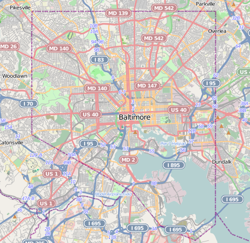
English: Map of Baltimore
Geographic limits of the map:
|
| Data | |
| Źródło | http://www.openstreetmap.org |
| Autor | OpenStreetMap contributors |
| Licencja (Ponowne użycie tego pliku) |
Cartography is licensed as CC-BY-SA (http://www.openstreetmap.org/copyright) |
Licencja[edytuj]
This work contains information from OpenStreetMap, which is made available under the Open Database License (ODbL). The ODbL does not require any particular license for maps produced from ODbL data. Prior to 1 August 2020, map tiles produced by the OpenStreetMap Foundation were licensed under the CC-BY-SA-2.0 license. Maps produced by other people may be subject to other licences. |
- Wolno:
- dzielić się – kopiować, rozpowszechniać, odtwarzać i wykonywać utwór
- modyfikować – tworzyć utwory zależne
- Na następujących warunkach:
- uznanie autorstwa – musisz określić autorstwo utworu, podać link do licencji, a także wskazać czy utwór został zmieniony. Możesz to zrobić w każdy rozsądny sposób, o ile nie będzie to sugerować, że licencjodawca popiera Ciebie lub Twoje użycie utworu.
- na tych samych warunkach – Jeśli zmienia się lub przekształca niniejszy utwór, lub tworzy inny na jego podstawie, można rozpowszechniać powstały w ten sposób nowy utwór tylko na podstawie tej samej lub podobnej licencji.
Historia pliku
Kliknij na odpowiedniej dacie/czasie, aby zobaczyć wersję pliku z tamtego okresu.
| Data/czas | Miniatura | Wymiary | Użytkownik | Opis | |
|---|---|---|---|---|---|
| aktualny | 21:29, 13 gru 2012 | | 490 × 475 (349 KB) | Alexrk2 (dyskusja | edycje) | {{Information |Description={{en|1=Map of Baltimore Geographic limits of the map: * N: 39.3805° * S: 39.1953° * W: -76.7426° * E: -76.4957° }} |Source=http://www.openstreetmap.org |Author=OpenStreetMap contributors |Date=2012-12 |Permission=Cart... |
Nie możesz nadpisać tego pliku.
Lokalne wykorzystanie pliku
Następujące strony korzystają z tego pliku:
- Baltimore, Maryland
- Category:2020 in Baltimore
- Category:Baltimore
- Category:Baltimore in the 1900s
- Category:Baltimore in the 1910s
- Category:Baltimore in the 1940s
- Category:Baltimore in the 1950s
- Category:Baltimore in the 1960s
- Category:Baltimore in the 1970s
- Category:Baltimore in the 1980s
- Category:Baltimore in the 1990s
- Category:Baltimore in the 2000s
- Category:Baltimore in the 2010s
- Category:Births in Baltimore
- Category:Bridges in Baltimore
- Category:Buildings in Baltimore
- Category:Cemeteries in Baltimore
- Category:Deaths in Baltimore
- Category:Education in Baltimore
- Category:Historic districts in Baltimore, Maryland
- Category:Hotels in Baltimore
- Category:Museums in Baltimore
- Category:National Register of Historic Places in Baltimore, Maryland
- Category:Neighborhoods in Baltimore, Maryland
- Category:Paintings in Baltimore
- Category:Parks in Baltimore
- Category:Politicians of Baltimore
- Category:Politics of Baltimore
- Category:Roads in Baltimore
- Category:Schools in Baltimore
- Category:Sports venues in Baltimore
- Category:Streets in Baltimore
- Category:Tunnels in Baltimore
- Category:Universities and colleges in Baltimore
Globalne wykorzystanie pliku
Ten plik jest wykorzystywany także w innych projektach wiki:
- Wykorzystanie na ar.wikipedia.org
- Wykorzystanie na arz.wikipedia.org
- Wykorzystanie na bh.wikipedia.org
- Wykorzystanie na ceb.wikipedia.org
- Wykorzystanie na en.wikipedia.org
- NS Savannah
- Oriole Park at Camden Yards
- M&T Bank Stadium
- SS John W. Brown
- USCGC Taney
- Inner Harbor
- USS Torsk
- United States lightship Chesapeake (LV-116)
- Fell's Point, Baltimore
- Westminster Hall and Burying Ground
- B&O Railroad Museum
- Locust Point, Baltimore
- Federal Hill, Baltimore
- Hampden, Baltimore
- Little Italy, Baltimore
- Congregation Tiferes Yisroel
- Canton, Baltimore
- Bolton Hill, Baltimore
- Phoenix Shot Tower
- Pigtown, Baltimore
- Lyric Performing Arts Center
- Peale Museum
- Armistead Gardens, Baltimore
- Mount Washington, Baltimore
- Curtis Bay, Baltimore
- Abell, Baltimore
- Template:Infobox hospital
- Baltimore Hebrew Congregation
- Reservoir Hill, Baltimore
- Upton, Baltimore
- Butchers Hill, Baltimore
- Washington Hill, Baltimore
- McElderry Park, Baltimore
- Carrollton Viaduct
- Cylburn Arboretum
- Loudon Park National Cemetery
- Jewish Museum of Maryland
- Greektown, Baltimore
- Highlandtown, Baltimore
- Brewers Hill, Baltimore
- Hamilton Hills, Baltimore
- Union Square, Baltimore
- Dickeyville Historic District
Pokaż listę globalnego wykorzystania tego pliku.