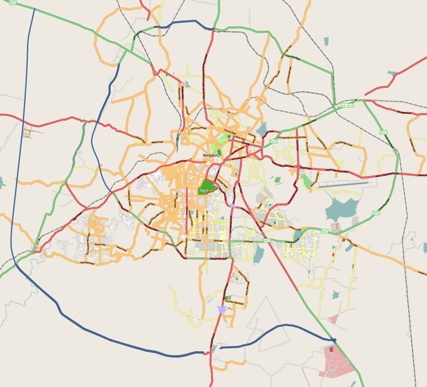
File:Bangalore street Map.png
Salta a la navegació
Salta a la cerca

Mida d'aquesta previsualització: 661 × 600 píxels. Altres resolucions: 264 × 240 píxels | 529 × 480 píxels | 846 × 768 píxels | 1.128 × 1.024 píxels | 1.722 × 1.563 píxels.
Fitxer original (1.722 × 1.563 píxels, mida del fitxer: 855 Ko, tipus MIME: image/png)
Llegendes
Llegendes
Afegeix una explicació d'una línia del que representa aquest fitxer
| Descripció | |
| Data |
31 de desembre de 2008 (original upload date) |
| Font | openstreetmap.org |
| Autor | Collaboratively created by the OpenStreetMap community using only free map sources and manual GPS surveying to build the map from scratch. Raise lkblr grabbed this image from OpenStreetMap |
| Permís (Com reutilitzar aquest fitxer) |
See OpenStreetMap License for details. |
| Altres versions | The 'live' version of this map is available at http://www.openstreetmap.org/?lat=12.9536&lon=77.598&zoom=13 Use the 'export' tab to get a fresh export in a variety of formats, including SVG and '.osm', the underlying geolocated data. Use the 'edit' tab there to edit the map! |
Resum
[modifica]
Latitudes from 77.46 to 77.72
Longitude from 12.83 to 13.06
Llicència
[modifica]
Aquest fitxer està disponible sota la llicència Creative Commons Reconeixement 2.0 Genèrica.
- Sou lliure de:
- compartir – copiar, distribuir i comunicar públicament l'obra
- adaptar – fer-ne obres derivades
- Amb les condicions següents:
- reconeixement – Heu de donar la informació adequada sobre l'autor, proporcionar un enllaç a la llicència i indicar si s'han realitzat canvis. Podeu fer-ho amb qualsevol mitjà raonable, però de cap manera no suggereixi que l'autor us dóna suport o aprova l'ús que en feu.
Registre original de càrregues
[modifica]
Transferred from en.wikipedia to Commons by Closedmouth.
La pàgina de descripció original era aquí. Els noms d'usuari a continuació es refereixen a en.wikipedia.
- 2008-12-31 03:39 Raise lkblr 1722×1563× (789839 bytes)
- 2008-12-30 08:49 Raise lkblr 1656×1019× (632450 bytes) updated
- 2008-12-30 08:34 Raise lkblr 1517×1520× (790374 bytes) from http://openstreetmap.org/
Historial del fitxer
Cliqueu una data/hora per veure el fitxer tal com era aleshores.
| Data/hora | Miniatura | Dimensions | Usuari/a | Comentari | |
|---|---|---|---|---|---|
| actual | 06:32, 20 jul 2012 | | 1.722 × 1.563 (855 Ko) | Wantsallanger (discussió | contribucions) | enhanced contrast |
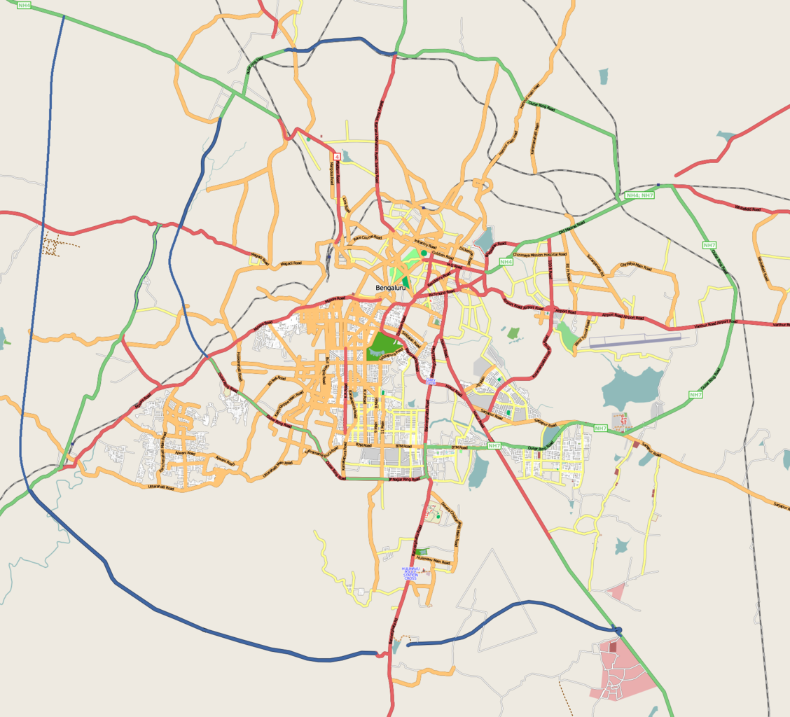
| 06:59, 4 març 2011 |  | 1.722 × 1.563 (861 Ko) | Raise lkblr (discussió | contribucions) | updated completed ring road | |
| 14:47, 24 març 2009 |  | 1.722 × 1.563 (771 Ko) | Closedmouth (discussió | contribucions) | {{Information |Description={{en|Map of en:Bangalore, India<br/> en:Category:OpenStreetMap maps}} |Source=Transferred from [http://en.wikipedia.org en.wikipedia]; transfer was stated to be made by User:Closedmouth.<br/> (Original text : ''[ht |
No podeu sobreescriure aquest fitxer.
Ús del fitxer
Les 16 pàgines següents utilitzen aquest fitxer:
- Bangalore - ಬೆಂಗಳೂರು
- User:DieBuche/resized3
- Category:Bangalore
- Category:Births in Bangalore
- Category:Deaths in Bangalore
- Category:Events in Bangalore
- Category:Hospitals in Bangalore
- Category:Maps of Bangalore
- Category:Palaces in Bangalore
- Category:Parks in Bangalore
- Category:People of Bangalore
- Category:Postcards of Bangalore
- Category:Rail transport in Bangalore
- Category:Railway stations in Bangalore
- Category:Roads in Bangalore
- Category:Visitor attractions in Bangalore
Ús global del fitxer
Utilització d'aquest fitxer en altres wikis:
- Utilització a af.wikipedia.org
- Utilització a ar.wikipedia.org
- Utilització a ba.wikipedia.org
- Utilització a bn.wikipedia.org
- বোম্মনাহাল্লি
- ইলেকট্রনিক সিটি
- মডিউল:অবস্থান মানচিত্র/উপাত্ত/ভারত বেঙ্গালুরু
- মডিউল:অবস্থান মানচিত্র/উপাত্ত/ভারত বেঙ্গালুরু/নথি
- বিধান সৌধ
- ডাঃ বি.আর. আম্বেদকর স্টেশন, বিধান সৌধ মেট্রো স্টেশন
- স্বামী বিবেকানন্দ রোড মেট্রো স্টেশন
- বাইয়াপ্পনহাল্লি মেট্রো স্টেশন
- ইন্দিরানগর মেট্রো স্টেশন
- হালাসুরু মেট্রো স্টেশন
- মহাত্মা গান্ধী রোড মেট্রো স্টেশন (বেঙ্গালুরু)
- কাবন পার্ক মেট্রো স্টেশন
- কেঙ্গেরি মেট্রো স্টেশন
- Utilització a ca.wikipedia.org
- Utilització a ceb.wikipedia.org
- Utilització a en.wikipedia.org
- Visvesvaraya Industrial and Technological Museum
- Vidhana Soudha
- Whitefield, Bangalore
- B.M.S. College of Engineering
- R.V. College of Engineering
- Jayanagar, Bangalore
- Lal Bagh
- Domlur
- Madiwala
- Basaveshwaranagara
- Koramangala
- Hebbal, Bangalore
- Indiranagar, Bangalore
- HSR Layout
- Begur, Bangalore
- Basavanagudi
- Sri Chamarajendra Udyanavana
- Ulsoor
- Hulimavu
- Shivajinagar, Bangalore
- Yelachenahalli
- Bommanahalli
- Gottigere
- Kengeri
- Konanakunte
- Krishnarajapuram
- Mahadevapura, Bangalore
- Uttarahalli
- Malleshwaram, Bengaluru
- Hoodi
- Arekere
- Gavi Gangadhareshwara Temple
Vegeu més usos globals d'aquest fitxer.