File:Bayou Teche and Atchafalaya River.jpg
Zur Navigation springen
Zur Suche springen
Größe dieser Vorschau: 399 × 599 Pixel. Weitere Auflösungen: 160 × 240 Pixel | 320 × 480 Pixel | 999 × 1.500 Pixel.
Originaldatei (999 × 1.500 Pixel, Dateigröße: 213 KB, MIME-Typ: image/jpeg)
Bildtexte
Kurzbeschreibungen
Ergänze eine einzeilige Erklärung, was diese Datei darstellt.
| Beschreibung |
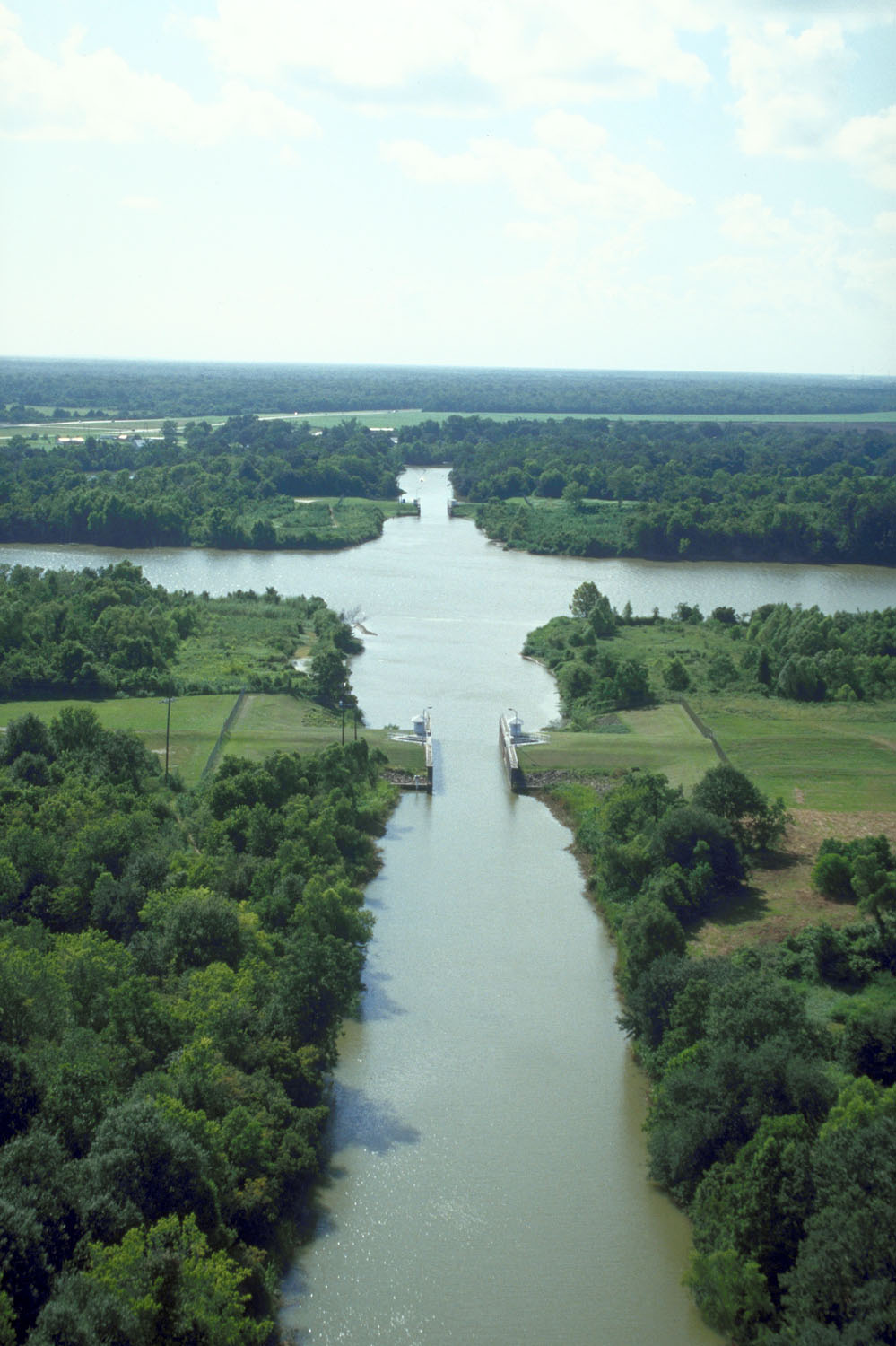
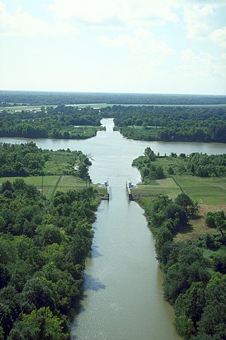
English: The intersection of Bayou Teche and the Wax Lake outlet of the Atachafalaya River near Patterson, Louisiana, USA. Bayou Teche runs straight up the center of the picture. The Wax Lake outlet of the Atchafalaya runs across left–right. The U.S. Army Corps of Engineers has built water control structures on the bayou where it intersects with the river. |
|||
| Datum | ||||
| Quelle |
U.S. Army Corps of Engineers Digital Visual Library Image page Image description page Digital Visual Library home page |
|||
| Urheber | Michael Maples, U.S. Army Corps of Engineers | |||
| Genehmigung (Weiternutzung dieser Datei) |
|
|||
| Ort | St. Mary Parish, Louisiana, USA |
| Kameraposition | | Dieses und weitere Bilder auf OpenStreetMap |
|---|
Dateiversionen
Klicke auf einen Zeitpunkt, um diese Version zu laden.
| Version vom | Vorschaubild | Maße | Benutzer | Kommentar | |
|---|---|---|---|---|---|
| aktuell | 19:57, 7. Apr. 2007 | | 999 × 1.500 (213 KB) | DanMS (Diskussion | Beiträge) | {{Information | Description = {{en|The intersection of Bayou Teche and the Wax Lake outlet of the Atachafalaya River near Patterson, Louisiana, USA. Bayou Teche runs straight up the center of the picture. The Wax Lake outlet of the Atchafalaya runs acr |
Du kannst diese Datei nicht überschreiben.
Dateiverwendung
Die folgende Seite verwendet diese Datei:
Globale Dateiverwendung
Die nachfolgenden anderen Wikis verwenden diese Datei:
- Verwendung auf ca.wikipedia.org
- Verwendung auf ceb.wikipedia.org
- Verwendung auf de.wikipedia.org
- Verwendung auf en.wikipedia.org
- Verwendung auf es.wikipedia.org
- Verwendung auf fa.wikipedia.org
- Verwendung auf fr.wikipedia.org
- Verwendung auf pt.wikipedia.org
- Verwendung auf www.wikidata.org