File:Benue Trough faults.svg
跳至導覽
跳至搜尋

此 SVG 檔案的 PNG 預覽的大小:411 × 308 像素。 其他解析度:320 × 240 像素 | 640 × 480 像素 | 1,024 × 767 像素 | 1,280 × 959 像素 | 2,560 × 1,918 像素。
原始檔案 (SVG 檔案,表面大小:411 × 308 像素,檔案大小:14 KB)
說明
說明
添加單行說明來描述出檔案所代表的內容
檔案歷史
點選日期/時間以檢視該時間的檔案版本。
| 日期/時間 | 縮圖 | 尺寸 | 用戶 | 備註 | |
|---|---|---|---|---|---|
| 目前 | 2011年1月30日 (日) 02:14 | | 411 × 308(14 KB) | Aymatth2(對話 | 貢獻) | Last try |
| 2011年1月30日 (日) 02:02 |  | 411 × 307(19 KB) | Aymatth2(對話 | 貢獻) | try again | |
| 2011年1月30日 (日) 02:00 |  | 225 × 176(15 KB) | Aymatth2(對話 | 貢獻) | try again | |
| 2011年1月30日 (日) 01:57 |  | 221 × 176(19 KB) | Aymatth2(對話 | 貢獻) | another shot | |
| 2011年1月30日 (日) 01:54 |  | 215 × 173(14 KB) | Aymatth2(對話 | 貢獻) | font fixes | |
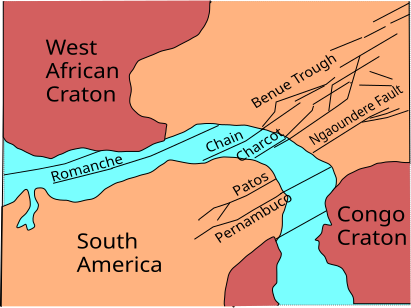
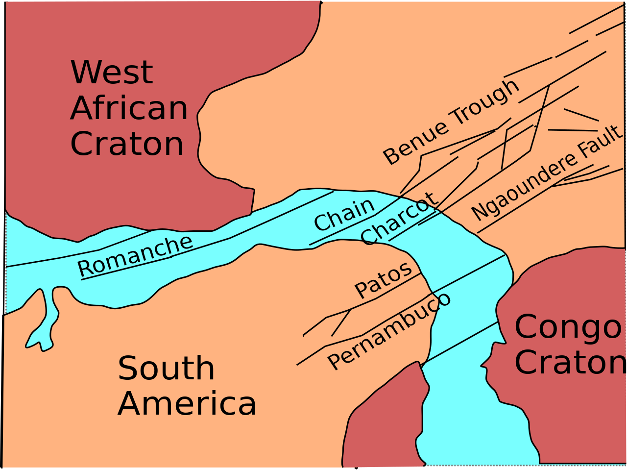
| 2011年1月30日 (日) 01:48 |  | 215 × 173(14 KB) | Aymatth2(對話 | 貢獻) | {{Information |Description ={{en|1=Sketch map of Benue Trough and Atlantic fracture zones}} |Source ={{own}} |Author =Aymatth2 |Date =2011-01-29 |Permission = |other_versions = }} [[Category:Geology of A |
無法覆蓋此檔案。
檔案用途
沒有使用此檔案的頁面。
全域檔案使用狀況
以下其他 wiki 使用了這個檔案:
- en.wikipedia.org 的使用狀況
- fr.wikipedia.org 的使用狀況
- zh.wikipedia.org 的使用狀況