File:Bethel Alaska aerial view.jpg
跳至導覽
跳至搜尋

預覽大小:641 × 599 像素。 其他解析度:257 × 240 像素 | 513 × 480 像素 | 821 × 768 像素 | 1,095 × 1,024 像素 | 1,493 × 1,396 像素。
原始檔案 (1,493 × 1,396 像素,檔案大小:843 KB,MIME 類型:image/jpeg)
說明
說明
添加單行說明來描述出檔案所代表的內容
摘要
[編輯]
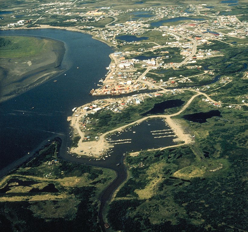
| 描述 | Aerial view of Bethel, Alaska. |
| 日期 | not specified or unknown |
| 來源 |
U.S. Army Corps of Engineers Digital Visual Library
|
| 作者 | U.S. Army Corps of Engineers, photographer not specified or unknown |
| 授權許可 (重用此檔案) |
Public Domain |
| 目標地點 | | 位於此地的本圖片與其他圖片: OpenStreetMap |
|---|
授權條款
[編輯]
This image or file is a work of a U.S. Army Corps of Engineers soldier or employee, taken or made as part of that person's official duties. As a work of the U.S. federal government, the image is in the public domain.
|
檔案歷史
點選日期/時間以檢視該時間的檔案版本。
| 日期/時間 | 縮圖 | 尺寸 | 使用者 | 備註 | |
|---|---|---|---|---|---|
| 目前 | 2017年6月10日 (六) 22:13 | | 1,493 × 1,396(843 KB) | Kingofthedead(留言 | 貢獻) | Cropped < 1 % horizontally using CropTool with precise mode. |
| 2007年3月20日 (二) 01:53 |  | 1,500 × 1,396(798 KB) | DanMS(留言 | 貢獻) | {{Information | Description = Aerial view of Bethel, Alaska. | Source = U.S. Army Corps of Engineers Digital Visual Library<br />[http://images.usace.army.mil/images/Hires/4414-21.Jpg Image page]<br />[http://images.usace.army.mil/scripts/PortW |
無法覆蓋此檔案。
檔案用途
下列3個頁面有用到此檔案:
全域檔案使用狀況
以下其他 wiki 使用了這個檔案:
- af.wikipedia.org 的使用狀況
- ar.wikipedia.org 的使用狀況
- arz.wikipedia.org 的使用狀況
- azb.wikipedia.org 的使用狀況
- az.wikipedia.org 的使用狀況
- ceb.wikipedia.org 的使用狀況
- de.wikipedia.org 的使用狀況
- en.wikipedia.org 的使用狀況
- en.wikivoyage.org 的使用狀況
- fa.wikipedia.org 的使用狀況
- fr.wikipedia.org 的使用狀況
- ga.wikipedia.org 的使用狀況
- he.wikipedia.org 的使用狀況
- incubator.wikimedia.org 的使用狀況
- io.wikipedia.org 的使用狀況
- it.wikipedia.org 的使用狀況
- ja.wikipedia.org 的使用狀況
- ko.wikipedia.org 的使用狀況
- mdf.wikipedia.org 的使用狀況
- ml.wikipedia.org 的使用狀況
- mrj.wikipedia.org 的使用狀況
- nl.wikipedia.org 的使用狀況
- pl.wikipedia.org 的使用狀況
- pt.wikipedia.org 的使用狀況
- ru.wikipedia.org 的使用狀況
- sd.wikipedia.org 的使用狀況
- sh.wikipedia.org 的使用狀況
- simple.wikipedia.org 的使用狀況
- sr.wikipedia.org 的使用狀況
- tly.wikipedia.org 的使用狀況
- tr.wikipedia.org 的使用狀況
- tum.wikipedia.org 的使用狀況
- uk.wikipedia.org 的使用狀況
- uz.wikipedia.org 的使用狀況
- vo.wikipedia.org 的使用狀況
- www.wikidata.org 的使用狀況
- zh-min-nan.wikipedia.org 的使用狀況
- zh.wikipedia.org 的使用狀況
- zh.wikivoyage.org 的使用狀況