File:Biscoe-Stub-Picture.png
跳至導覽
跳至搜尋

預覽大小:466 × 600 像素。 其他解析度:186 × 240 像素 | 617 × 794 像素。
原始檔案 (617 × 794 像素,檔案大小:1.4 MB,MIME 類型:image/png)
說明
說明
添加單行說明來描述出檔案所代表的內容
摘要
[編輯]
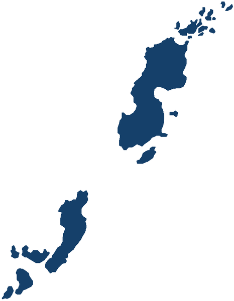
| 描述 | Image of Biscoe Islands in Antarctica. |
| 日期 | 06-11-2015 |
| 來源 | 自己的作品 |
| 作者 | Apcbg |
授權條款
[編輯]
我,本作品的著作權持有者,決定用以下授權條款發佈本作品:
| 此檔案在創用CC CC0 1.0 通用公有領域貢獻宣告之下分發。 | |
| 在此宣告之下分發本作品者,已依據各國著作權法,在全世界放棄其對本作品所擁有的著作權及所有相關相似的法律權利,從而將本作品貢獻至公有領域。您可以複製、修改、分發和演示該作品,用於任何商業用途,所有這些都不需要請求授權。
|
檔案歷史
點選日期/時間以檢視該時間的檔案版本。
| 日期/時間 | 縮圖 | 尺寸 | 用戶 | 備註 | |
|---|---|---|---|---|---|
| 目前 | 2017年4月27日 (四) 19:01 | | 617 × 794(1.4 MB) | Apcbg(對話 | 貢獻) | Update |
| 2017年4月27日 (四) 18:33 |  | 671 × 849(16 KB) | Apcbg(對話 | 貢獻) | Update | |
| 2015年11月7日 (六) 08:58 |  | 645 × 819(15 KB) | Apcbg(對話 | 貢獻) | resized | |
| 2015年11月6日 (五) 14:20 |  | 695 × 914(17 KB) | Apcbg(對話 | 貢獻) | {{Information |Description=Image of Biscoe Islands in Antarctica. |Source=own work |Date=06-11-2015 |Author=Apcbg |Permission= |other_versions= }} Category:Graham Land |
無法覆蓋此檔案。
檔案用途
下列2個頁面有用到此檔案:
全域檔案使用狀況
以下其他 wiki 使用了這個檔案:
- en.wikipedia.org 的使用狀況
- Biscoe Islands
- Renaud Island
- Rabot Island
- Lavoisier Island
- Watkins Island
- Pitt Islands
- Decazes Island
- Yaglou Point
- Zukriegel Island
- Irving Island
- Symington Islands
- Extension Reef
- Atwater Hill
- Adolph Islands
- Wittmann Island
- Woolpack Island
- Armstrong Reef
- Barcroft Islands
- Bardell Rock
- Bates Island
- Bazett Island
- Bedford Island
- Belding Island
- Benedict Point
- Bernal Islands
- Büdel Islands
- Burton Point
- Buzfuz Rock
- Clements Island
- Wiese Islands
- Nusser Island
- Nupkins Island
- Newburgh Point
- Wardle Entrance
- Weller Island
- Cornet Island
- Crystal Sound
- Johannessen Harbour
- Jinks Island
- Jingle Island
- Dennison Reef
- Krogh Island
- Kuno Point
- Mutton Cove, Biscoe Islands
- Dickens Rocks
- Tupman Island
- Guile Island
- Trivial Islands
- Trundle Island
- Pendleton Strait
檢視此檔案的更多全域使用狀況。