File:Blank-Map-Iran-With-Water-Bodies.PNG
Aller à la navigation
Aller à la recherche

Taille de cet aperçu : 652 × 600 pixels. Autres résolutions : 261 × 240 pixels | 522 × 480 pixels | 895 × 823 pixels.
Fichier d’origine (895 × 823 pixels, taille du fichier : 28 kio, type MIME : image/png)
Légendes
Légendes
Ajoutez en une ligne la description de ce que représente ce fichier
Description
[modifier]
| Description |
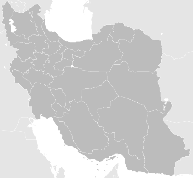
English: Blank Map of the territory claimed by Iran With Water Bodies and Neighbors فارسی: نقشه خالی ایران به همراه سرزمینهای آبی و کشورهای همسایه |
| Date | |
| Source | self-made adding water bodies and neighbors and applying some corrections and updates to a previous version Image:Blank-Map-Iran.PNG, which in turn was a corrected and updated version of Image:BlankMap-Iran.PNG created and uploaded by Shinas |
| Auteur | Siamax |
Conditions d’utilisation
[modifier]
| Cette œuvre a été placée dans le domaine public par son auteur, I, Siamax. Ceci s’applique dans le monde entier. Dans certains pays, ceci peut ne pas être possible ; dans ce cas : I, Siamax accorde à toute personne le droit d’utiliser cette œuvre dans n’importe quel but, sans aucune condition, sauf celles requises par la loi. |
Historique du fichier
Cliquer sur une date et heure pour voir le fichier tel qu'il était à ce moment-là.
| Date et heure | Vignette | Dimensions | Utilisateur | Commentaire | |
|---|---|---|---|---|---|
| actuel | 23 juin 2013 à 11:33 | | 895 × 823 (28 kio) | BasilLeaf (d | contributions) | بروزرسانی استانهای یزد و خراسان جنوبی |
| 12 novembre 2010 à 12:32 |  | 895 × 823 (43 kio) | M samadi (d | contributions) | Border of South & Razavi Khorasans updated. | |
| 18 octobre 2010 à 05:07 |  | 895 × 823 (46 kio) | Siamax (d | contributions) | Alborz province added | |
| 29 juillet 2007 à 22:01 |  | 895 × 823 (46 kio) | Siamax (d | contributions) | == Summary == {{Information |Description=Blank Map of Iran With Water Bodies and Neighbors |Source=self-made adding water bodies and neighbors and applying some corrections and updates to a previous version Image:Blank-Map-Iran.PNG, which in turn wa | |
| 29 juillet 2007 à 18:39 |  | 895 × 823 (46 kio) | Siamax (d | contributions) | {{Information |Description=Blank Map of Iran With Water Bodies and Neighbors |Source=self-made adding water bodies and neighbors and applying some corrections and updates to a previous version Image:Blank-Map-Iran.PNG, which in turn was a corrected |
Vous ne pouvez pas remplacer ce fichier.
Utilisations locales du fichier
La page suivante utilise ce fichier :
Utilisations du fichier sur d’autres wikis
Les autres wikis suivants utilisent ce fichier :
- Utilisation sur ar.wikipedia.org
- Utilisation sur av.wikipedia.org
- Utilisation sur ba.wikipedia.org
- Utilisation sur bn.wikipedia.org
- Utilisation sur ce.wikipedia.org
- Utilisation sur ckb.wikipedia.org
- Utilisation sur diq.wikipedia.org
- Utilisation sur el.wikipedia.org
- Utilisation sur en.wikipedia.org
- Iran
- Law Enforcement Command of the Islamic Republic of Iran
- User:Siamax
- Template:Provinces of Iran Labelled Map
- User:Jonny-mt/Gallery of current first-level administrative country subdivisions maps
- Outline of Iran
- Administrative divisions of Iran
- Talk:Iran/Archive 11
- List of cities in Iran by province
- User:Reza1615/pdf2
- Borders of Iran
- User:Falcaorib/Mediterranean Basin, Near East and Middle East
- Utilisation sur eu.wikipedia.org
- Utilisation sur fa.wikipedia.org
- Utilisation sur fi.wikipedia.org
- Utilisation sur hi.wikipedia.org
- Utilisation sur hr.wikipedia.org
- Utilisation sur hu.wiktionary.org
- Utilisation sur id.wikipedia.org
- Utilisation sur is.wikipedia.org
Voir davantage sur l’utilisation globale de ce fichier.