File:BlankEurope.png
Sautar la navigacion
Sautar la recèrca

Talha d'aquesta previsualizacion: 595 × 599 pixèls. Autras resolucions : 238 × 240 pixèls | 477 × 480 pixèls | 762 × 768 pixèls | 1 236 × 1 245 pixèls.
Fichièr d'origina (1 236 × 1 245 pixèl, talha del fichièr: 78 Ko, tipe MIME: image/png)
Llegendes
Llegendes
Afegeix una explicació d'una línia del que representa aquest fitxer

|
Una version vectoriala d'aqueste imatge existís, dins lo format "SVG".
Deuriá èsser utilizada a la plaça de la presenta version per d'afichatges en dimensions mai grandas o que necessitan una resolucion melhora. File:BlankEurope.png → File:Blank map of Europe (with disputed regions).svg
Per mai d'entresenhas suls imatges vectorials, consultatz la pagina de transicion de Commons cap al format SVG. Vejatz tanben las entresenhas a prepaus del biais que lo logicial MediaWiki supòrta los imatges al format SVG. |
.svg) |
Descripcion
[modificar]
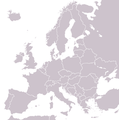
A blank political map of Europe extracted from Image:European Union member states by number of houses.png. +Hexagon1 (t) 04:47, 26 November 2006 (UTC)
Other versions: if you wish to use a map to show historical information before 2008, use Image:BlankEurope-BeforeKosovo.png
Publicat jos licéncia(s)
[modificar]

|
Avètz la permission de copiar, distribuir e modificar aqueste document segon los tèrmes de la Licéncia de documentacion liura GNU, version 1.2 o mai recenta publicada per la Free Software Foundation; sens seccions inalterablas, sens tèxte de primièra pagina de tempa e sens tèxte de darrièra pagina de tempa. Un exemplar de la licéncia es inclús dins la seccion intitulada GNU Free Documentation License. |
| Aqueste fichièr es jos licéncia Creative Commons licéncia generica atribucion-partiment a l'identic 3.0 | ||
| ||
| Aquest avís de llicència s'ha afegit a aquest fitxer d'acord amb l'actualització de la llicència GFDL. |
Istoric del fichièr
Clicar sus una data e una ora per veire lo fichièr tal coma èra a aqueste moment
| Data e ora | Miniatura | Dimensions | Utilizaire | Comentari | |
|---|---|---|---|---|---|
| actual | 26 setembre de 2022 a 13.31 | | 1 236 × 1 245 (78 Ko) | BlackShadowG (discussion | contribucions) | Reverted to version as of 14:55, 27 October 2008 (UTC) |
| 23 febrièr de 2009 a 22.40 |  | 1 236 × 1 245 (78 Ko) | Avala (discussion | contribucions) | ||
| 27 octobre de 2008 a 14.55 |  | 1 236 × 1 245 (78 Ko) | Quilbert (discussion | contribucions) | Reverted to version as of 05:53, 5 April 2008 – there is already Image:BlankEurope-BeforeKosovo.png | |
| 24 octobre de 2008 a 18.13 |  | 1 236 × 1 245 (78 Ko) | Avala (discussion | contribucions) | ||
| 5 abril de 2008 a 05.53 |  | 1 236 × 1 245 (78 Ko) | Hoshie (discussion | contribucions) | redid microstates, beefed up Spanish N. Africa, SBAs, and Gibraltar | |
| 25 febrièr de 2008 a 18.42 |  | 1 236 × 1 245 (78 Ko) | Hoshie (discussion | contribucions) | fixed Gibraltar, Ceuta and Melilla, and the SBAs | |
| 24 febrièr de 2008 a 02.39 |  | 1 236 × 1 245 (78 Ko) | Hoshie (discussion | contribucions) | Added Kosovo since it has been internationally recognized | |
| 3 genièr de 2008 a 22.40 |  | 1 236 × 1 245 (78 Ko) | Hoshie (discussion | contribucions) | Re-drew ESBA and WSBA with circles until I study the CIA maps, boundary between Gibraltar and Spain. | |
| 26 novembre de 2006 a 04.47 |  | 1 236 × 1 245 (44 Ko) | Happenstance (discussion | contribucions) | A blank map of Europe extracted from Image:European Union member states by number of houses.png. ~~~~ |
Podètz pas remplaçar aqueste fichièr.
Paginas que contenon lo fichièr
Las paginas çaijós compòrtan aqueste imatge :
Usatge global del fichièr
Los autres wikis seguents utilizan aqueste imatge :
- Utilizacion sus de.wiktionary.org
- Utilizacion sus hu.wikipedia.org
- Utilizacion sus incubator.wikimedia.org
- Utilizacion sus it.wiktionary.org
- Utilizacion sus sl.wiktionary.org
- Utilizacion sus uk.wikipedia.org