File:BlankMap-World-1993.png

Fitxer original (1.500 × 740 píxels, mida del fitxer: 90 Ko, tipus MIME: image/png)
Llegendes
Llegendes

|
Aquesta imatge (de tipus locator map) s'hauria de tornar a crear utilitzant gràfics vectorials com ara un fitxer SVG. Això té diversos avantatges; en trobareu més informació a Commons:Media for cleanup. Si ja disposeu d'una versió d'aquesta imatge en format SVG, us preguem que la pengeu; després, reemplaceu aquesta plantilla amb la plantilla {{Vector version available|nom nou de la imatge.svg}} en aquesta imatge.
|
Resum[modifica]
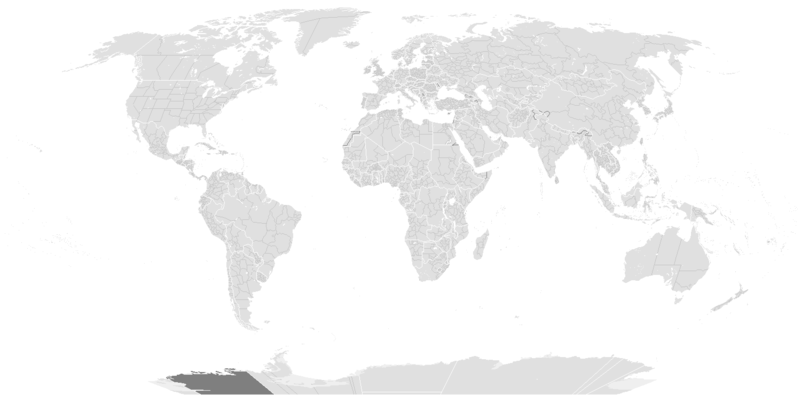
Blank map of the world between January 1, 1993 (Czechoslovakia splits into Czech Republic and Slovakia) and May 24, 1993 (Eritrea breaks off from Ethiopia).
Previous map currently available (there are missing steps, see here): Image:BlankMap-World-1990.png Next map: Image:BlankMap-World-2000.png
| Blank maps of the world for historical use | |
| pre-1800 | |
|
19th century | |
|
20th century | |
|
1902 · 1912 · 1914 · WWI · Aug 1918 · 1920 · 1921 · 1924 · 1926 · 1935 · 1937 · Mar 1938 · Oct 1938 · Mar 1939 · Oct 1939 · WWII · Nov 1942 · May 1945 · 1957 · 1959 · 1962 · 1968 · 1970 · 1985 · 1990 · 1993 | |
|
21st century | |
| (this template: · view · discuss ) | |
.PNG)
Llicència[modifica]

|
S'autoritza la còpia, la distribució i la modificació d'aquest document sota els termes de la llicència de documentació lliure GNU versió 1.2 o qualsevol altra versió posterior que publiqui la Free Software Foundation; sense seccions invariants, ni textos de portada, ni textos de contraportada. S'inclou una còpia d'aquesta llicència en la secció titulada GNU Free Documentation License. |
| Aquest fitxer està subjecte a la llicència de Creative Commons Reconeixement i Compartir Igual 3.0 No adaptada. | ||
| ||
| Aquest avís de llicència s'ha afegit a aquest fitxer d'acord amb l'actualització de la llicència GFDL. |
Historial del fitxer
Cliqueu una data/hora per veure el fitxer tal com era aleshores.
| Data/hora | Miniatura | Dimensions | Usuari/a | Comentari | |
|---|---|---|---|---|---|
| actual | 09:36, 14 set 2019 | | 1.500 × 740 (90 Ko) | AKS471883 (discussió | contribucions) | Chongqing was separated from Sichuan in 1997, North Kalimantan was separated from East Kalimantan in 2012. |
| 11:08, 10 oct 2017 |  | 1.500 × 740 (104 Ko) | Expertseeker90 (discussió | contribucions) | Substantial overhall. | |
| 21:30, 15 maig 2015 |  | 1.425 × 625 (18 Ko) | RokerHRO (discussió | contribucions) | optipng -o7 -i0 → 42.16% decrease | |
| 17:30, 10 març 2010 |  | 1.425 × 625 (30 Ko) | SeNeKa~commonswiki (discussió | contribucions) | Updated | |
| 13:16, 13 juny 2009 |  | 1.427 × 628 (50 Ko) | Hoshie (discussió | contribucions) | Added a pixel around Timor island, fixed Cabinda (Angola), fixed the border of Yemen and Saudi Arabia to where it was before the 2000 treaty based on this 1976 map [http://www.lib.utexas.edu/maps/middle_east_and_asia/middle_east_pol_1976.jpg http://www.li | |
| 03:06, 24 set 2007 |  | 1.427 × 628 (50 Ko) | Hoshie (discussió | contribucions) | put the (N/S) Yemen boundary in white due to the fact the boundaries in southern Saudi Arabia have been disputed, undemarcated, or undisclosed over the years. fixed Yugoslavia. See talk | |
| 10:56, 24 gen 2007 |  | 1.427 × 628 (50 Ko) | Hoshie (discussió | contribucions) | The Yemen boundry with Saudi Arabia did not exist until 2000 | |
| 00:37, 22 des 2006 |  | 1.427 × 628 (50 Ko) | Roke~commonswiki (discussió | contribucions) | Blank map of the world between January 1, 1993 (Czechoslovakia splits into Czech Republic and Slovakia) and May 24, 1993 (Eritrea breaks off from Ethiopia). Next map: Image:BlankMap-World-2000.png Category:Historical blank world maps |
No podeu sobreescriure aquest fitxer.
Ús del fitxer
No hi ha pàgines que utilitzin aquest fitxer.
Ús global del fitxer
Utilització d'aquest fitxer en altres wikis:
- Utilització a ca.wikipedia.org
- Utilització a en.wikipedia.org
- Utilització a fr.wikipedia.org