File:Brazil State Pernambuco.svg
跳至導覽
跳至搜尋

此 SVG 檔案的 PNG 預覽的大小:613 × 600 像素。 其他解析度:245 × 240 像素 | 490 × 480 像素 | 785 × 768 像素 | 1,046 × 1,024 像素 | 2,093 × 2,048 像素 | 702 × 687 像素。
原始檔案 (SVG 檔案,表面大小:702 × 687 像素,檔案大小:676 KB)
說明
說明
添加單行說明來描述出檔案所代表的內容

|
Standardization of derivative maps
Feel free to create derivations of this work, but if you want to illustrate a Wikipedia article with derivative works of this or similar maps of Brazil, please strictly follow the visual standard, nomenclature and classification already in use. All maps of Brazilian subdivisions are being adaptated or created in this way. We do not want to inhibit creativity but the pattern adopted here was presented and accepted by the Lusophone community and should be followed whenever possible. |
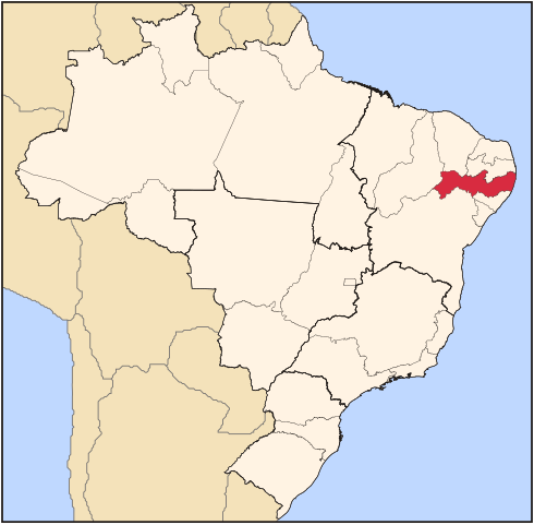
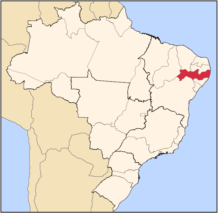
| 描述 | Map locator of Brazil's Pernambuco state | ||||||||
| 日期 | |||||||||
| 來源 | 自己的作品 | ||||||||
| 作者 | Raphael Lorenzeto de Abreu | ||||||||
| 授權許可 (重用此檔案) |
我,本作品的著作權持有者,決定用以下授權條款發佈本作品:
此檔案採用創用CC 姓名標示 2.5 通用版授權條款。
您可以選擇您需要的授權條款。 |

檔案歷史
點選日期/時間以檢視該時間的檔案版本。
| 日期/時間 | 縮圖 | 尺寸 | 用戶 | 備註 | |
|---|---|---|---|---|---|
| 目前 | 2006年6月3日 (六) 02:58 | | 702 × 687(676 KB) | Raphael.lorenzeto(對話 | 貢獻) | |
| 2006年6月3日 (六) 02:44 |  | 702 × 687(676 KB) | Raphael.lorenzeto(對話 | 貢獻) | ||
| 2006年4月22日 (六) 03:16 |  | 702 × 687(448 KB) | Raphael.lorenzeto(對話 | 貢獻) | {{Information| |Description=Map locator of Brazil's Pernambuco state |Source=own work |Date=April, 21 2006 |Author=Raphael Lorenzeto de Abreu |Permission={{self2|GFDL|cc-by-2.5}} |other_versions= }} Category:Maps of Brazil |
無法覆蓋此檔案。
檔案用途
下列4個頁面有用到此檔案:
全域檔案使用狀況
以下其他 wiki 使用了這個檔案:
- af.wikipedia.org 的使用狀況
- an.wikipedia.org 的使用狀況
- ar.wikipedia.org 的使用狀況
- arz.wikipedia.org 的使用狀況
- be-tarask.wikipedia.org 的使用狀況
- bg.wikipedia.org 的使用狀況
- bpy.wikipedia.org 的使用狀況
- ceb.wikipedia.org 的使用狀況
- da.wikipedia.org 的使用狀況
- de.wikipedia.org 的使用狀況
- en.wikipedia.org 的使用狀況
- Recife
- Pernambuco
- Ilha de Itamaracá
- Olinda
- Paulista
- Fernando de Noronha
- Caruaru
- Camaragibe
- Salgueiro
- Bezerros
- Flores, Pernambuco
- Lajedo, Pernambuco
- Arcoverde
- São Bento do Una
- Goiana
- Nazaré da Mata
- Carpina
- Lagoa dos Gatos
- São Vicente Ferrer, Pernambuco
- Petrolina
- Garanhuns
- Igarassu, Pernambuco
- Serra Talhada
- Cabrobó
- Pesqueira, Pernambuco
- Cabo de Santo Agostinho
- Tamandaré
- Jaboatão dos Guararapes
- Abreu e Lima, Pernambuco
- Gravatá
檢視此檔案的更多全域使用狀況。