File:Britain and Ireland satellite image bright.png
跳转到导航
跳转到搜索

本预览的尺寸:522 × 600像素。 其他分辨率:209 × 240像素 | 418 × 480像素 | 668 × 768像素 | 1,024 × 1,177像素。
原始文件 (1,024 × 1,177像素,文件大小:2.21 MB,MIME类型:image/png)
说明
说明
添加一行文字以描述该文件所表现的内容
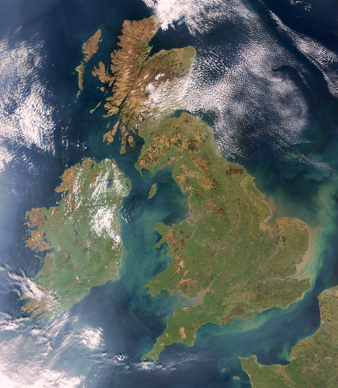
Satellite view of western European archipelago
摘要
[编辑]
Brightened version of Image:United_Kingdom_satellite_image.png. Enhancement performed with w:en:the GIMP.
许可协议
[编辑]
| 本文件完全由NASA创作,在美国属于公有领域。根据NASA的版权方针,NASA的材料除非另有声明否则不受版权保护。(参见Template:PD-USGov/zh、NASA版权方针页面或JPL图片使用方针。) | ||
 |
警告:
|
文件历史
点击某个日期/时间查看对应时刻的文件。
| 日期/时间 | 缩略图 | 大小 | 用户 | 备注 | |
|---|---|---|---|---|---|
| 当前 | 2009年4月7日 (二) 19:32 | | 1,024 × 1,177(2.21 MB) | HighKing(留言 | 贡献) | Used original NASA source instead of version that had political border drawn in |
| 2009年4月5日 (日) 18:24 |  | 917 × 1,124(1.15 MB) | HighKing(留言 | 贡献) | Cropped a little finer | |
| 2009年4月5日 (日) 18:06 |  | 934 × 1,284(1.87 MB) | HighKing(留言 | 贡献) | {{Information |Description={{en|1=Brightened and correctly renamed version of Image:United_Kingdom_satellite_image.png. Enhancement performed with w:en:the GIMP.}} |Source=NASA |Author=NASA |Date= |Permission= |other_versions= }} <!--{{ImageUplo |
您不可以覆盖此文件。
文件用途
没有页面使用本文件。
全域文件用途
以下其他wiki使用此文件:
- en.wikipedia.org上的用途
- User:Bduke
- Wikipedia:Userboxes/Location/Europe
- Names of the British Isles
- User:CsikosLo
- User:MariAdkins
- User:Tk420
- British nationalism
- User talk:HighKing/BritishIsles
- Template:User British-Isles
- User:KingKarp
- User:Knox490
- User:Byzantium Purple
- Wikipedia:Userboxes/Life/Ancestry
- Wikipedia talk:Userboxes/Archive 13
- Template:User British Isles≠UK,GBorEngland
- User:Adam9007
- Wikipedia:Userboxes/Life/Ethnicity
- User:Clawraich (Dalek)
- User:Mmitchell10
- User:Volksliam
- User:Nicnote
- User:Specto73
- User:Chris0282
- User:Markus1423
- User:RyTellyFan91
- User:HurricaneKappa
- User:SHISHIR DUA
- User:HurricaneKappa/sandbox/My Userboxes
- User:Shadestar474
- User:LowBattsMatt
- Draft:History of Bourbon Sicily
- en.wikisource.org上的用途
- it.wikipedia.org上的用途
- ja.wikipedia.org上的用途
- no.wikipedia.org上的用途
- si.wikipedia.org上的用途
- zh.wikipedia.org上的用途