File:British Isles map showing UK, Republic of Ireland, and historic counties.svg
Mine navigeerimisribale
Mine otsikasti

Selle SVG-faili PNG-vormingus eelvaate suurus: 408 × 599 pikslit. Teised eraldusvõimed: 163 × 240 pikslit | 327 × 480 pikslit | 523 × 768 pikslit | 697 × 1024 pikslit | 1395 × 2048 pikslit | 1250 × 1835 pikslit.
Algfail (SVG-fail, algsuurus 1250 × 1835 pikslit, faili suurus: 1003 KB)
Pealdised
Pealdised
Lisa üherealine seletus sellest, mida fail esitab
Lühikirjeldus
[muuda]
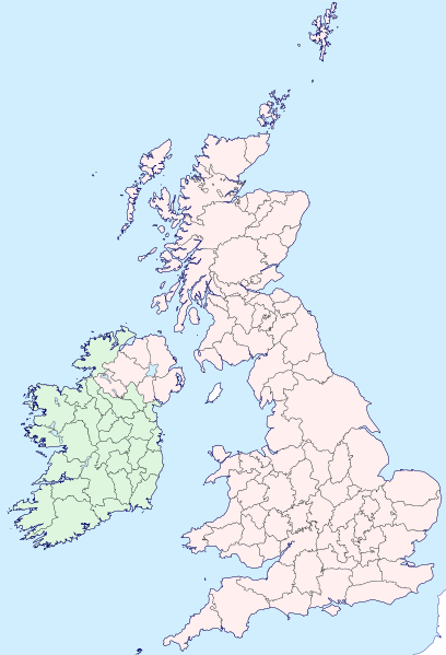
| Kirjeldus | Map of the British Isles with counties |
| Kuupäev | |
| Allikas | |
| Autor | Visitor from Wikishire |
| Luba (Faili edasikasutus) |
See fail kuulub Creative Commonsi rahvusvahelise litsentsi "Autorile viitamine + jagamine samadel tingimustel 4.0" alla. Omistamine: Wikishire
|
| SVG genesis | See vektorkujutis on valmistatud rakendusega Inkscape. |
Faili ajalugu
Klõpsa kuupäeva ja kellaaega, et näha sel ajahetkel kasutusel olnud failiversiooni.
| Kuupäev/kellaaeg | Pisipilt | Mõõtmed | Kasutaja | Kommentaar | |
|---|---|---|---|---|---|
| viimane | 13. september 2019, kell 19:35 | | 1250 × 1835 (1003 KB) | Visitor from Wikishire (arutelu | kaastöö) | Conformed colours to Hogweard's improvements |
| 29. mai 2015, kell 22:32 |  | 1250 × 1835 (1002 KB) | Visitor from Wikishire (arutelu | kaastöö) | Minor refinements & optional Yorkshire Ridings layer | |
| 11. jaanuar 2015, kell 21:53 |  | 1250 × 1835 (933 KB) | Visitor from Wikishire (arutelu | kaastöö) | {{Information |Description=Map of the British Isles with counties |Source=*[http://wikishire.co.uk/vectormap/GBDefinitionA.svg Wikishire: Vector map GB Definition A] *Ireland and Ulster, counties.svg |Date=201... | |
| 17. november 2014, kell 22:30 |  | 1250 × 1830 (910 KB) | Visitor from Wikishire (arutelu | kaastöö) | {{Information |Description=Map of the British Isles with counties |Source=*[http://wikishire.co.uk/vectormap/GBDefinitionA.svg] *Ireland and Ulster, counties.svg |Date=2014-11-17 |Author=[[:User:Visitor from W... |
Sa ei saa seda faili üle kirjutada.
Faili kasutus
Seda faili kasutavad järgmised 36 lehekülge:
- File:Ayrshire.svg
- File:Banffshire County.svg
- File:Berwickshire County.svg
- File:British Isles in counties.svg (failiümbersuunamine)
- File:Buteshire - Scotland.svg
- File:Cromartyshire - Scotland.svg
- File:Dumfriesshire County.svg
- File:Galloway.svg
- File:Inverness-shire - Scotland.svg
- File:Kincardineshire - Scotland.svg
- File:Kirkcudbrightshire - Scotland.svg
- File:Lanarkshire - Scotland.svg
- File:Lothian County.svg
- File:Map of Oswald distribution in Scotland 1690-1800.jpg
- File:Morayshire - Scotland.svg
- File:Perthshire County.svg
- File:Ross-shire County.svg
- File:Roxburghshire - Scotland.svg
- File:Selkirkshire - Scotland.svg
- File:Stirlingshire - Scotland.svg
- File:Tweeddale.svg
- File:Wales Historic Counties map.svg
- File:Wales Historic Counties map Anglesey.svg
- File:Wales Historic Counties map Brecknockshire.svg
- File:Wales Historic Counties map Caernarfonshire.svg
- File:Wales Historic Counties map Cardiganshire.svg
- File:Wales Historic Counties map Carmarthenshire.svg
- File:Wales Historic Counties map Denbighshire.svg
- File:Wales Historic Counties map Flintshire.svg
- File:Wales Historic Counties map Glamorgan.svg
- File:Wales Historic Counties map Merionethshire.svg
- File:Wales Historic Counties map Monmouthshire.svg
- File:Wales Historic Counties map Montgomeryshire.svg
- File:Wales Historic Counties map Pembrokeshire.svg
- File:Wales Historic Counties map Radnorshire.svg
- File:Wigtownshire - Scotland.svg
Globaalne failikasutus
Järgmised muud vikid kasutavad seda faili:
- Faili kasutus vikis fr.wikipedia.org
- Faili kasutus vikis ku.wikipedia.org
- Cornwall
- Surrey
- Glamorgan
- Devon
- Somerset
- Dorset
- Yorkshire
- Lancashire
- County Cork
- Cumberland
- Northumberland
- Westmorland
- Kent
- Suffolk
- Norfolk
- Rutland
- Hampshire
- Wiltshire
- Berkshire
- Middlesex
- Hertfordshire
- Buckinghamshire
- Oxfordshire
- Gloucestershire
- Herefordshire
- Worcestershire
- Warwickshire
- Northamptonshire
- Bedfordshire
- Cambridgeshire
- Huntingdonshire
- Leicestershire
- Nottinghamshire
- Derbyshire
- Staffordshire
- Cheshire
- County Durham
- Lincolnshire
- Shropshire
- Şablon:Parêzgehên Giravên Brîtanî
- Angus
- Morayshire
- West Lothian
- East Lothian
- Midlothian
- Anglesey
- Brecknockshire
- Caernarfonshire
- Cardiganshire
Vaata selle faili globaalset kasutust.