File:BrucePeninsulaLocator.png
跳去導覽
跳去搵嘢
冇更高解像度嘅圖像。
BrucePeninsulaLocator.png (497 × 315 像素,檔案大細:11 KB ,MIME類型:image/png)
Captions
Captions
Add a one-line explanation of what this file represents
摘要
[編輯]
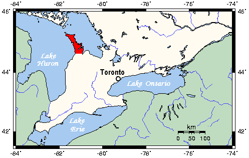
| 描述 | Map of Southern Ontario showing Bruce Peninsula in red. |
| 日期 | |
| 來源 | This map has been imported in English Wikipedia by Kelisi from a source from here, and the GMT homepage. Kelisi mention that the tools are released under the GNU General Public License. |
| 作者 | Kelisi |
| Other versions | en:Image:BrucePeninsulaLocator.png |
協議
[編輯]
| 呢個檔案用共享創意 姓名標示-非商業性-相同方式分享3.0 未本地化版本條款授權。 Subject to disclaimers. | ||
| ||
| This licensing tag was added to this file as part of the GFDL licensing update. |

|
根據自由軟體基金會發佈嘅無固定段落、封面文字同封底文字GNU自由文件授權條款第1.2或打後嘅版本,你獲授權可以重製、散佈同埋修改爾份文件。授權條款嘅副本喺章節GNU自由文件授權條款。 Subject to disclaimers. |
檔案歷史
撳個日期/時間去睇響嗰個時間出現過嘅檔案。
| 日期/時間 | 縮圖 | 尺寸 | 用戶 | 註解 | |
|---|---|---|---|---|---|
| 現時 | 2008年10月29號 (三) 16:46 | | 497 × 315(11 KB) | Pierre cb(傾偈 | 貢獻) | {{Information |Description=Map of Southern Ontario showing Bruce Peninsula in red. |Source=This map has been imported in English Wikipedia by Kelisi from a source from [http://www.aquarius.ifm-geomar.de/ here], and the [http://gmt.soest |
你無得衾咗個檔案。
檔案用途
以下嘅1版用到呢個檔:
全域檔案使用情況
下面嘅維基都用緊呢個檔案:
- az.wikipedia.org嘅使用情況
- be.wikipedia.org嘅使用情況
- bn.wikipedia.org嘅使用情況
- ceb.wikipedia.org嘅使用情況
- da.wikipedia.org嘅使用情況
- de.wikipedia.org嘅使用情況
- en.wikipedia.org嘅使用情況
- en.wikivoyage.org嘅使用情況
- fr.wikipedia.org嘅使用情況
- he.wikivoyage.org嘅使用情況
- it.wikipedia.org嘅使用情況
- no.wikipedia.org嘅使用情況
- pl.wikipedia.org嘅使用情況
- pt.wikipedia.org嘅使用情況
- ru.wikipedia.org嘅使用情況
- sv.wikipedia.org嘅使用情況
- uk.wikipedia.org嘅使用情況
- www.wikidata.org嘅使用情況
- zh-yue.wikipedia.org嘅使用情況
- zh.wikipedia.org嘅使用情況