File:Brunei location map Topographic.png
跳去導覽
跳去搵嘢

預覽大細:739 × 600 像素。 第啲解像度:296 × 240 像素 | 591 × 480 像素 | 946 × 768 像素 | 1,262 × 1,024 像素 | 2,331 × 1,892 像素。
原本檔案 (2,331 × 1,892 像素,檔案大細:5.92 MB ,MIME類型:image/png)
Captions
Captions
Add a one-line explanation of what this file represents
摘要
[編輯]
| 描述 |
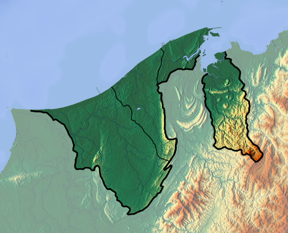
Deutsch: Positionskarte von Brunei
Quadratische Plattkarte. Geographische Begrenzung der Karte:
English: Location map of Brunei
Equirectangular projection. Geographic limits of the map:
|
| 日期 | |
| 來源 |
自己作品
|
| 作者 | Dr Brains |
協議
[編輯]
I, the copyright holder of this work, hereby publish it under the following licenses:

|
Permission is granted to copy, distribute and/or modify this document under the terms of the GNU Free Documentation License, Version 1.2 only as published by the Free Software Foundation; with no Invariant Sections, no Front-Cover Texts, and no Back-Cover Texts. A copy of the license is included in the section entitled GNU Free Documentation License. | 1.2 only |
|
|
Permission is granted to copy, distribute and/or modify this document under the terms of the GNU Free Documentation License, Version 1.3 or any later version published by the Free Software Foundation; with no Invariant Sections, no Front-Cover Texts, and no Back-Cover Texts. A copy of the license is included in the section entitled GNU Free Documentation License.
|
你可以揀你想用嘅牌照。
檔案歷史
撳個日期/時間去睇響嗰個時間出現過嘅檔案。
| 日期/時間 | 縮圖 | 尺寸 | 用戶 | 註解 | |
|---|---|---|---|---|---|
| 現時 | 2012年6月10號 (日) 11:22 | | 2,331 × 1,892(5.92 MB) | Dr Brains(傾偈 | 貢獻) |
你無得衾咗個檔案。
檔案用途
全域檔案使用情況
下面嘅維基都用緊呢個檔案:
- ar.wikipedia.org嘅使用情況
- ast.wikipedia.org嘅使用情況
- bcl.wikipedia.org嘅使用情況
- bn.wikipedia.org嘅使用情況
- bs.wikipedia.org嘅使用情況
- ceb.wikipedia.org嘅使用情況
- ce.wikipedia.org嘅使用情況
- cs.wikipedia.org嘅使用情況
- el.wikipedia.org嘅使用情況
- en.wikipedia.org嘅使用情況
- Brunei
- Geography of Brunei
- Bandar Seri Begawan
- Brunei Bay
- Jerudong Park
- Brunei Open
- Pagon Hill
- Aberdeen Brunei Senior Masters
- Tasek Merimbun
- Ulu Temburong National Park
- Module:Location map/data/Brunei/doc
- Batu Apoi Forest Reserve
- Seria oil field
- Benutan Dam
- Ulu Tutong Dam
- Ash-Shaliheen Mosque
- Pehin Khatib Abdullah Mosque
- Hassanal Bolkiah Mosque
- Hassanal Bolkiah Mosque, Mentiri
- Module:Location map/data/Brunei
- Kedayan River
- Kianggeh River
- Jerudong Park Amphitheater
- Saeh Hill
- Retak Hill
- Tudal Hill
- Lalak Lake
- Serasa Bay
- Teraja Waterfall
- fa.wikipedia.org嘅使用情況
- fr.wikipedia.org嘅使用情況
睇呢個檔案嘅更多全域使用情況。