File:Bundesautobahn 28 map.png
ナビゲーションに移動
検索に移動
このプレビューのサイズ: 444 × 600 ピクセル。 その他の解像度: 178 × 240 ピクセル | 355 × 480 ピクセル | 569 × 768 ピクセル | 1,122 × 1,515 ピクセル。
元のファイル (1,122 × 1,515 ピクセル、ファイルサイズ: 76キロバイト、MIME タイプ: image/png)
キャプション
キャプション
このファイルの内容を1行で記述してください
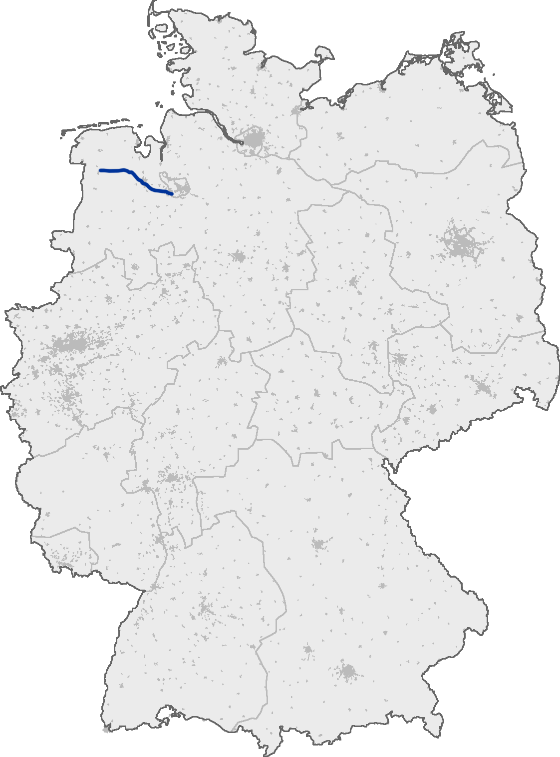
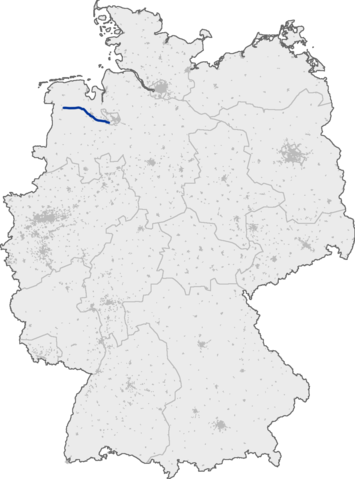
Bundesautobahn 28 in Germany
ファイルの履歴
過去の版のファイルを表示するには、その版の日時をクリックしてください。
| 日付と時刻 | サムネイル | 寸法 | 利用者 | コメント | |
|---|---|---|---|---|---|
| 現在の版 | 2005年9月13日 (火) 19:18 | | 1,122 × 1,515 (76キロバイト) | Qualle (トーク | 投稿記録) | Bundesautobahn 28 in Germany {{GFDL-OpenGeoDB}} 028 |
このファイルは上書きできません。
ファイルの使用状況
以下の 2 ページがこのファイルを使用しています:
グローバルなファイル使用状況
以下に挙げる他のウィキがこの画像を使っています:
- en.wikipedia.org での使用状況
- fr.wikipedia.org での使用状況
- hr.wikipedia.org での使用状況
- hu.wikipedia.org での使用状況
- ja.wikipedia.org での使用状況
- ko.wikipedia.org での使用状況
- no.wikipedia.org での使用状況
- pl.wikipedia.org での使用状況
- pt.wikipedia.org での使用状況
- tr.wikipedia.org での使用状況